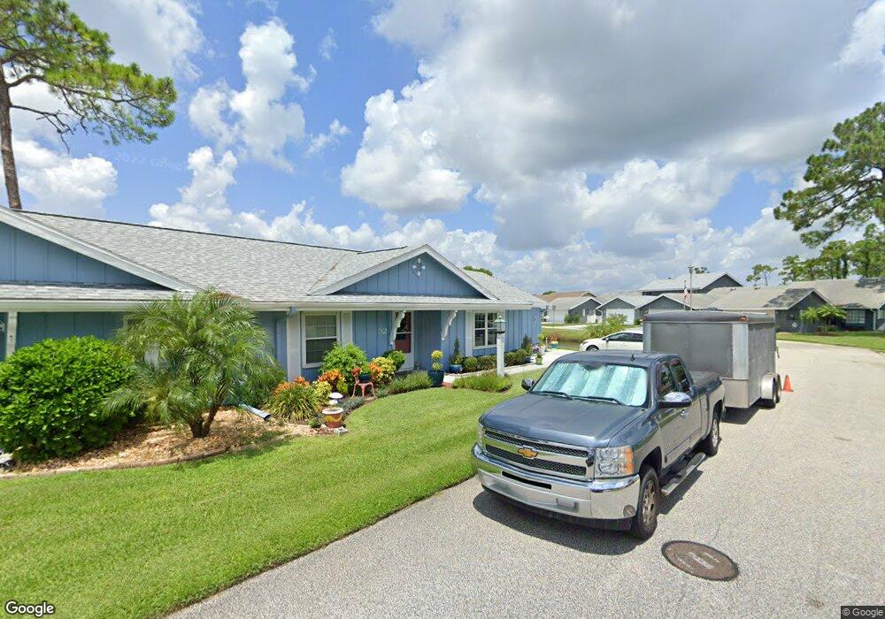
32 Fore Dr New Smyrna Beach, FL 32168
Fairway NeighborhoodEstimated Value: $255,261 - $302,000
2
Beds
2
Baths
1,364
Sq Ft
$203/Sq Ft
Est. Value
About This Home
This home is located at 32 Fore Dr, New Smyrna Beach, FL 32168 and is currently estimated at $277,565, approximately $203 per square foot. 32 Fore Dr is a home with nearby schools including Chisholm Elementary School, New Smyrna Beach Middle School, and New Smyrna Beach High School.
Ownership History
Date
Name
Owned For
Owner Type
Purchase Details
Closed on
Nov 17, 2004
Sold by
Hanley Claire E
Bought by
Hanley Claire E
Current Estimated Value
Purchase Details
Closed on
Nov 28, 2000
Sold by
Wolf John J
Bought by
Hanley Claire E
Purchase Details
Closed on
Jun 9, 1993
Sold by
Wolf John J and Wolf Veronica C
Bought by
Wolf John J
Purchase Details
Closed on
May 15, 1991
Bought by
Hanley Claire E L and Hanley E
Purchase Details
Closed on
Jul 15, 1988
Bought by
Hanley Claire E L and Hanley E
Purchase Details
Closed on
Jul 15, 1985
Bought by
Hanley Claire E L and Hanley E
Create a Home Valuation Report for This Property
The Home Valuation Report is an in-depth analysis detailing your home's value as well as a comparison with similar homes in the area
Home Values in the Area
Average Home Value in this Area
Purchase History
| Date | Buyer | Sale Price | Title Company |
|---|---|---|---|
| Hanley Claire E | -- | -- | |
| Hanley Claire E | $79,000 | -- | |
| Wolf John J | -- | -- | |
| Hanley Claire E L | $72,000 | -- | |
| Hanley Claire E L | $75,000 | -- | |
| Hanley Claire E L | $74,000 | -- |
Source: Public Records
Tax History Compared to Growth
Tax History
| Year | Tax Paid | Tax Assessment Tax Assessment Total Assessment is a certain percentage of the fair market value that is determined by local assessors to be the total taxable value of land and additions on the property. | Land | Improvement |
|---|---|---|---|---|
| 2025 | $527 | $100,206 | -- | -- |
| 2024 | $527 | $96,757 | -- | -- |
| 2023 | $527 | $93,939 | $0 | $0 |
| 2022 | $547 | $91,203 | $0 | $0 |
| 2021 | $539 | $88,547 | $0 | $0 |
| 2020 | $532 | $87,324 | $0 | $0 |
| 2019 | $523 | $85,361 | $0 | $0 |
| 2018 | $517 | $83,769 | $0 | $0 |
| 2017 | $511 | $82,046 | $0 | $0 |
| 2016 | $541 | $80,358 | $0 | $0 |
| 2015 | $559 | $79,799 | $0 | $0 |
| 2014 | $563 | $79,166 | $0 | $0 |
Source: Public Records
Map
Nearby Homes