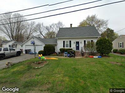
32 Gleason St Unit 1 Framingham, MA 01701
Saxonville NeighborhoodEstimated Value: $615,000 - $696,000
3
Beds
2
Baths
1,188
Sq Ft
$563/Sq Ft
Est. Value
About This Home
This home is located at 32 Gleason St Unit 1, Framingham, MA 01701 and is currently estimated at $668,450, approximately $562 per square foot. 32 Gleason St Unit 1 is a home located in Middlesex County with nearby schools including Framingham High School, Christa McAuliffe Charter School, and MetroWest Jewish Day School.
Ownership History
Date
Name
Owned For
Owner Type
Purchase Details
Closed on
Aug 3, 1998
Sold by
Mccarthy Steven T
Bought by
Kim Euncha Cha
Current Estimated Value
Home Financials for this Owner
Home Financials are based on the most recent Mortgage that was taken out on this home.
Original Mortgage
$145,500
Interest Rate
6.92%
Mortgage Type
Purchase Money Mortgage
Purchase Details
Closed on
Jan 29, 1997
Sold by
Porter Robert S
Bought by
Mccarthy Steven T
Home Financials for this Owner
Home Financials are based on the most recent Mortgage that was taken out on this home.
Original Mortgage
$95,000
Interest Rate
7.75%
Mortgage Type
Purchase Money Mortgage
Purchase Details
Closed on
Dec 13, 1996
Sold by
Foisy Francis E
Bought by
Porter Robert S
Home Financials for this Owner
Home Financials are based on the most recent Mortgage that was taken out on this home.
Original Mortgage
$95,000
Interest Rate
7.75%
Mortgage Type
Purchase Money Mortgage
Create a Home Valuation Report for This Property
The Home Valuation Report is an in-depth analysis detailing your home's value as well as a comparison with similar homes in the area
Home Values in the Area
Average Home Value in this Area
Purchase History
| Date | Buyer | Sale Price | Title Company |
|---|---|---|---|
| Kim Euncha Cha | $194,000 | -- | |
| Mccarthy Steven T | $121,500 | -- | |
| Porter Robert S | $107,000 | -- |
Source: Public Records
Mortgage History
| Date | Status | Borrower | Loan Amount |
|---|---|---|---|
| Open | Euncha Kim | $175,500 | |
| Open | Buckner Lynne M | $295,000 | |
| Closed | Porter Robert S | $145,500 | |
| Previous Owner | Porter Robert S | $95,000 |
Source: Public Records
Tax History Compared to Growth
Tax History
| Year | Tax Paid | Tax Assessment Tax Assessment Total Assessment is a certain percentage of the fair market value that is determined by local assessors to be the total taxable value of land and additions on the property. | Land | Improvement |
|---|---|---|---|---|
| 2024 | $7,183 | $576,500 | $235,600 | $340,900 |
| 2023 | $6,813 | $520,500 | $210,300 | $310,200 |
| 2022 | $6,450 | $469,400 | $190,800 | $278,600 |
| 2021 | $6,242 | $444,300 | $183,400 | $260,900 |
| 2020 | $6,263 | $418,100 | $166,700 | $251,400 |
| 2019 | $6,126 | $398,300 | $166,700 | $231,600 |
| 2018 | $6,058 | $371,200 | $160,400 | $210,800 |
| 2017 | $5,927 | $354,700 | $155,800 | $198,900 |
| 2016 | $5,920 | $340,600 | $155,800 | $184,800 |
| 2015 | $5,391 | $302,500 | $155,900 | $146,600 |
Source: Public Records
Map
Nearby Homes
- 4 Dunham Rd
- 1206 Concord St
- 680 Old Connecticut Path
- 33 Debra Ln
- 9B Victoria Garden Unit B
- 393 Old Connecticut Path
- 33 Mcphee Rd
- 67 Greenleaf Cir
- 10 Ballydrain Rd
- 114 Newbury St
- 28 Paxton Rd
- 83 Central St Unit 1
- 87 Summer St
- 21 Burr St
- 25 Prior Dr
- 240 Central St
- 5 Paxton Rd
- 25 Lasalle Ave
- 85 Cottage St
- 420 Central St