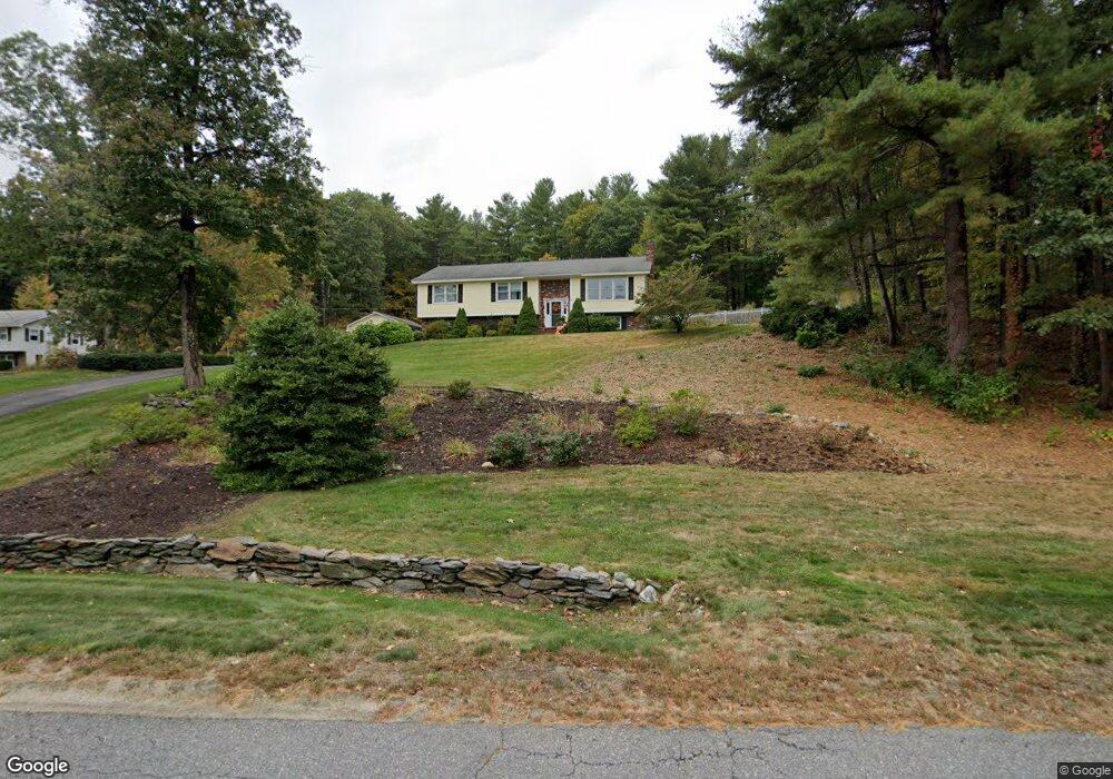
32 Laurelwood Rd Sterling, MA 01564
Estimated Value: $618,000 - $698,000
4
Beds
3
Baths
2,064
Sq Ft
$311/Sq Ft
Est. Value
About This Home
This home is located at 32 Laurelwood Rd, Sterling, MA 01564 and is currently estimated at $642,321, approximately $311 per square foot. 32 Laurelwood Rd is a home located in Worcester County with nearby schools including Wachusett Regional High School and South Lancaster Academy.
Ownership History
Date
Name
Owned For
Owner Type
Purchase Details
Closed on
Apr 23, 2018
Sold by
Williamson Mark W and Williamson Hope T
Bought by
Grove Nt
Current Estimated Value
Purchase Details
Closed on
Aug 13, 1999
Sold by
Chiavaras Michael G and Chiavaras Kathleen
Bought by
Williamson Mark W and Williamson Hope T
Home Financials for this Owner
Home Financials are based on the most recent Mortgage that was taken out on this home.
Original Mortgage
$190,000
Interest Rate
7.65%
Mortgage Type
Purchase Money Mortgage
Create a Home Valuation Report for This Property
The Home Valuation Report is an in-depth analysis detailing your home's value as well as a comparison with similar homes in the area
Home Values in the Area
Average Home Value in this Area
Purchase History
| Date | Buyer | Sale Price | Title Company |
|---|---|---|---|
| Grove Nt | -- | -- | |
| Williamson Mark W | $240,000 | -- |
Source: Public Records
Mortgage History
| Date | Status | Borrower | Loan Amount |
|---|---|---|---|
| Previous Owner | Williamson Mark W | $315,000 | |
| Previous Owner | Williamson Mark W | $260,000 | |
| Previous Owner | Williamson Mark W | $190,000 |
Source: Public Records
Tax History Compared to Growth
Tax History
| Year | Tax Paid | Tax Assessment Tax Assessment Total Assessment is a certain percentage of the fair market value that is determined by local assessors to be the total taxable value of land and additions on the property. | Land | Improvement |
|---|---|---|---|---|
| 2025 | $7,327 | $568,900 | $148,100 | $420,800 |
| 2024 | $7,439 | $558,900 | $148,100 | $410,800 |
| 2023 | $7,209 | $504,100 | $148,100 | $356,000 |
| 2022 | $7,050 | $462,300 | $128,800 | $333,500 |
| 2021 | $6,957 | $421,100 | $128,800 | $292,300 |
| 2020 | $6,457 | $384,100 | $128,800 | $255,300 |
| 2019 | $6,383 | $369,600 | $128,800 | $240,800 |
| 2018 | $6,592 | $375,800 | $133,700 | $242,100 |
| 2017 | $6,375 | $353,600 | $124,000 | $229,600 |
| 2016 | $6,529 | $356,200 | $124,000 | $232,200 |
| 2015 | $5,559 | $321,500 | $119,100 | $202,400 |
| 2014 | $5,443 | $321,500 | $119,100 | $202,400 |
Source: Public Records
Map
Nearby Homes
- 2 Stuart Rd
- 45 Meetinghouse Hill Rd
- 41 Meetinghouse Hill Rd
- 5 Pine Woods Ln
- 17 Taft Rd
- 4 Redstone Hill Rd
- 25 North Row
- 5 Leo's Way Unit 1
- 7 Leo's Way Unit 1
- 96 Clinton Rd
- 6 Ashton Ln
- 45 Kendall Hill Rd
- 133 Rowley Hill Rd
- 6 Belmont Dr
- 25 N Row Rd
- 121 &125 Flanagan Hill Rd
- 20 Woodside Dr
- 28 Sandy Ridge Rd
- 163 Rowley Hill Rd
- 0 Brockelman Rd Unit 73424117
- 26 Laurelwood Rd Unit 28
- 26 Laurelwood Rd
- 38 Laurelwood Rd
- 41 Laurelwood Rd
- 85 Meetinghouse Hill Rd Unit 87
- 97 Meetinghouse Hill Rd
- 83 Meetinghouse Hill Rd
- 40 Laurelwood Rd
- 81 Meetinghouse Hill Rd
- 24 Laurelwood Rd
- 80 Meetinghouse Hill Rd
- 44 Laurelwood Rd
- 79 Meetinghouse Hill Rd
- 79 Meetinghouse Hill Rd Unit 79
- 79 Meetinghouse Hill Rd Unit 1
- 3 Stuart Rd
- LOT 6 Stuart Rd
- 26 Stuart Rd
- 100 Meetinghouse Hill Rd
- 77 Meetinghouse Hill Rd