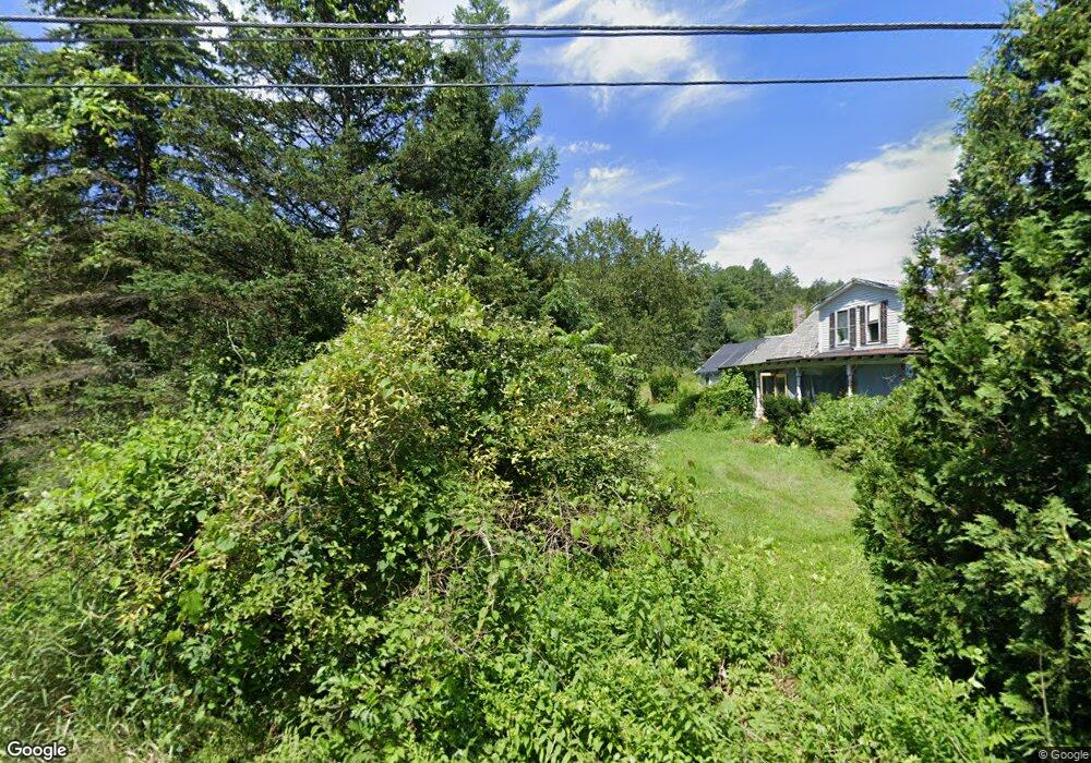
32 Mathews Rd Conway, MA 01341
Estimated Value: $360,000 - $401,000
2
Beds
1
Bath
1,440
Sq Ft
$264/Sq Ft
Est. Value
About This Home
This home is located at 32 Mathews Rd, Conway, MA 01341 and is currently estimated at $380,112, approximately $263 per square foot. 32 Mathews Rd is a home with nearby schools including Frontier Regional School.
Ownership History
Date
Name
Owned For
Owner Type
Purchase Details
Closed on
Dec 19, 2017
Sold by
Potter Nicholas
Bought by
Lally Josephine
Current Estimated Value
Purchase Details
Closed on
Nov 23, 2016
Sold by
Langevin Raymond F and Langevin Ray
Bought by
Langevin Robert A
Purchase Details
Closed on
Jun 21, 2012
Sold by
Ward Thomas J and Ward Janet M
Bought by
Miner Patrick L and Miner Sarah C
Home Financials for this Owner
Home Financials are based on the most recent Mortgage that was taken out on this home.
Original Mortgage
$32,800
Interest Rate
3.84%
Mortgage Type
New Conventional
Create a Home Valuation Report for This Property
The Home Valuation Report is an in-depth analysis detailing your home's value as well as a comparison with similar homes in the area
Home Values in the Area
Average Home Value in this Area
Purchase History
| Date | Buyer | Sale Price | Title Company |
|---|---|---|---|
| Lally Josephine | $150,000 | -- | |
| Langevin Robert A | $65,000 | -- | |
| Miner Patrick L | $41,000 | -- |
Source: Public Records
Mortgage History
| Date | Status | Borrower | Loan Amount |
|---|---|---|---|
| Previous Owner | Miner Patrick L | $122,400 | |
| Previous Owner | Miner Patrick L | $122,400 | |
| Previous Owner | Miner Patrick L | $32,800 |
Source: Public Records
Tax History
| Year | Tax Paid | Tax Assessment Tax Assessment Total Assessment is a certain percentage of the fair market value that is determined by local assessors to be the total taxable value of land and additions on the property. | Land | Improvement |
|---|---|---|---|---|
| 2025 | $4,022 | $278,500 | $86,700 | $191,800 |
| 2024 | $4,026 | $245,500 | $78,700 | $166,800 |
| 2023 | $4,210 | $245,500 | $78,700 | $166,800 |
| 2022 | $4,091 | $227,900 | $73,500 | $154,400 |
| 2021 | $4,027 | $215,000 | $69,900 | $145,100 |
| 2020 | $4,465 | $238,000 | $69,700 | $168,300 |
| 2019 | $4,448 | $238,500 | $69,700 | $168,800 |
| 2018 | $3,386 | $183,000 | $69,700 | $113,300 |
| 2017 | $3,248 | $183,000 | $69,700 | $113,300 |
| 2016 | $3,024 | $181,300 | $60,800 | $120,500 |
| 2015 | $2,932 | $181,300 | $60,800 | $120,500 |
Source: Public Records
Map
Nearby Homes
- 71 Mathews Rd
- 3 Adams Ct Unit A
- 15 Stillwater Rd
- 41 Upper Rd
- 345 Greenfield Rd
- 208 Greenfield Rd
- 90 Whately Rd
- 24 Elm St
- 0 Greenfield Rd Unit 73472322
- 26 S Main St
- 18 Stage Rd
- 15 Crestview Dr
- 0 Pocumtuck Dr Unit 73379330
- 259 Wisdom Way
- 0 North St Unit 73407299
- 7 Christian Ln
- 130 Laurel St
- 0 N Bear River Rd Unit 73485981
- 23 Robbins Rd
- 240 Beldingville Rd
- 64 Mathews Rd
- LOT3 Boyden Rd
- LOT 1 Boyden Rd
- Lot 0 Graves Rd
- 23 Boyden Rd
- Lot 1 Mathews Rd
- 25 Mathews Rd
- 0 Graves & Matthews Roads
- 92 Mathews Rd
- 35 Graves Rd
- 104 Mathews Rd
- 46 Larch Meadow Dr
- 46 Larch Meadow Dr Unit 1
- 960 S Deerfield Rd
- 25 Larch Meadow Dr
- 91 Mathews Rd
- 124 Mathews Rd
- 1101 S Deerfield Rd
- 75 Boyden Rd
- 100 Graves Rd
Your Personal Tour Guide
Ask me questions while you tour the home.