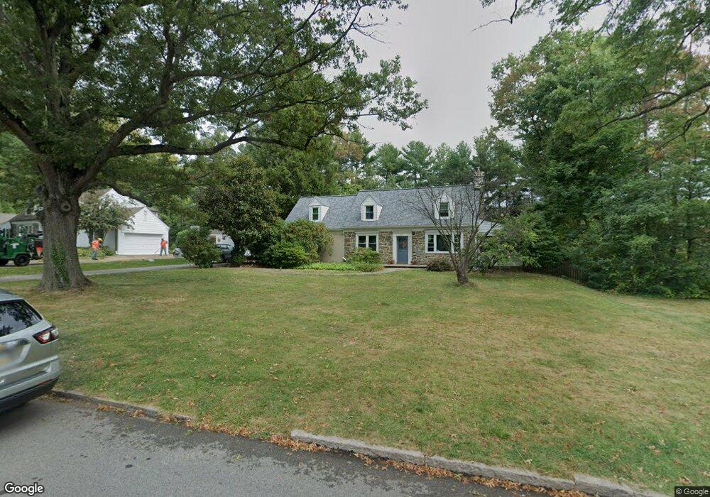
32 Meadowood Rd Bryn Mawr, PA 19010
Estimated Value: $1,171,549 - $1,473,000
4
Beds
3
Baths
2,611
Sq Ft
$504/Sq Ft
Est. Value
About This Home
This home is located at 32 Meadowood Rd, Bryn Mawr, PA 19010 and is currently estimated at $1,315,137, approximately $503 per square foot. 32 Meadowood Rd is a home located in Delaware County with nearby schools including Radnor El School, Radnor Middle School, and Radnor Senior High School.
Ownership History
Date
Name
Owned For
Owner Type
Purchase Details
Closed on
Oct 21, 2020
Sold by
Bynum Thomas A
Bought by
Bowers Lee Stephen and Bowers Janine Wingerter
Current Estimated Value
Home Financials for this Owner
Home Financials are based on the most recent Mortgage that was taken out on this home.
Original Mortgage
$502,000
Outstanding Balance
$445,688
Interest Rate
2.8%
Mortgage Type
New Conventional
Estimated Equity
$869,449
Purchase Details
Closed on
Apr 30, 1998
Sold by
Rosener James D and Rosener Susan F
Bought by
Bynum Thomas A and Bynum Marie C
Home Financials for this Owner
Home Financials are based on the most recent Mortgage that was taken out on this home.
Original Mortgage
$227,100
Interest Rate
7.05%
Mortgage Type
Purchase Money Mortgage
Create a Home Valuation Report for This Property
The Home Valuation Report is an in-depth analysis detailing your home's value as well as a comparison with similar homes in the area
Home Values in the Area
Average Home Value in this Area
Purchase History
| Date | Buyer | Sale Price | Title Company |
|---|---|---|---|
| Bowers Lee Stephen | $752,000 | Surety Abstract Services Llc | |
| Bynum Thomas A | $350,000 | Commonwealth Land Title Ins |
Source: Public Records
Mortgage History
| Date | Status | Borrower | Loan Amount |
|---|---|---|---|
| Open | Bowers Lee Stephen | $502,000 | |
| Previous Owner | Bynum Thomas A | $227,100 |
Source: Public Records
Tax History Compared to Growth
Tax History
| Year | Tax Paid | Tax Assessment Tax Assessment Total Assessment is a certain percentage of the fair market value that is determined by local assessors to be the total taxable value of land and additions on the property. | Land | Improvement |
|---|---|---|---|---|
| 2025 | $12,466 | $616,570 | $214,990 | $401,580 |
| 2024 | $12,466 | $616,570 | $214,990 | $401,580 |
| 2023 | $11,972 | $616,570 | $214,990 | $401,580 |
| 2022 | $11,841 | $616,570 | $214,990 | $401,580 |
| 2021 | $19,020 | $616,570 | $214,990 | $401,580 |
| 2020 | $11,565 | $332,450 | $123,030 | $209,420 |
| 2019 | $11,239 | $332,450 | $123,030 | $209,420 |
| 2018 | $11,018 | $332,450 | $0 | $0 |
| 2017 | $10,788 | $332,450 | $0 | $0 |
| 2016 | $1,862 | $332,450 | $0 | $0 |
| 2015 | $1,862 | $332,450 | $0 | $0 |
| 2014 | $1,862 | $332,450 | $0 | $0 |
Source: Public Records
Map
Nearby Homes
- 219 S Ithan Ave
- 7 Lockwood Ln
- 131 Fairfax Rd
- 4 Lockwood Ln
- 3 Lockwood Ln
- 200 S Ithan Ave
- 12 Lockwood Ln
- 15 Lockwood Ln
- 12 Chalous Ln
- 189 Meredith Ave
- 68 Garrett Ave
- 406 Barclay Rd
- 1030 E Lancaster Ave Unit 216
- 1030 E Lancaster Ave Unit 702
- 1030 E Lancaster Ave Unit 923
- 101 Highfield Rd
- 100 Radnor Ave
- 1962 Montgomery Ave
- 253 Ithan Creek Rd
- 215 Cornell Dr
- 34 Meadowood Rd
- 30 Meadowood Rd
- 36 Meadowood Rd
- 27 Meadowood Rd
- 25 Meadowood Rd
- 28 Meadowood Rd
- 29 Meadowood Rd
- 23 Meadowood Rd
- 129 S Ithan Ave
- 135 S Ithan Ave
- 21 Meadowood Rd
- 26 Meadowood Rd
- 201 S Ithan Ave
- 103 Browning Ln
- 217 S Ithan Ave
- 24 Meadowood Rd
- 105 Browning Ln
- 100 Browning Ln
- 176 Brooklea Rd
- 174 Brooklea Rd