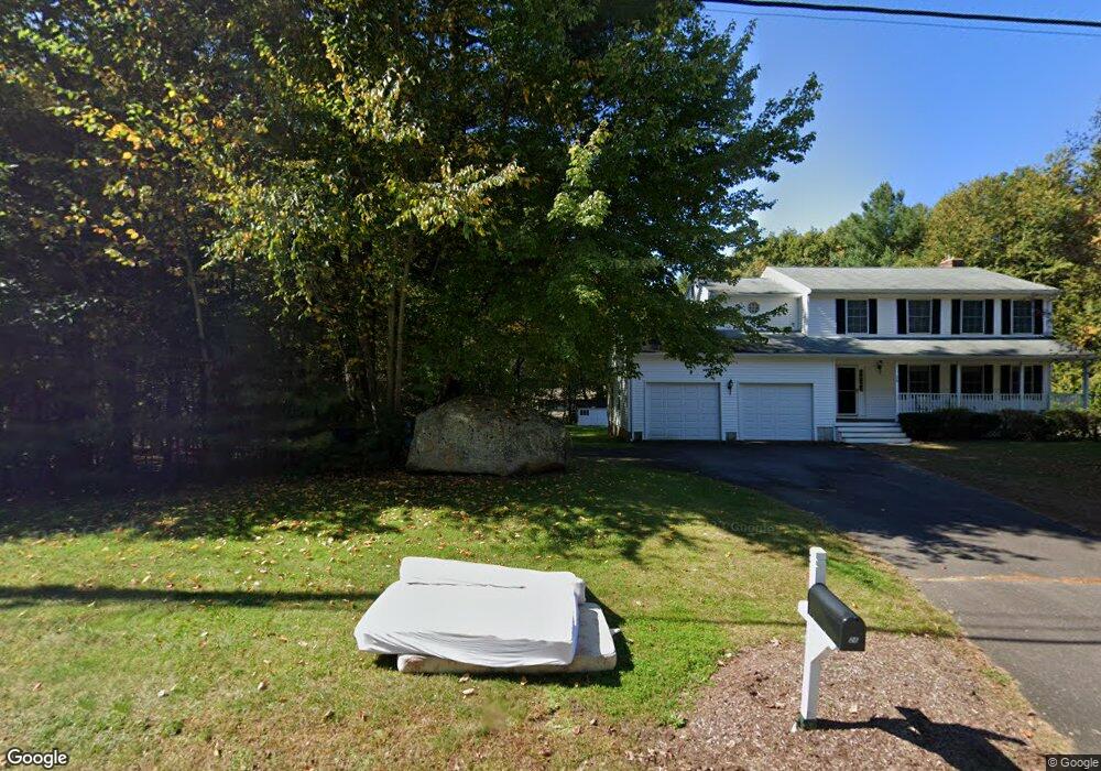
32 Merlot Way Tolland, CT 06084
Estimated Value: $509,964 - $556,000
3
Beds
3
Baths
1,994
Sq Ft
$264/Sq Ft
Est. Value
About This Home
This home is located at 32 Merlot Way, Tolland, CT 06084 and is currently estimated at $526,491, approximately $264 per square foot. 32 Merlot Way is a home located in Tolland County with nearby schools including Birch Grove Primary School, Tolland Intermediate School, and Tolland Middle School.
Ownership History
Date
Name
Owned For
Owner Type
Purchase Details
Closed on
May 12, 1999
Sold by
Lee & Lemont Rlty
Bought by
Hill Stephen and Hill Anne
Current Estimated Value
Home Financials for this Owner
Home Financials are based on the most recent Mortgage that was taken out on this home.
Original Mortgage
$188,598
Interest Rate
6.92%
Create a Home Valuation Report for This Property
The Home Valuation Report is an in-depth analysis detailing your home's value as well as a comparison with similar homes in the area
Home Values in the Area
Average Home Value in this Area
Purchase History
| Date | Buyer | Sale Price | Title Company |
|---|---|---|---|
| Hill Stephen | $209,900 | -- | |
| Hill Stephen | $209,900 | -- |
Source: Public Records
Mortgage History
| Date | Status | Borrower | Loan Amount |
|---|---|---|---|
| Closed | Hill Stephen | $160,000 | |
| Closed | Hill Stephen | $188,598 |
Source: Public Records
Tax History Compared to Growth
Tax History
| Year | Tax Paid | Tax Assessment Tax Assessment Total Assessment is a certain percentage of the fair market value that is determined by local assessors to be the total taxable value of land and additions on the property. | Land | Improvement |
|---|---|---|---|---|
| 2025 | $8,310 | $305,630 | $83,530 | $222,100 |
| 2024 | $7,942 | $210,285 | $79,285 | $131,000 |
| 2023 | $7,850 | $210,285 | $79,285 | $131,000 |
| 2022 | $7,692 | $210,285 | $79,285 | $131,000 |
| 2021 | $7,804 | $210,285 | $79,285 | $131,000 |
| 2020 | $7,581 | $210,285 | $79,285 | $131,000 |
| 2019 | $7,903 | $219,235 | $81,535 | $137,700 |
| 2018 | $7,673 | $219,235 | $81,535 | $137,700 |
| 2017 | $7,496 | $219,235 | $81,535 | $137,700 |
| 2016 | $7,496 | $219,235 | $81,535 | $137,700 |
| 2015 | $7,314 | $219,235 | $81,535 | $137,700 |
| 2014 | $7,136 | $229,835 | $90,635 | $139,200 |
Source: Public Records
Map
Nearby Homes
- 5 Melissa Way
- 487 Buff Cap Rd
- 476 Old Stafford Rd
- 68 Cook Rd
- 71 Neff Hill Rd
- 8 Neff Hill Rd
- 110 Neff Hill Rd
- 130 Neff Hill Rd
- 105 Neff Hill Rd
- 137 Neff Hill Rd
- 77 Neff Hill Rd
- 84 Neff Hill Rd
- 15 Usher Ridge
- 68 Usher Ridge
- 36 Usher Ridge
- 0 Tolland Stage Rd Unit 24101836
- 644 Buff Cap Rd
- 999 Tolland Stage Rd
- 19 Thomas Dr
- 25 Josephine Way