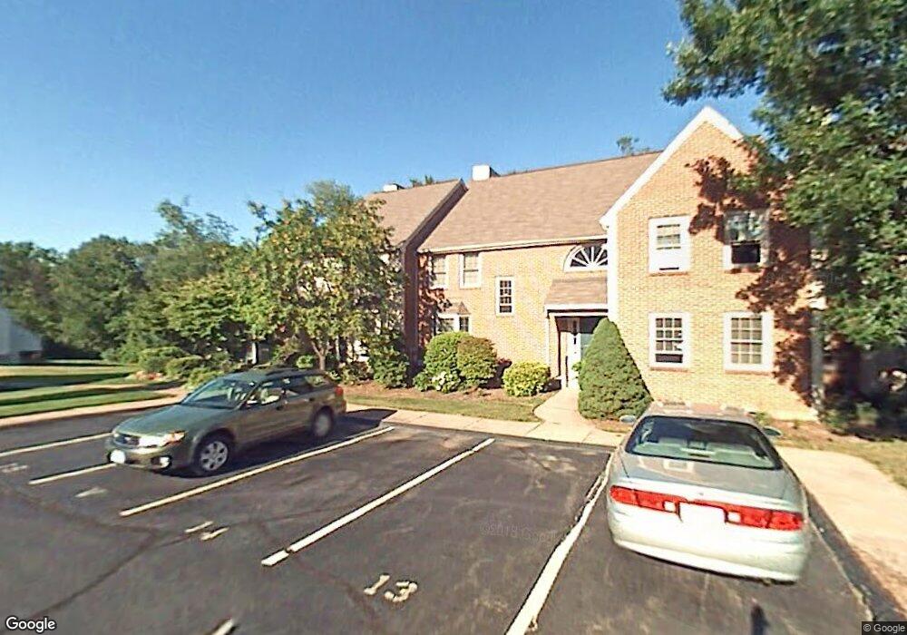
32 Orchard Brook Dr Wethersfield, CT 06109
Estimated Value: $304,000 - $324,000
2
Beds
2
Baths
1,241
Sq Ft
$255/Sq Ft
Est. Value
About This Home
This home is located at 32 Orchard Brook Dr, Wethersfield, CT 06109 and is currently estimated at $316,931, approximately $255 per square foot. 32 Orchard Brook Dr is a home located in Hartford County with nearby schools including Samuel B. Webb Elementary School, Woodcrest Elementary School, and Silas Deane Middle School.
Ownership History
Date
Name
Owned For
Owner Type
Purchase Details
Closed on
May 24, 2021
Sold by
Laitinen Gregory W
Bought by
Laitinen Gregory W and Laitinen Darcy M
Current Estimated Value
Purchase Details
Closed on
Sep 30, 1998
Sold by
Wilson James A
Bought by
Laitiner Barbara W
Home Financials for this Owner
Home Financials are based on the most recent Mortgage that was taken out on this home.
Original Mortgage
$40,000
Interest Rate
6.89%
Mortgage Type
Unknown
Purchase Details
Closed on
Jul 18, 1988
Sold by
Broadbent Gina
Bought by
Wilson James A
Home Financials for this Owner
Home Financials are based on the most recent Mortgage that was taken out on this home.
Original Mortgage
$146,700
Interest Rate
10.57%
Create a Home Valuation Report for This Property
The Home Valuation Report is an in-depth analysis detailing your home's value as well as a comparison with similar homes in the area
Home Values in the Area
Average Home Value in this Area
Purchase History
| Date | Buyer | Sale Price | Title Company |
|---|---|---|---|
| Laitinen Gregory W | -- | None Available | |
| Laitiner Barbara W | $114,000 | -- | |
| Wilson James A | $163,000 | -- |
Source: Public Records
Mortgage History
| Date | Status | Borrower | Loan Amount |
|---|---|---|---|
| Previous Owner | Wilson James A | $40,000 | |
| Previous Owner | Wilson James A | $146,700 |
Source: Public Records
Tax History Compared to Growth
Tax History
| Year | Tax Paid | Tax Assessment Tax Assessment Total Assessment is a certain percentage of the fair market value that is determined by local assessors to be the total taxable value of land and additions on the property. | Land | Improvement |
|---|---|---|---|---|
| 2025 | $6,784 | $164,580 | $0 | $164,580 |
| 2024 | $5,106 | $118,130 | $0 | $118,130 |
| 2023 | $4,935 | $118,130 | $0 | $118,130 |
| 2022 | $4,853 | $118,130 | $0 | $118,130 |
| 2021 | $4,804 | $118,130 | $0 | $118,130 |
| 2020 | $4,807 | $118,130 | $0 | $118,130 |
| 2019 | $4,813 | $118,130 | $0 | $118,130 |
| 2018 | $4,759 | $116,700 | $0 | $116,700 |
| 2017 | $4,641 | $116,700 | $0 | $116,700 |
| 2016 | $4,498 | $116,700 | $0 | $116,700 |
| 2015 | $4,457 | $116,700 | $0 | $116,700 |
| 2014 | $4,288 | $116,700 | $0 | $116,700 |
Source: Public Records
Map
Nearby Homes
- 6 Barrington Dr Unit B
- 7 Barrington Dr Unit C
- 5 Barrington Dr Unit D
- 274 Cedarwood Ln
- 15 Grass Bonnet Ln
- 76 Luca Lane Homesite 8
- 61 Luca Ln
- 8 Stella Dr
- 268 Goff Rd
- 104 Willow St
- 91 Centerwood Rd
- 67 Luca (Homesite 6) Ln
- 53 Luca (Homesite 4) Ln
- 0 Collier Rd
- 122 Cottonwood Rd Unit 122
- 6 Vinnie Dr
- 39 Cottonwood Rd Unit 39
- 5 Robeth Ln
- 155 Cottonwood Rd
- 64 Kenlock St
- 50 Orchard Brook Dr
- 49 Orchard Brook Dr
- 48 Orchard Brook Dr
- 47 Orchard Brook Dr
- 46 Orchard Brook Dr
- 45 Orchard Brook Dr
- 44 Orchard Brook Dr
- 43 Orchard Brook Dr
- 42 Orchard Brook Dr
- 41 Orchard Brook Dr
- 40 Orchard Brook Dr
- 39 Orchard Brook Dr
- 38 Orchard Brook Dr
- 37 Orchard Brook Dr
- 36 Orchard Brook Dr
- 35 Orchard Brook Dr
- 34 Orchard Brook Dr
- 33 Orchard Brook Dr
- 31 Orchard Brook Dr
- 30 Orchard Brook Dr