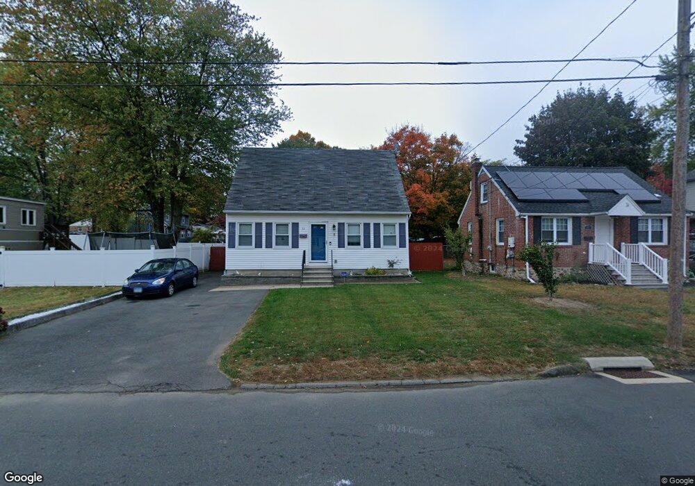
32 Poplar St Bristol, CT 06010
Forestville NeighborhoodEstimated Value: $284,000 - $407,000
3
Beds
2
Baths
1,287
Sq Ft
$253/Sq Ft
Est. Value
About This Home
This home is located at 32 Poplar St, Bristol, CT 06010 and is currently estimated at $326,187, approximately $253 per square foot. 32 Poplar St is a home located in Hartford County with nearby schools including Bristol Central High School, St Matthew School, and St. Joseph School.
Ownership History
Date
Name
Owned For
Owner Type
Purchase Details
Closed on
Dec 9, 2009
Sold by
Cassin Rhonda M
Bought by
Niedermayer Joseph F
Current Estimated Value
Purchase Details
Closed on
Sep 2, 2008
Sold by
Goodwin Harold C and Goodwin Nancy L
Bought by
Niedermayer Joseph F and Cassin Rhonda M
Home Financials for this Owner
Home Financials are based on the most recent Mortgage that was taken out on this home.
Original Mortgage
$144,700
Interest Rate
6.29%
Purchase Details
Closed on
Aug 7, 2001
Sold by
Wilson Amy L
Bought by
Goodwin Harold C and Goodwin Nancy L
Create a Home Valuation Report for This Property
The Home Valuation Report is an in-depth analysis detailing your home's value as well as a comparison with similar homes in the area
Home Values in the Area
Average Home Value in this Area
Purchase History
| Date | Buyer | Sale Price | Title Company |
|---|---|---|---|
| Niedermayer Joseph F | -- | -- | |
| Niedermayer Joseph F | $180,900 | -- | |
| Goodwin Harold C | $113,000 | -- |
Source: Public Records
Mortgage History
| Date | Status | Borrower | Loan Amount |
|---|---|---|---|
| Previous Owner | Goodwin Harold C | $144,700 | |
| Previous Owner | Goodwin Harold C | $74,000 |
Source: Public Records
Tax History
| Year | Tax Paid | Tax Assessment Tax Assessment Total Assessment is a certain percentage of the fair market value that is determined by local assessors to be the total taxable value of land and additions on the property. | Land | Improvement |
|---|---|---|---|---|
| 2025 | $4,850 | $143,710 | $29,190 | $114,520 |
| 2024 | $4,577 | $143,710 | $29,190 | $114,520 |
| 2023 | $4,362 | $143,710 | $29,190 | $114,520 |
| 2022 | $3,914 | $102,060 | $21,280 | $80,780 |
| 2021 | $3,914 | $102,060 | $21,280 | $80,780 |
| 2020 | $3,914 | $102,060 | $21,280 | $80,780 |
| 2019 | $3,883 | $102,060 | $21,280 | $80,780 |
| 2018 | $3,764 | $102,060 | $21,280 | $80,780 |
| 2017 | $3,460 | $96,040 | $28,980 | $67,060 |
| 2016 | $3,460 | $96,040 | $28,980 | $67,060 |
| 2015 | $3,324 | $96,040 | $28,980 | $67,060 |
| 2014 | $3,324 | $96,040 | $28,980 | $67,060 |
Source: Public Records
Map
Nearby Homes
- 122 Bayberry Dr
- 524 Broad St
- 370 Emmett St Unit 5-5
- 370 Emmett St Unit 5-2
- 370 Emmett St Unit 4-3
- 370 Emmett St Unit 4-2
- 370 Emmett St Unit 3-2
- 370 Emmett St Unit 5-3
- 370 Emmett St Unit 3-4
- 370 Emmett St Unit 4-1
- 370 Emmett St Unit 5-1
- 370 Emmett St Unit 5-4
- 370 Emmett St Unit 3-3
- 196 Frederick St
- 422 Emmett St Unit E
- 426 Emmett St Unit A
- 64 4th St
- 155 Redstone Hill Rd Unit 60
- 155 Redstone Hill Rd Unit 176
- 513 Emmett St Unit 13
Your Personal Tour Guide
Ask me questions while you tour the home.