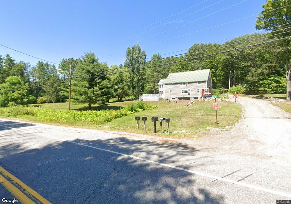
32 Rankin Rd Bristol, NH 03222
Estimated Value: $610,820 - $1,063,000
3
Beds
4
Baths
2,182
Sq Ft
$338/Sq Ft
Est. Value
About This Home
This home is located at 32 Rankin Rd, Bristol, NH 03222 and is currently estimated at $737,705, approximately $338 per square foot. 32 Rankin Rd is a home with nearby schools including Bridgewater-Hebron Village School.
Ownership History
Date
Name
Owned For
Owner Type
Purchase Details
Closed on
Sep 16, 1999
Sold by
Zimmer Roy A and Zimmer Margaret M
Bought by
Smith Robin N
Current Estimated Value
Home Financials for this Owner
Home Financials are based on the most recent Mortgage that was taken out on this home.
Original Mortgage
$108,900
Interest Rate
7.83%
Create a Home Valuation Report for This Property
The Home Valuation Report is an in-depth analysis detailing your home's value as well as a comparison with similar homes in the area
Home Values in the Area
Average Home Value in this Area
Purchase History
| Date | Buyer | Sale Price | Title Company |
|---|---|---|---|
| Smith Robin N | $169,900 | -- |
Source: Public Records
Mortgage History
| Date | Status | Borrower | Loan Amount |
|---|---|---|---|
| Open | Smith Robin N | $90,000 | |
| Closed | Smith Robin N | $108,900 |
Source: Public Records
Tax History Compared to Growth
Tax History
| Year | Tax Paid | Tax Assessment Tax Assessment Total Assessment is a certain percentage of the fair market value that is determined by local assessors to be the total taxable value of land and additions on the property. | Land | Improvement |
|---|---|---|---|---|
| 2024 | $2,998 | $555,100 | $112,400 | $442,700 |
| 2023 | $3,063 | $380,000 | $81,100 | $298,900 |
| 2022 | $3,139 | $380,000 | $81,100 | $298,900 |
| 2021 | $3,142 | $379,900 | $81,100 | $298,800 |
| 2020 | $6,176 | $379,900 | $81,100 | $298,800 |
| 2019 | $3,061 | $313,600 | $72,500 | $241,100 |
| 2018 | $2,973 | $313,600 | $72,500 | $241,100 |
| 2017 | $3,017 | $313,600 | $72,500 | $241,100 |
| 2016 | $2,957 | $313,600 | $72,500 | $241,100 |
| 2015 | $3,156 | $324,400 | $83,100 | $241,300 |
| 2014 | $3,027 | $324,400 | $83,100 | $241,300 |
Source: Public Records
Map
Nearby Homes
- 862 Mayhew Turnpike Unit 1
- 114 Ledgewood Terrace
- 199 Cottage City Rd
- 383 Wulamat Rd
- 10 Merrill Rd
- 94 Mandi Ln
- 40 Adams Rd
- 497 W Shore Rd
- 35 Manor Estates Dr Unit 14
- 26 Don Gerry Rd
- 4 Birchwood Dr Unit A
- 00 Ledgewood Cir Unit 7
- Lot 7 Hall Rd
- Lots 1 & 2 Hall Rd
- Lot 26 Skyline Dr
- 125 Verrill Rd
- 0 Skyline Dr Unit 19
- 341 Perkins Hill Rd
- 00 Peaked Hill Rd Unit 7.1, 7.2, 7.3, 7.4,
- 301 Perkins Hill Rd
- 5 Chrisden
- 1030 Mayhew Turnpike
- 4 Chrisden Dr
- 1074 Mayhew Turnpike
- 1096 Mayhew Turnpike
- 10 Chrisden Dr
- Lot 10 Chrisden Dr
- 0 Chrisden Dr Unit 5
- 129 Rankin Rd
- 24 Scott Dr
- 21 Scott Dr
- 54 Chrisden Dr
- 60 Chrisden Dr
- 82 Chrisden Dr
- 47 Chrisden Dr
- 1198 Mayhew # 9 Turnpike Unit 9
- 1111 Mayhew Turnpike
- 130 Rankin Rd
- 59 Chrisden Dr
- 1121 Mayhew Turnpike