32 Richardson Rd Orrington, ME 04474
Estimated Value: $341,000 - $514,000
4
Beds
3
Baths
--
Sq Ft
7
Acres
About This Home
This home is located at 32 Richardson Rd, Orrington, ME 04474 and is currently estimated at $442,081. 32 Richardson Rd is a home located in Penobscot County with nearby schools including Center Drive School.
Ownership History
Date
Name
Owned For
Owner Type
Purchase Details
Closed on
Sep 13, 2021
Sold by
Lawrence Patricia A and Wank Vincent
Bought by
Lawrence Patricia A
Current Estimated Value
Home Financials for this Owner
Home Financials are based on the most recent Mortgage that was taken out on this home.
Original Mortgage
$153,500
Interest Rate
3.14%
Mortgage Type
Purchase Money Mortgage
Purchase Details
Closed on
Dec 16, 2015
Sold by
Lawrence Patricia A and Wank Vincent
Bought by
Lawrence Patricia A and Wank Vincent
Home Financials for this Owner
Home Financials are based on the most recent Mortgage that was taken out on this home.
Original Mortgage
$130,000
Interest Rate
3.89%
Mortgage Type
Unknown
Create a Home Valuation Report for This Property
The Home Valuation Report is an in-depth analysis detailing your home's value as well as a comparison with similar homes in the area
Home Values in the Area
Average Home Value in this Area
Purchase History
| Date | Buyer | Sale Price | Title Company |
|---|---|---|---|
| Lawrence Patricia A | -- | None Available | |
| Lawrence Patricia A | -- | -- |
Source: Public Records
Mortgage History
| Date | Status | Borrower | Loan Amount |
|---|---|---|---|
| Previous Owner | Lawrence Patricia A | $153,500 | |
| Previous Owner | Lawrence Patricia A | $130,000 | |
| Previous Owner | Lawrence Patricia A | $240,000 |
Source: Public Records
Tax History Compared to Growth
Tax History
| Year | Tax Paid | Tax Assessment Tax Assessment Total Assessment is a certain percentage of the fair market value that is determined by local assessors to be the total taxable value of land and additions on the property. | Land | Improvement |
|---|---|---|---|---|
| 2024 | $4,481 | $411,100 | $56,600 | $354,500 |
| 2023 | $4,245 | $385,900 | $50,200 | $335,700 |
| 2022 | $4,487 | $351,900 | $58,800 | $293,100 |
| 2021 | $4,680 | $312,000 | $58,800 | $253,200 |
| 2020 | $4,716 | $296,600 | $58,800 | $237,800 |
| 2019 | $4,716 | $296,600 | $58,800 | $237,800 |
| 2018 | $4,123 | $296,600 | $58,800 | $237,800 |
| 2017 | $454 | $296,600 | $58,800 | $237,800 |
| 2016 | $1,045 | $287,400 | $44,700 | $242,700 |
| 2015 | $4,124 | $287,400 | $44,700 | $242,700 |
| 2014 | $4,184 | $291,600 | $44,700 | $246,900 |
| 2013 | $3,922 | $291,600 | $44,700 | $246,900 |
Source: Public Records
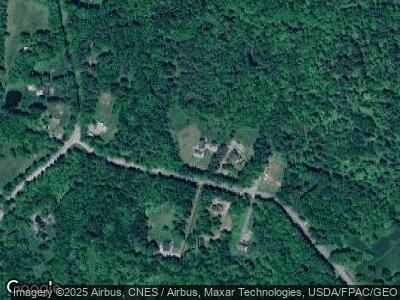
Map
Nearby Homes
- 518 Betts Rd
- 284 Hoxie Hill Rd
- 3 Rogers Rd
- 38A&38B Cottage Shore Dr
- 76 Cottage Shore Dr
- 0 Dresser Rd Unit 1619871
- 52 Appalachian Trail
- 55 Orcutt Mountain Rd
- 23 Granite Ledge Ln
- 61 Harvest Dr
- 40 Skyline Dr
- 63 Lower Oak Point Rd
- 55 Lower Oak Point Rd
- 521 Millvale Rd
- 00 River Rd
- 1002 River Rd
- M25 L12-02 Maine 46
- 63 Church Rd
- 00 Center Dr
- 157 Lower Dedham Rd
- 32 Richardson Rd
- 36 Richardson Rd
- 39 Richardson Rd
- 33 Richardson Rd
- 1202 Center Dr
- 45 Richardson Rd
- Lot 1E Richardson Rd
- Map 4 Lot Richardson St
- 1190 Center Dr
- 1205 Center Dr
- 1189 Center Dr
- 1224 Center Dr
- 1170 Center Dr
- 1227 Center Dr
- 69 E Bucksport Rd
- Lot 2 E Bucksport Rd
- 53 E Bucksport Rd
- 27 E Bucksport Rd
- 35 E Bucksport Rd
- 1158 Center Dr