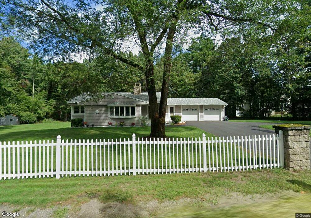
32 S Depot Rd Hollis, NH 03049
West Hollis NeighborhoodEstimated Value: $480,000 - $597,000
3
Beds
2
Baths
1,348
Sq Ft
$399/Sq Ft
Est. Value
About This Home
This home is located at 32 S Depot Rd, Hollis, NH 03049 and is currently estimated at $537,595, approximately $398 per square foot. 32 S Depot Rd is a home with nearby schools including Hollis Primary School, Hollis Upper Elementary School, and Hollis-Brookline Middle School.
Ownership History
Date
Name
Owned For
Owner Type
Purchase Details
Closed on
Sep 15, 1999
Sold by
Pelletier Michael A and Pelletier Sandra L
Bought by
Dimambro Daniel A and Dimambro Dona A
Current Estimated Value
Home Financials for this Owner
Home Financials are based on the most recent Mortgage that was taken out on this home.
Original Mortgage
$40,000
Interest Rate
7.83%
Create a Home Valuation Report for This Property
The Home Valuation Report is an in-depth analysis detailing your home's value as well as a comparison with similar homes in the area
Home Values in the Area
Average Home Value in this Area
Purchase History
| Date | Buyer | Sale Price | Title Company |
|---|---|---|---|
| Dimambro Daniel A | $160,000 | -- |
Source: Public Records
Mortgage History
| Date | Status | Borrower | Loan Amount |
|---|---|---|---|
| Open | Dimambro Daniel A | $30,000 | |
| Closed | Dimambro Daniel A | $40,000 |
Source: Public Records
Tax History Compared to Growth
Tax History
| Year | Tax Paid | Tax Assessment Tax Assessment Total Assessment is a certain percentage of the fair market value that is determined by local assessors to be the total taxable value of land and additions on the property. | Land | Improvement |
|---|---|---|---|---|
| 2024 | $8,237 | $464,600 | $217,600 | $247,000 |
| 2023 | $7,740 | $464,600 | $217,600 | $247,000 |
| 2022 | $10,486 | $464,600 | $217,600 | $247,000 |
| 2021 | $6,508 | $286,700 | $139,200 | $147,500 |
| 2020 | $6,646 | $286,700 | $139,200 | $147,500 |
| 2019 | $6,623 | $286,700 | $139,200 | $147,500 |
| 2018 | $6,213 | $286,700 | $139,200 | $147,500 |
| 2017 | $5,211 | $225,100 | $117,200 | $107,900 |
| 2016 | $5,274 | $225,100 | $117,200 | $107,900 |
| 2015 | $5,182 | $225,100 | $117,200 | $107,900 |
| 2014 | $5,207 | $225,100 | $117,200 | $107,900 |
| 2013 | $5,137 | $225,100 | $117,200 | $107,900 |
Source: Public Records
Map
Nearby Homes
- 8 Cross Rd Unit 8
- 28 S Depot Rd
- 33 S Depot Rd
- 29 S Depot Rd
- 39 S Depot Rd
- 24 S Depot Rd
- 12 Rail Way Unit 12
- 12 Rail Way
- 10 Rail Way
- 8 Rail Way Unit 2
- 4 Rail Way Unit 4
- 31 S Depot Rd
- 2 Rail Way Unit 2
- 2 Rail Way
- 47 S Depot Rd
- 19 Old Runnells Bridge Rd
- 51 Rail Way
- 49 S Depot Rd
- 15 Old Runnells Bridge Rd
- 17 Old Runnells Bridge Rd