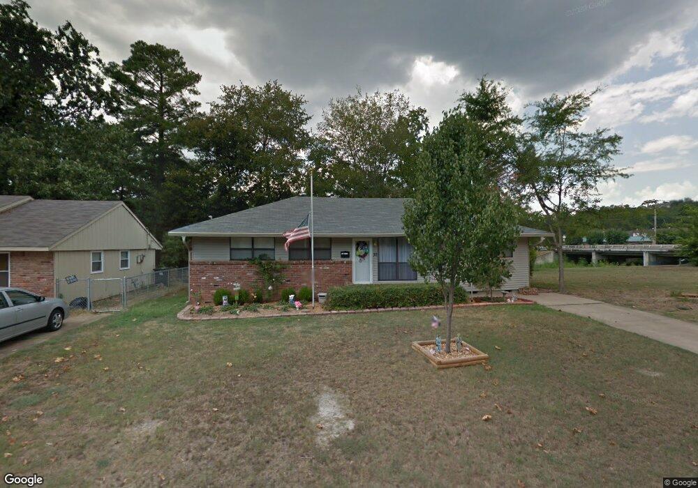
32 Serenity Dr Little Rock, AR 72205
West Markham NeighborhoodEstimated Value: $158,352 - $177,000
--
Bed
3
Baths
1,508
Sq Ft
$109/Sq Ft
Est. Value
About This Home
This home is located at 32 Serenity Dr, Little Rock, AR 72205 and is currently estimated at $164,338, approximately $108 per square foot. 32 Serenity Dr is a home located in Pulaski County with nearby schools including McDermott Elementary School, J.A. Fair K8 Preparatory School, and Henderson Middle School.
Ownership History
Date
Name
Owned For
Owner Type
Purchase Details
Closed on
Mar 18, 2010
Sold by
Chronister John and Chronister Marlene
Bought by
Lewis Ellen M and Lewis Richard M
Current Estimated Value
Home Financials for this Owner
Home Financials are based on the most recent Mortgage that was taken out on this home.
Original Mortgage
$98,188
Outstanding Balance
$66,745
Interest Rate
5.5%
Mortgage Type
FHA
Estimated Equity
$97,593
Purchase Details
Closed on
Mar 8, 2009
Sold by
Mcelrath Wayne M
Bought by
Chronister John and Chronister Marlene
Create a Home Valuation Report for This Property
The Home Valuation Report is an in-depth analysis detailing your home's value as well as a comparison with similar homes in the area
Home Values in the Area
Average Home Value in this Area
Purchase History
| Date | Buyer | Sale Price | Title Company |
|---|---|---|---|
| Lewis Ellen M | $100,000 | The Title Company | |
| Chronister John | -- | The Title Company |
Source: Public Records
Mortgage History
| Date | Status | Borrower | Loan Amount |
|---|---|---|---|
| Open | Lewis Ellen M | $98,188 |
Source: Public Records
Tax History Compared to Growth
Tax History
| Year | Tax Paid | Tax Assessment Tax Assessment Total Assessment is a certain percentage of the fair market value that is determined by local assessors to be the total taxable value of land and additions on the property. | Land | Improvement |
|---|---|---|---|---|
| 2025 | $1,602 | $26,118 | $5,800 | $20,318 |
| 2024 | $1,602 | $26,118 | $5,800 | $20,318 |
| 2023 | $1,602 | $26,118 | $5,800 | $20,318 |
| 2022 | $1,602 | $26,118 | $5,800 | $20,318 |
| 2021 | $1,614 | $22,890 | $3,050 | $19,840 |
| 2020 | $1,227 | $22,890 | $3,050 | $19,840 |
| 2019 | $1,227 | $22,890 | $3,050 | $19,840 |
| 2018 | $1,252 | $22,890 | $3,050 | $19,840 |
| 2017 | $1,252 | $22,890 | $3,050 | $19,840 |
| 2016 | $1,219 | $22,420 | $3,800 | $18,620 |
| 2015 | $1,572 | $22,420 | $3,800 | $18,620 |
| 2014 | $1,572 | $22,420 | $3,800 | $18,620 |
Source: Public Records
Map
Nearby Homes
- 423 Brookside Dr
- 15 Brooklawn Dr
- 4 Brookridge Cove
- 7 Brookfield Cove
- 9 Brookfield Cove
- 814 Shea Dr
- 41 Brookridge Dr
- 8306 Louwanda Dr
- 22 Nob Hill Cove
- 411 Burnside Dr
- 8806 Mayflower Rd
- 73 Reservoir Heights Dr
- 22 Nob View Cir
- 10 Reservoir Heights Dr
- 3 Edgestone Dr
- 8815 Cloverhill Rd
- 409 Sunnymeade Dr
- 9605 Brooks Ct
- 8700 White Rock Ln
- 9317 Cynthia Dr
- 30 Serenity Dr
- 28 Serenity Dr
- 409 Brookside Dr
- 415 Brookside Dr
- 31 Serenity Dr
- 33 Serenity Dr
- 0 Serenity Unit 20038635
- 0 Serenity Unit 17002445
- 0 Serenity Unit 17007269
- 0 Serenity Unit 17024354
- 26 Serenity Dr
- 403 Brookside Dr
- 29 Serenity Dr
- 35 Serenity Dr
- 0 Brookside Dr Unit 16018733
- 0 Brookside Dr Unit 16022637
- 0 Brookside Dr Unit 20038199
- 0 Brookside Dr Unit 15026518
- 0 Brookside Dr Unit 17032456
- 0 Brookside Dr Unit 6 17022273