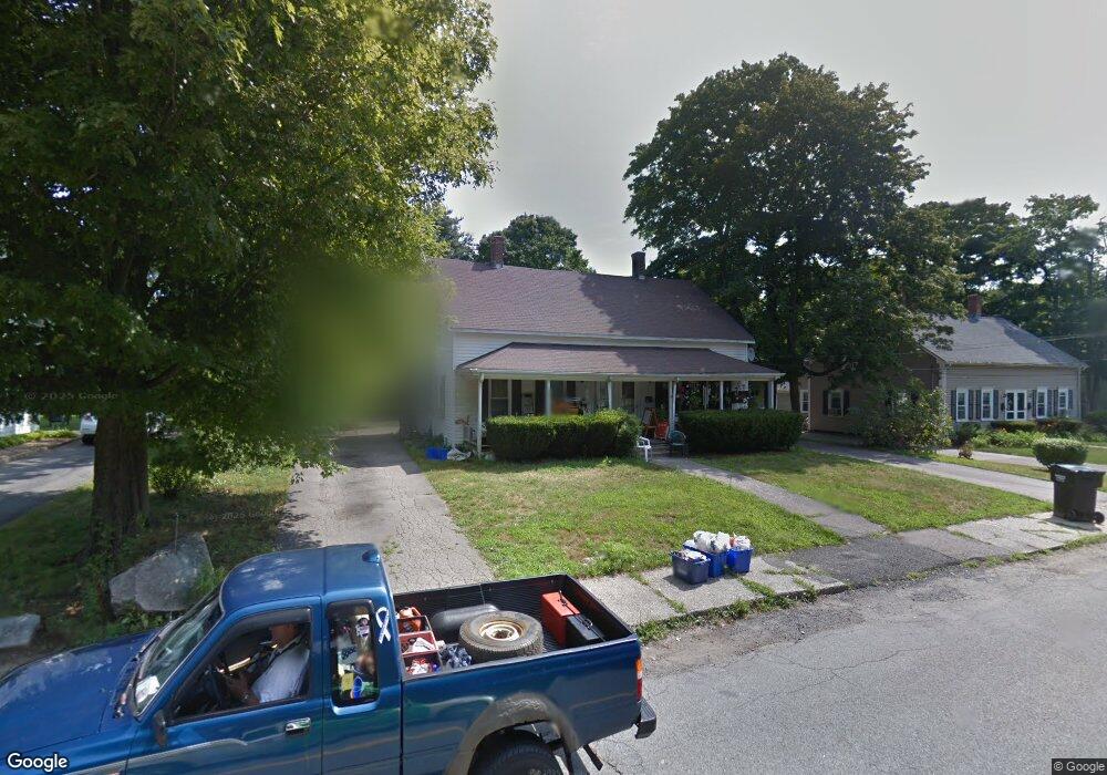
32 Sherman St Foxboro, MA 02035
Estimated Value: $612,000 - $784,000
9
Beds
4
Baths
2,109
Sq Ft
$329/Sq Ft
Est. Value
About This Home
This home is located at 32 Sherman St, Foxboro, MA 02035 and is currently estimated at $693,289, approximately $328 per square foot. 32 Sherman St is a home located in Norfolk County with nearby schools including Foxborough High School, Foxborough Regional Charter School, and The Sage School.
Ownership History
Date
Name
Owned For
Owner Type
Purchase Details
Closed on
Feb 4, 2019
Sold by
Vora Aruna N
Bought by
Vora Nishith Est
Current Estimated Value
Purchase Details
Closed on
Oct 10, 2002
Sold by
Kierce Brendan M and Kierce Mary
Bought by
Vora Nishith B and Vora Aruna N
Home Financials for this Owner
Home Financials are based on the most recent Mortgage that was taken out on this home.
Original Mortgage
$280,000
Interest Rate
6.24%
Mortgage Type
Purchase Money Mortgage
Create a Home Valuation Report for This Property
The Home Valuation Report is an in-depth analysis detailing your home's value as well as a comparison with similar homes in the area
Home Values in the Area
Average Home Value in this Area
Purchase History
| Date | Buyer | Sale Price | Title Company |
|---|---|---|---|
| Vora Nishith Est | -- | -- | |
| Vora Nishith B | $350,000 | -- |
Source: Public Records
Mortgage History
| Date | Status | Borrower | Loan Amount |
|---|---|---|---|
| Previous Owner | Vora Aruna N | $315,000 | |
| Previous Owner | Vora Nishith B | $280,000 |
Source: Public Records
Tax History Compared to Growth
Tax History
| Year | Tax Paid | Tax Assessment Tax Assessment Total Assessment is a certain percentage of the fair market value that is determined by local assessors to be the total taxable value of land and additions on the property. | Land | Improvement |
|---|---|---|---|---|
| 2025 | $7,223 | $546,400 | $210,100 | $336,300 |
| 2024 | $6,098 | $451,400 | $210,100 | $241,300 |
| 2023 | $5,985 | $421,200 | $200,100 | $221,100 |
| 2022 | $5,821 | $400,900 | $191,400 | $209,500 |
| 2021 | $5,824 | $395,100 | $174,000 | $221,100 |
| 2020 | $5,757 | $395,100 | $174,000 | $221,100 |
| 2019 | $5,363 | $364,800 | $165,700 | $199,100 |
| 2018 | $4,673 | $320,700 | $165,700 | $155,000 |
| 2017 | $4,661 | $309,900 | $154,900 | $155,000 |
| 2016 | $4,505 | $304,000 | $149,000 | $155,000 |
| 2015 | $4,100 | $269,900 | $125,900 | $144,000 |
| 2014 | $4,134 | $275,800 | $123,500 | $152,300 |
Source: Public Records
Map
Nearby Homes
- 66 Cocasset St Unit F
- 34 Pleasant St Unit 107
- 3 Bassett St
- 84 Cocasset St Unit A6
- 88 Cocasset St Unit 1
- 194 Central St
- 14 Baker St
- 7 Bentwood St
- 27 Sullivan Way
- 51 Granite St
- 96 Main St Unit C5
- 96 Main St Unit B6
- 4 Highland Cir
- 6 Morningside Ln
- 27 Connie Dr
- 30 Twilight Dr
- 11 Adams St
- 356 Central St
- 5 Post Rd
- 9 Linda St
- 32 Sherman St Unit 1
- 32 Sherman St
- 34 Sherman St Unit 2
- 36 Sherman St
- 21 Leonard St
- 26 Sherman St Unit 2
- 24 Sherman St Unit 2
- 24 Sherman St Unit 1
- 26 Sherman St Unit 28
- 26 Sherman St Unit 26
- 44 Sherman St
- 42 Sherman St
- 37 Sherman St
- 17 Leonard St
- 23 Leonard St
- 23 Leonard St Unit 25
- 29 Sherman St Unit 1
- 29 Sherman St Unit 8
- 29 Sherman St Unit 4
- 29 Sherman St Unit 5