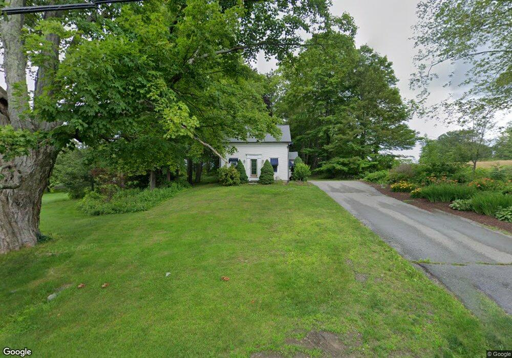
32 Singletary Ave Sutton, MA 01590
Estimated Value: $398,000 - $447,000
2
Beds
2
Baths
948
Sq Ft
$444/Sq Ft
Est. Value
About This Home
This home is located at 32 Singletary Ave, Sutton, MA 01590 and is currently estimated at $420,642, approximately $443 per square foot. 32 Singletary Ave is a home located in Worcester County with nearby schools including Sutton Elementary School, Sutton Middle School, and Sutton High School.
Ownership History
Date
Name
Owned For
Owner Type
Purchase Details
Closed on
Mar 21, 2005
Sold by
Martocci Karen and Mcgovern Karen
Bought by
Nashawaty Dona
Current Estimated Value
Purchase Details
Closed on
Feb 27, 2002
Sold by
Durkin Kathleen
Bought by
Mcgovern Karen
Home Financials for this Owner
Home Financials are based on the most recent Mortgage that was taken out on this home.
Original Mortgage
$88,000
Interest Rate
6.85%
Mortgage Type
Purchase Money Mortgage
Purchase Details
Closed on
Jun 27, 1990
Sold by
Pearson Rudolph E
Bought by
Durkin Kathleen
Create a Home Valuation Report for This Property
The Home Valuation Report is an in-depth analysis detailing your home's value as well as a comparison with similar homes in the area
Home Values in the Area
Average Home Value in this Area
Purchase History
| Date | Buyer | Sale Price | Title Company |
|---|---|---|---|
| Nashawaty Dona | $279,900 | -- | |
| Mcgovern Karen | $110,000 | -- | |
| Durkin Kathleen | $56,000 | -- |
Source: Public Records
Mortgage History
| Date | Status | Borrower | Loan Amount |
|---|---|---|---|
| Previous Owner | Durkin Kathleen | $20,000 | |
| Previous Owner | Durkin Kathleen | $50,000 | |
| Previous Owner | Durkin Kathleen | $88,000 |
Source: Public Records
Tax History Compared to Growth
Tax History
| Year | Tax Paid | Tax Assessment Tax Assessment Total Assessment is a certain percentage of the fair market value that is determined by local assessors to be the total taxable value of land and additions on the property. | Land | Improvement |
|---|---|---|---|---|
| 2025 | $4,741 | $394,400 | $134,200 | $260,200 |
| 2024 | $4,821 | $380,200 | $128,100 | $252,100 |
| 2023 | $4,213 | $304,200 | $115,800 | $188,400 |
| 2022 | $3,733 | $245,900 | $88,200 | $157,700 |
| 2021 | $3,813 | $238,300 | $88,200 | $150,100 |
| 2020 | $3,683 | $232,200 | $88,200 | $144,000 |
| 2019 | $3,511 | $212,500 | $84,200 | $128,300 |
| 2018 | $5,221 | $204,900 | $84,200 | $120,700 |
| 2017 | $3,214 | $194,800 | $71,100 | $123,700 |
| 2016 | $3,173 | $190,200 | $71,100 | $119,100 |
| 2015 | $3,071 | $184,100 | $71,100 | $113,000 |
| 2014 | $3,070 | $181,900 | $73,300 | $108,600 |
Source: Public Records
Map
Nearby Homes
- 242 Boston Rd
- 1 Burbank Rd
- 63 Uxbridge Rd
- 99 Burbank Rd
- 99 Burbank Road Lot 182
- 29 Winwood Rd
- 168 Burbank Rd
- 11 Laurel Dr
- 31 Central Turnpike
- 51 Central Turnpike
- 7 Fuller Rd
- 5 Hamlets Way
- 15 Westview Dr
- 128 Worcester Providence Turnpike
- 354 W Sutton Rd
- 345 W Sutton Rd
- 28 Brierly Cir
- 124 Worcester Providence Turnpike
- 5 Mogren Dr
- 47 Southwick Rd
- 29 Singletary Ave
- 34 Singletary Ave
- 33 Singletary Ave
- 24 Singletary Ave
- 35 Singletary Ave
- 23 Singletary Ave
- 22 Singletary Ave
- 20 Singletary Ave
- 19 Singletary Ave
- 5 Cole Ave
- 41 Singletary Ave
- 7 Cole Ave
- 7 1/2 Cole Ave
- 18 Singletary Ave
- 15 Singletary Ave
- 9 Cole Ave
- 16 Singletary Ave
- 13 Singletary Ave
- 4 Cole Ave
- 11 Singletary Ave