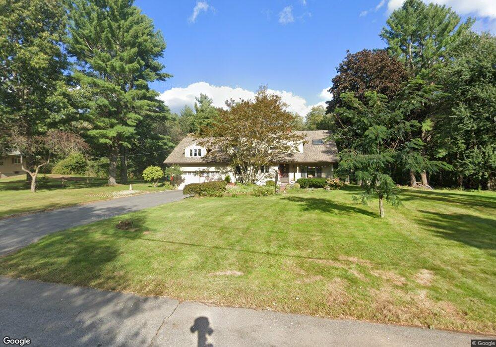
32 Suncrest Rd Andover, MA 01810
Estimated Value: $972,297 - $1,204,000
4
Beds
3
Baths
2,482
Sq Ft
$424/Sq Ft
Est. Value
About This Home
This home is located at 32 Suncrest Rd, Andover, MA 01810 and is currently estimated at $1,053,574, approximately $424 per square foot. 32 Suncrest Rd is a home located in Essex County with nearby schools including South Elementary School, Doherty Middle School, and Andover High School.
Ownership History
Date
Name
Owned For
Owner Type
Purchase Details
Closed on
Aug 12, 2014
Sold by
Greaves Paul H and Greaves Amna E
Bought by
Greaves Ft and Greaves Paul H
Current Estimated Value
Purchase Details
Closed on
Jun 30, 1998
Sold by
Prattan Alex Maclean
Bought by
Greaves Paul H
Purchase Details
Closed on
Jan 31, 1995
Sold by
Kluck Richard P
Bought by
Pratt Alec Maclean
Create a Home Valuation Report for This Property
The Home Valuation Report is an in-depth analysis detailing your home's value as well as a comparison with similar homes in the area
Purchase History
| Date | Buyer | Sale Price | Title Company |
|---|---|---|---|
| Greaves Ft | -- | -- | |
| Greaves Paul H | $325,000 | -- | |
| Pratt Alec Maclean | $284,000 | -- |
Source: Public Records
Mortgage History
| Date | Status | Borrower | Loan Amount |
|---|---|---|---|
| Previous Owner | Pratt Alec Maclean | $168,000 | |
| Previous Owner | Pratt Alec Maclean | $248,500 |
Source: Public Records
Tax History
| Year | Tax Paid | Tax Assessment Tax Assessment Total Assessment is a certain percentage of the fair market value that is determined by local assessors to be the total taxable value of land and additions on the property. | Land | Improvement |
|---|---|---|---|---|
| 2024 | $10,439 | $810,500 | $445,200 | $365,300 |
| 2023 | $9,976 | $730,300 | $401,200 | $329,100 |
| 2022 | $9,475 | $649,000 | $348,900 | $300,100 |
| 2021 | $9,056 | $592,300 | $317,100 | $275,200 |
| 2020 | $8,682 | $578,400 | $309,300 | $269,100 |
| 2019 | $8,585 | $562,200 | $300,200 | $262,000 |
| 2018 | $8,278 | $529,300 | $288,800 | $240,500 |
| 2017 | $7,918 | $521,600 | $283,200 | $238,400 |
| 2016 | $7,730 | $521,600 | $283,200 | $238,400 |
| 2015 | $7,437 | $496,800 | $272,300 | $224,500 |
Source: Public Records
Map
Nearby Homes
- 344 S Main St
- 56 Sunset Rock Rd
- 11 Wyncrest Cir
- 3 West Hollow
- 133B Salem
- 4 Hammond Way
- 16 Porter Rd
- 104 Salem St
- 47 Harold Parker Rd
- 31 Porter Rd
- 5 Colonial Dr Unit B5-6
- 57 Salem St
- 52 Salem St
- 11 Cogswell Rd
- 18 Dale St Unit 9D
- 12 B Chester Rd Unit D
- 154 Main St
- 12D Chester Rd
- 3 Torr St
- 12 Parkview Terrace
- 28 Suncrest Rd
- 31 Suncrest Rd
- 35 Suncrest Rd
- 21 Pinecrest Rd
- 24 Suncrest Rd
- 15 Pinecrest Rd
- 23 Suncrest Rd
- 6 Meadowbrook Dr
- 7 Meadowbrook Dr
- 14 Pinecrest Rd
- 20 Suncrest Rd
- 13 Pinecrest Rd
- 6 Pinecrest Rd
- 4 Meadowbrook Dr
- 5 Meadowbrook Dr
- 9 Pinecrest Rd
- 9 Suncrest Rd
- 398 S Main St
- 16 Suncrest Rd
- 3 Meadowbrook Dr
Your Personal Tour Guide
Ask me questions while you tour the home.