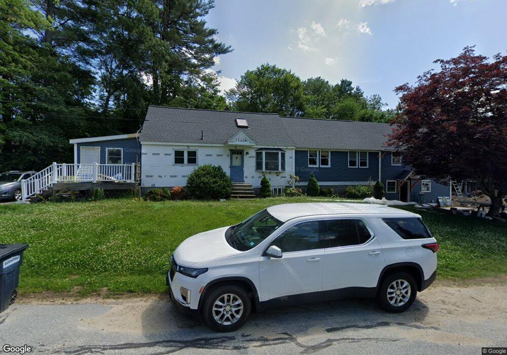
32 Tiger Ave Pelham, NH 03076
Estimated Value: $573,000 - $655,000
3
Beds
2
Baths
2,395
Sq Ft
$257/Sq Ft
Est. Value
About This Home
This home is located at 32 Tiger Ave, Pelham, NH 03076 and is currently estimated at $616,498, approximately $257 per square foot. 32 Tiger Ave is a home with nearby schools including Pelham Elementary School, Pelham Memorial School, and Pelham High School.
Ownership History
Date
Name
Owned For
Owner Type
Purchase Details
Closed on
Jan 20, 2004
Sold by
Johansen Eric B and Johansen Linda
Bought by
Steele Tammy L
Current Estimated Value
Home Financials for this Owner
Home Financials are based on the most recent Mortgage that was taken out on this home.
Original Mortgage
$240,000
Outstanding Balance
$109,341
Interest Rate
5.98%
Mortgage Type
Purchase Money Mortgage
Estimated Equity
$507,157
Create a Home Valuation Report for This Property
The Home Valuation Report is an in-depth analysis detailing your home's value as well as a comparison with similar homes in the area
Home Values in the Area
Average Home Value in this Area
Purchase History
| Date | Buyer | Sale Price | Title Company |
|---|---|---|---|
| Steele Tammy L | $305,000 | -- | |
| Steele Tammy L | $305,000 | -- |
Source: Public Records
Mortgage History
| Date | Status | Borrower | Loan Amount |
|---|---|---|---|
| Open | Steele Tammy L | $240,000 | |
| Closed | Steele Tammy L | $240,000 |
Source: Public Records
Tax History
| Year | Tax Paid | Tax Assessment Tax Assessment Total Assessment is a certain percentage of the fair market value that is determined by local assessors to be the total taxable value of land and additions on the property. | Land | Improvement |
|---|---|---|---|---|
| 2024 | $6,412 | $349,600 | $149,500 | $200,100 |
| 2023 | $6,359 | $349,600 | $149,500 | $200,100 |
| 2022 | $6,090 | $349,600 | $149,500 | $200,100 |
| 2021 | $5,538 | $347,000 | $149,500 | $197,500 |
| 2020 | $5,541 | $274,300 | $108,100 | $166,200 |
| 2019 | $5,279 | $272,100 | $108,100 | $164,000 |
| 2018 | $5,457 | $254,300 | $108,100 | $146,200 |
| 2017 | $5,455 | $254,300 | $108,100 | $146,200 |
| 2016 | $5,328 | $254,300 | $108,100 | $146,200 |
| 2015 | $5,310 | $228,300 | $102,700 | $125,600 |
| 2014 | $5,221 | $228,300 | $102,700 | $125,600 |
| 2013 | $5,180 | $226,500 | $102,700 | $123,800 |
Source: Public Records
Map
Nearby Homes
- 5 Lori Ln
- 28 Bridal Path Rd
- 29 Saddle Rd
- 45 Currier Rd
- 19 Esther Way Unit Lot 10
- 5 Esther Way
- 170 E Richardson Rd
- 23 Frank St Unit 2
- 26 Frank St
- 4 Wilshire Ln Unit 4
- 4 Wilshire Ln
- 6 Wilshire Ln Unit 6
- 12 Tanglewood Dr
- 9 Cornstalk Ln
- 1573 Bridge St
- 2 S Shore Dr
- 1563 Bridge St
- 6 David Dr
- 315 Broadway Rd Unit 1
- 315 Broadway Rd Unit 7
Your Personal Tour Guide
Ask me questions while you tour the home.