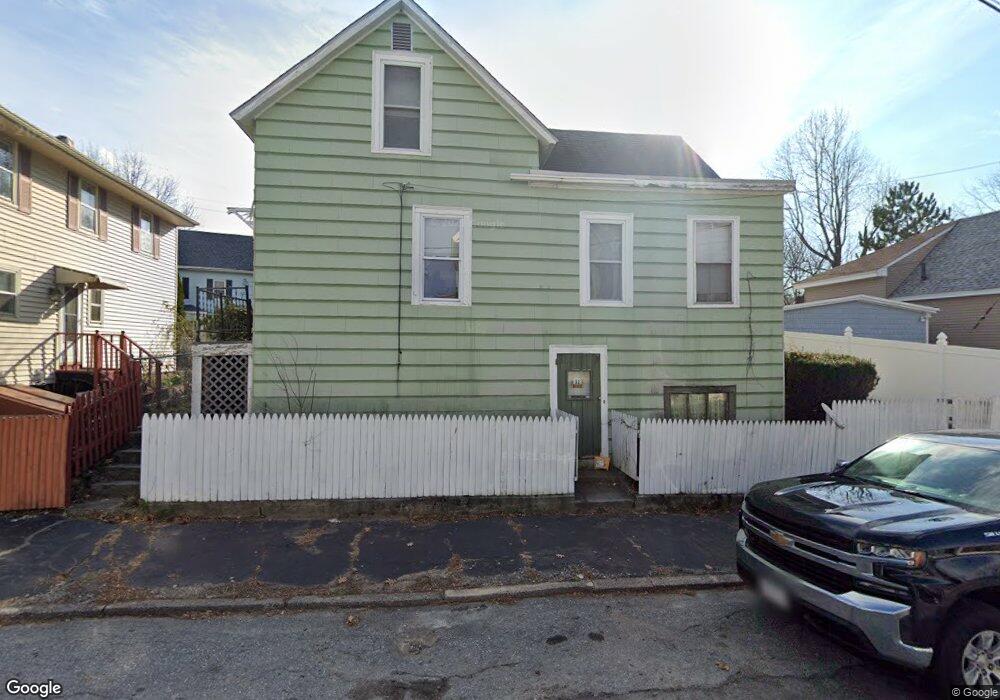
32 Tyler St Lawrence, MA 01843
South West NeighborhoodEstimated Value: $382,000 - $495,000
4
Beds
1
Bath
1,224
Sq Ft
$356/Sq Ft
Est. Value
About This Home
This home is located at 32 Tyler St, Lawrence, MA 01843 and is currently estimated at $436,208, approximately $356 per square foot. 32 Tyler St is a home located in Essex County with nearby schools including John Breen School, Emily G. Wetherbee School (K-8), and School For Exceptional Studies.
Ownership History
Date
Name
Owned For
Owner Type
Purchase Details
Closed on
Jun 30, 2010
Sold by
Noel Tr Raymond J and White Lucille A
Bought by
Duclos 2Nd Daniel A and Duclos Susan M
Current Estimated Value
Home Financials for this Owner
Home Financials are based on the most recent Mortgage that was taken out on this home.
Original Mortgage
$126,467
Outstanding Balance
$84,709
Interest Rate
4.88%
Mortgage Type
Purchase Money Mortgage
Estimated Equity
$351,500
Purchase Details
Closed on
Nov 25, 2009
Sold by
Noel Leda
Bought by
Noel Raymond J and White Lucille A
Create a Home Valuation Report for This Property
The Home Valuation Report is an in-depth analysis detailing your home's value as well as a comparison with similar homes in the area
Home Values in the Area
Average Home Value in this Area
Purchase History
| Date | Buyer | Sale Price | Title Company |
|---|---|---|---|
| Duclos 2Nd Daniel A | $128,800 | -- | |
| Noel Raymond J | -- | -- |
Source: Public Records
Mortgage History
| Date | Status | Borrower | Loan Amount |
|---|---|---|---|
| Open | Duclos 2Nd Daniel A | $126,467 |
Source: Public Records
Tax History
| Year | Tax Paid | Tax Assessment Tax Assessment Total Assessment is a certain percentage of the fair market value that is determined by local assessors to be the total taxable value of land and additions on the property. | Land | Improvement |
|---|---|---|---|---|
| 2025 | $2,882 | $327,500 | $100,100 | $227,400 |
| 2024 | $2,610 | $282,200 | $108,300 | $173,900 |
| 2023 | $2,686 | $264,400 | $100,400 | $164,000 |
| 2022 | $2,746 | $240,000 | $91,000 | $149,000 |
| 2021 | $2,669 | $217,500 | $91,000 | $126,500 |
| 2020 | $2,457 | $197,700 | $86,300 | $111,400 |
| 2019 | $2,543 | $185,900 | $71,700 | $114,200 |
| 2018 | $2,327 | $162,500 | $67,900 | $94,600 |
| 2017 | $2,267 | $147,800 | $64,100 | $83,700 |
| 2016 | $2,130 | $137,300 | $52,800 | $84,500 |
| 2015 | $2,076 | $137,300 | $52,800 | $84,500 |
Source: Public Records
Map
Nearby Homes
- 91-93 Newton St
- 49 Bowdoin St Unit 51
- 82 S Broadway
- 33-35 Coolidge St
- 543 Andover St Unit 6
- 87-87A Brookfield St
- 31 Garfield St
- 11 W Hawley St
- 37 Tewksbury St Unit 39
- 100 Bailey St Unit 1
- 100 Bailey St Unit 3
- 24 Inman St Unit 6
- 24 Inman St Unit 4
- 341 S Broadway- Parcel II
- 82 Water St
- 27-29 Dorchester St
- 312 Water St Unit 4
- 46-46A Dorchester St
- 356-360 S Union St
- 151-153 Bailey St
Your Personal Tour Guide
Ask me questions while you tour the home.