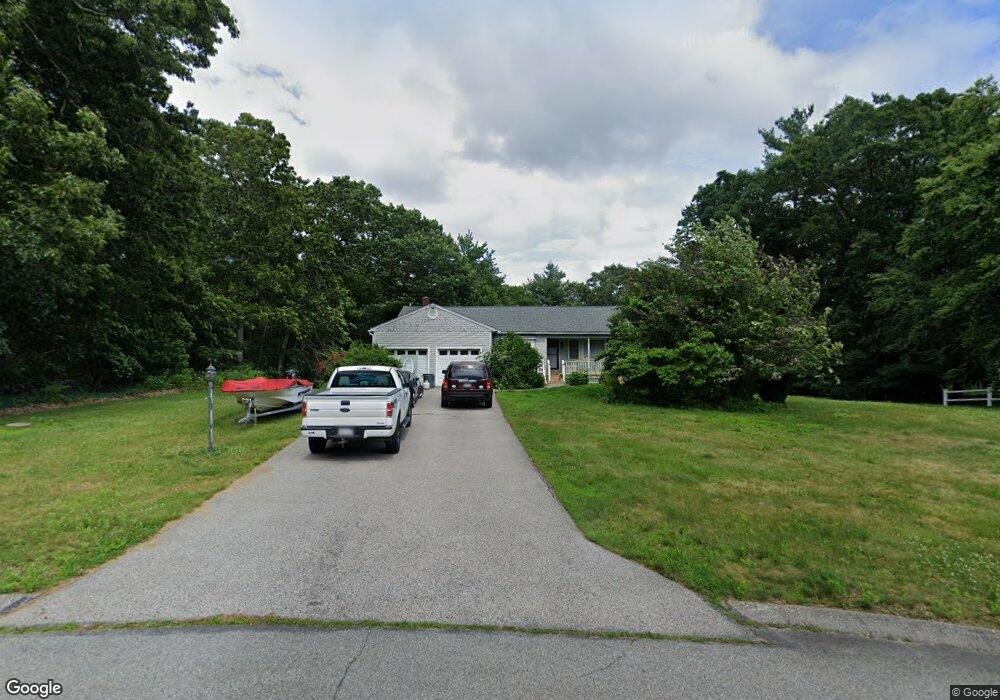
32 Wamsutta Ridge Rd Charlton, MA 01507
Estimated Value: $476,874 - $571,000
3
Beds
2
Baths
1,237
Sq Ft
$426/Sq Ft
Est. Value
About This Home
This home is located at 32 Wamsutta Ridge Rd, Charlton, MA 01507 and is currently estimated at $526,969, approximately $426 per square foot. 32 Wamsutta Ridge Rd is a home located in Worcester County with nearby schools including Shepherd Hill Regional High School.
Ownership History
Date
Name
Owned For
Owner Type
Purchase Details
Closed on
Apr 26, 2011
Sold by
Laplante Lori J and Ditommaso Mark A
Bought by
Colicum Rt and Prouty
Current Estimated Value
Purchase Details
Closed on
Jul 10, 2002
Sold by
Youngsma Irrevoc Ft and Youngsma Alvin H
Bought by
Laplante Lori J and Ditommaso Mark A
Home Financials for this Owner
Home Financials are based on the most recent Mortgage that was taken out on this home.
Original Mortgage
$160,000
Interest Rate
6.79%
Mortgage Type
Purchase Money Mortgage
Purchase Details
Closed on
Dec 4, 1991
Sold by
Arrow Rt
Bought by
Youngsma Myrnie S
Create a Home Valuation Report for This Property
The Home Valuation Report is an in-depth analysis detailing your home's value as well as a comparison with similar homes in the area
Home Values in the Area
Average Home Value in this Area
Purchase History
| Date | Buyer | Sale Price | Title Company |
|---|---|---|---|
| Colicum Rt | $230,000 | -- | |
| Colicum Rt | $230,000 | -- | |
| Laplante Lori J | $200,000 | -- | |
| Laplante Lori J | $200,000 | -- | |
| Youngsma Myrnie S | $42,500 | -- | |
| Youngsma Myrnie S | $42,500 | -- |
Source: Public Records
Mortgage History
| Date | Status | Borrower | Loan Amount |
|---|---|---|---|
| Open | Youngsma Myrnie S | $185,000 | |
| Previous Owner | Youngsma Myrnie S | $162,000 | |
| Previous Owner | Youngsma Myrnie S | $160,000 |
Source: Public Records
Tax History Compared to Growth
Tax History
| Year | Tax Paid | Tax Assessment Tax Assessment Total Assessment is a certain percentage of the fair market value that is determined by local assessors to be the total taxable value of land and additions on the property. | Land | Improvement |
|---|---|---|---|---|
| 2025 | $4,685 | $420,900 | $104,600 | $316,300 |
| 2024 | $4,471 | $394,300 | $99,000 | $295,300 |
| 2023 | $4,431 | $364,100 | $99,000 | $265,100 |
| 2022 | $4,157 | $312,800 | $87,600 | $225,200 |
| 2021 | $3,915 | $260,800 | $79,200 | $181,600 |
| 2020 | $3,837 | $256,800 | $75,200 | $181,600 |
| 2019 | $3,793 | $256,800 | $75,200 | $181,600 |
| 2018 | $3,467 | $256,800 | $75,200 | $181,600 |
| 2017 | $3,397 | $240,900 | $75,200 | $165,700 |
| 2016 | $3,320 | $240,900 | $75,200 | $165,700 |
| 2015 | $3,233 | $240,900 | $75,200 | $165,700 |
| 2014 | $3,121 | $246,500 | $80,800 | $165,700 |
Source: Public Records
Map
Nearby Homes
- 44 Buffum Rd
- 13 Boucher Dr
- 18 Old Worcester Rd
- 0 Partridge Hill Rd
- 71 Bay Path Rd
- 20 Drury Ln
- Lot 7 Coughlin Rd
- Lot 8 Coughlin Rd
- Lot 6 Coughlin Rd
- Lot 4 Coughlin Rd
- 0 Oxbow Rd
- 105 Carroll Hill Rd
- 58 Colburn Rd
- 18 Mckinstry Dr
- 0 Freeman Rd Unit 73369281
- 57 Coughlin Rd
- 3 Lelandville Rd
- 2 Lelandville Rd
- 124 Charlton St Unit F
- 4 Toria Heights Rd
- 30 Wamsutta Ridge Rd
- 0 Wamsutta Ridge Rd
- 40 Colicum Dr
- 38 Colicum Dr
- 31 Wamsutta Ridge Rd
- 39 Colicum Dr
- 29 Wamsutta Ridge Rd
- 28 Wamsutta Ridge Rd
- 37 Colicum Dr
- 27 Wamsutta Ridge Rd
- 35 Colicum Dr
- 34 Colicum Dr
- 26 Wamsutta Ridge Rd
- 36 Colicum Dr
- 33 Colicum Dr
- 24 Wamsutta Ridge Rd
- 32 Colicum Dr
- 32 Colicum Dr
- 31 Colicum Dr
- 23 Wamsutta Ridge Rd