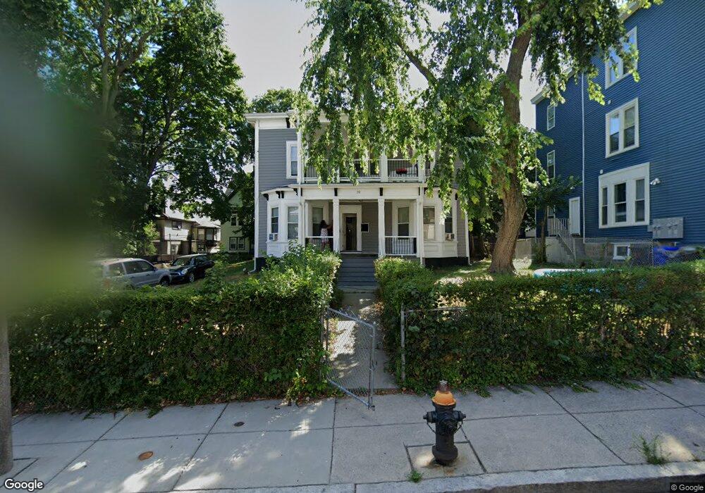
32 Wayne St Unit 1 Dorchester, MA 02121
Washington Park NeighborhoodEstimated Value: $758,000 - $932,000
3
Beds
1
Bath
1,500
Sq Ft
$580/Sq Ft
Est. Value
About This Home
This home is located at 32 Wayne St Unit 1, Dorchester, MA 02121 and is currently estimated at $870,000, approximately $580 per square foot. 32 Wayne St Unit 1 is a home located in Suffolk County with nearby schools including Bridge Boston Charter School and Mother Caroline Academy & Education Center.
Ownership History
Date
Name
Owned For
Owner Type
Purchase Details
Closed on
Aug 26, 2019
Sold by
Mascoll Kevin E and Mascoll Martin J
Bought by
Mascoll Kevin E
Current Estimated Value
Purchase Details
Closed on
Jul 7, 1995
Sold by
Mascoll Edna
Bought by
Mascoll Kevin
Home Financials for this Owner
Home Financials are based on the most recent Mortgage that was taken out on this home.
Original Mortgage
$61,750
Interest Rate
7.84%
Mortgage Type
Purchase Money Mortgage
Create a Home Valuation Report for This Property
The Home Valuation Report is an in-depth analysis detailing your home's value as well as a comparison with similar homes in the area
Home Values in the Area
Average Home Value in this Area
Purchase History
| Date | Buyer | Sale Price | Title Company |
|---|---|---|---|
| Mascoll Kevin E | -- | -- | |
| Mascoll Kevin | $65,000 | -- |
Source: Public Records
Mortgage History
| Date | Status | Borrower | Loan Amount |
|---|---|---|---|
| Previous Owner | Mascoll Kevin | $162,000 | |
| Previous Owner | Mascoll Kevin | $105,000 | |
| Previous Owner | Mascoll Kevin | $24,998 | |
| Previous Owner | Mascoll Kevin | $61,750 |
Source: Public Records
Tax History
| Year | Tax Paid | Tax Assessment Tax Assessment Total Assessment is a certain percentage of the fair market value that is determined by local assessors to be the total taxable value of land and additions on the property. | Land | Improvement |
|---|---|---|---|---|
| 2025 | $8,236 | $711,200 | $247,100 | $464,100 |
| 2024 | $7,472 | $685,500 | $240,700 | $444,800 |
| 2023 | $6,571 | $611,800 | $214,800 | $397,000 |
| 2022 | $6,219 | $571,600 | $200,700 | $370,900 |
| 2021 | $5,865 | $549,700 | $193,000 | $356,700 |
| 2020 | $5,298 | $501,700 | $177,900 | $323,800 |
| 2019 | $4,723 | $448,100 | $131,600 | $316,500 |
| 2018 | $4,471 | $426,600 | $131,600 | $295,000 |
| 2017 | $4,518 | $426,600 | $131,600 | $295,000 |
| 2016 | $4,080 | $370,900 | $131,600 | $239,300 |
| 2015 | $4,153 | $342,900 | $127,500 | $215,400 |
| 2014 | $3,852 | $306,200 | $127,500 | $178,700 |
Source: Public Records
Map
Nearby Homes
- 87 Maple St
- 94 Normandy St
- 157-165 Stanwood St
- 408 Seaver St Unit 2
- 35 Ellington St
- 27 Brinsley St
- 7 Waumbeck St Unit 2
- 7 Waumbeck St Unit 3
- 52 Intervale St
- 132 Ellington St
- 33 Waumbeck St
- 109 Ellington St Unit 1
- 36 Mclellan St
- 340 Blue Hill Ave
- 162 Humboldt Ave
- 23 Lawrence Ave
- 31 Homestead St Unit 2
- 42 Greenwood St
- 16 Bowdoin Ave Unit 3
- 69 Greenwood St
- 32 Wayne St
- 38 Wayne St
- 38 Wayne St Unit 1
- 38 Wayne St
- 38 Wayne St Unit 2
- 26 Wayne St
- 39 Nazing St
- 43 Nazing St
- 43 Nazing St Unit 1
- 35 Nazing St
- 35 Nazing St Unit 3
- 19 Wayne St
- 22 Wayne St
- 15 Wayne St
- 31 Nazing St Unit 2
- 31 Nazing St Unit 1
- 31 Nazing St
- 92 Maple St
- 92 Maple St Unit 92 Maple Street
- 92 Maple St Unit 6
Your Personal Tour Guide
Ask me questions while you tour the home.