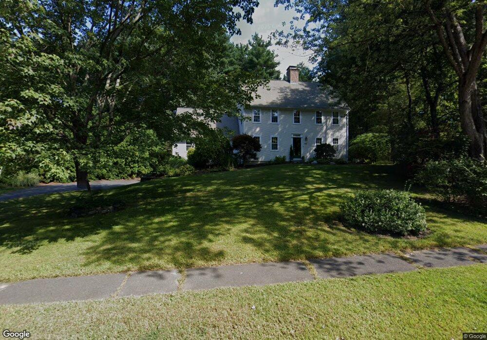
32 Woodlot Rd Amherst, MA 01002
Estimated Value: $768,209 - $869,000
4
Beds
3
Baths
3,221
Sq Ft
$254/Sq Ft
Est. Value
About This Home
This home is located at 32 Woodlot Rd, Amherst, MA 01002 and is currently estimated at $819,302, approximately $254 per square foot. 32 Woodlot Rd is a home located in Hampshire County with nearby schools including Fort River Elementary School, Amherst Regional Middle School, and Amherst Regional High School.
Ownership History
Date
Name
Owned For
Owner Type
Purchase Details
Closed on
Dec 18, 2019
Sold by
Peake Word D and Daisley Janet R
Bought by
Seldin Catherine K
Current Estimated Value
Home Financials for this Owner
Home Financials are based on the most recent Mortgage that was taken out on this home.
Original Mortgage
$395,000
Outstanding Balance
$348,930
Interest Rate
3.7%
Mortgage Type
New Conventional
Estimated Equity
$470,372
Purchase Details
Closed on
May 30, 1996
Sold by
Jones Gerald Lewis
Bought by
Daisley Janet R
Create a Home Valuation Report for This Property
The Home Valuation Report is an in-depth analysis detailing your home's value as well as a comparison with similar homes in the area
Home Values in the Area
Average Home Value in this Area
Purchase History
| Date | Buyer | Sale Price | Title Company |
|---|---|---|---|
| Seldin Catherine K | $495,000 | None Available | |
| Daisley Janet R | $280,000 | -- |
Source: Public Records
Mortgage History
| Date | Status | Borrower | Loan Amount |
|---|---|---|---|
| Open | Seldin Catherine K | $395,000 | |
| Previous Owner | Daisley Janet R | $350,000 | |
| Previous Owner | Daisley Janet R | $25,000 |
Source: Public Records
Tax History Compared to Growth
Tax History
| Year | Tax Paid | Tax Assessment Tax Assessment Total Assessment is a certain percentage of the fair market value that is determined by local assessors to be the total taxable value of land and additions on the property. | Land | Improvement |
|---|---|---|---|---|
| 2025 | $128 | $712,000 | $197,700 | $514,300 |
| 2024 | $12,472 | $673,800 | $186,600 | $487,200 |
| 2023 | $11,803 | $587,200 | $169,900 | $417,300 |
| 2022 | $11,679 | $549,100 | $161,300 | $387,800 |
| 2021 | $11,119 | $509,600 | $149,500 | $360,100 |
| 2020 | $11,528 | $540,700 | $155,700 | $385,000 |
| 2019 | $11,046 | $506,700 | $155,700 | $351,000 |
| 2018 | $10,712 | $506,700 | $155,700 | $351,000 |
| 2017 | $10,513 | $481,600 | $148,300 | $333,300 |
| 2016 | $10,220 | $481,600 | $148,300 | $333,300 |
| 2015 | $9,892 | $481,600 | $148,300 | $333,300 |
Source: Public Records
Map
Nearby Homes
- 481 Old Farm Rd
- 53 Pine Grove Unit 53
- 57 Tanglewood Rd
- 100 Larkspur Dr
- 96 Logtown Rd
- 130 Linden Ridge Rd
- 265 Stanley St
- 324 Pomeroy Ln
- 14 Pebble Ridge Rd
- 0 Heatherstone Rd
- 61 S Valley Rd
- 365 Middle St
- 0 Amherst Rd
- 170 E Hadley Rd Unit 123
- 170 E Hadley Rd Unit 46
- 9 Harkness Rd
- 112 North St
- 41 Arnold Rd
- 48 Gray St
- 1730 S East St
- 28 Woodlot Rd
- 34 Woodlot Rd
- 178 Wildflower Dr
- 182 Wildflower Dr
- 35 Woodlot Rd
- 174 Wildflower Dr
- 33 Woodlot Rd
- 36 Woodlot Rd
- 26 Woodlot Rd
- 31 Woodlot Rd
- 186 Wildflower Dr
- 37 Woodlot Rd
- 170 Wildflower Dr
- 38 Woodlot Rd
- 181 Wildflower Dr
- 185 Wildflower Dr
- 24 Woodlot Rd
- 190 Wildflower Dr
- 8 Tanglewood Rd
- 27 Woodlot Rd