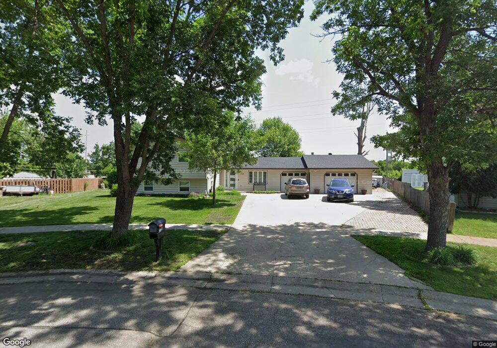
320 11th Ave E West Fargo, ND 58078
Eastwood NeighborhoodEstimated Value: $326,000 - $355,353
3
Beds
2
Baths
2,256
Sq Ft
$151/Sq Ft
Est. Value
About This Home
This home is located at 320 11th Ave E, West Fargo, ND 58078 and is currently estimated at $340,677, approximately $151 per square foot. 320 11th Ave E is a home located in Cass County with nearby schools including Eastwood Elementary School, Cheney Middle School, and West Fargo High School.
Ownership History
Date
Name
Owned For
Owner Type
Purchase Details
Closed on
Jul 21, 2006
Sold by
Laverdure Joseph and Laverdure Marilyn
Bought by
Davila Paloma Ramos
Current Estimated Value
Home Financials for this Owner
Home Financials are based on the most recent Mortgage that was taken out on this home.
Original Mortgage
$125,200
Outstanding Balance
$74,656
Interest Rate
6.73%
Mortgage Type
New Conventional
Estimated Equity
$266,021
Create a Home Valuation Report for This Property
The Home Valuation Report is an in-depth analysis detailing your home's value as well as a comparison with similar homes in the area
Home Values in the Area
Average Home Value in this Area
Purchase History
| Date | Buyer | Sale Price | Title Company |
|---|---|---|---|
| Davila Paloma Ramos | -- | -- |
Source: Public Records
Mortgage History
| Date | Status | Borrower | Loan Amount |
|---|---|---|---|
| Open | Davila Paloma Ramos | $125,200 |
Source: Public Records
Tax History
| Year | Tax Paid | Tax Assessment Tax Assessment Total Assessment is a certain percentage of the fair market value that is determined by local assessors to be the total taxable value of land and additions on the property. | Land | Improvement |
|---|---|---|---|---|
| 2024 | $4,483 | $164,950 | $27,050 | $137,900 |
| 2023 | $4,588 | $168,100 | $27,050 | $141,050 |
| 2022 | $4,398 | $153,300 | $27,050 | $126,250 |
| 2021 | $4,059 | $136,050 | $19,650 | $116,400 |
| 2020 | $4,011 | $136,650 | $19,650 | $117,000 |
| 2019 | $3,959 | $132,100 | $19,650 | $112,450 |
| 2018 | $3,503 | $120,800 | $19,650 | $101,150 |
| 2017 | $3,324 | $116,900 | $19,650 | $97,250 |
| 2016 | $2,954 | $113,400 | $19,650 | $93,750 |
| 2015 | $2,791 | $97,700 | $18,650 | $79,050 |
| 2014 | $2,741 | $91,300 | $18,650 | $72,650 |
| 2013 | $2,613 | $87,200 | $18,650 | $68,550 |
Source: Public Records
Map
Nearby Homes
- 245 12th Ave E
- 332 13th Ave E
- 602 12 1 2 Ave E Unit 5
- 622 12th Ave E
- 714 14th Ave E
- 631 7th Ave E
- 226 10 1/2 Ave W
- 431 5th Ave E Unit 1
- 783 14 1 2 Ave E
- 620 Sukut St
- 801 9th St E
- 832 5th Ave E
- 790 Lakeridge Dr
- 1814 Brentwood Ct
- 1059 Sommerset Place
- 217 1st Ave E
- 1550 Sheyenne St
- 520 6th Ave W Unit 8
- 868 Lakeridge Place
- 1511 11th Ave E
- 314 11th Ave E
- 1101 4th St E
- 11th 11th Ave E
- 319 10 1/2 Ave E
- 308 11th Ave E
- 1102 4th St E
- 1019 4 St E
- 1019 4th St E
- 313 10 1/2 Ave E
- 313 10 1 2 Ave E
- 1113 4th St E
- 302 11th Ave E
- 301 11th Ave E
- 307 10 1/2 Ave E
- 1108 4th St E
- 1013 4th St E
- 244 11th Ave E
- 301 10 1 2 Ave E
- 301 10 1/2 Ave E
- 302 12th Ave E
Your Personal Tour Guide
Ask me questions while you tour the home.