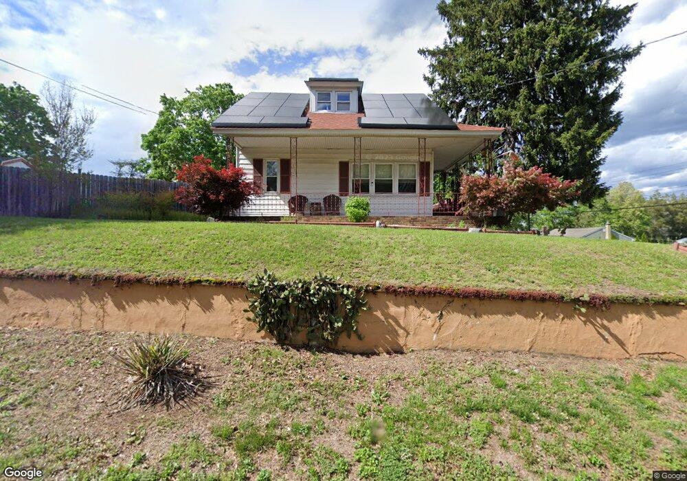
320 Berkley Rd Mantua, NJ 08051
Mantua Township NeighborhoodEstimated Value: $257,354 - $291,000
--
Bed
--
Bath
1,409
Sq Ft
$199/Sq Ft
Est. Value
About This Home
This home is located at 320 Berkley Rd, Mantua, NJ 08051 and is currently estimated at $280,589, approximately $199 per square foot. 320 Berkley Rd is a home located in Gloucester County with nearby schools including Centre City School, Clearview Regional Middle School, and Clearview Regional High School.
Ownership History
Date
Name
Owned For
Owner Type
Purchase Details
Closed on
Jul 31, 1998
Sold by
Lydon Kenneth G and Lydon Linda J
Bought by
Westergard John H and Westergard Suzanne E
Current Estimated Value
Home Financials for this Owner
Home Financials are based on the most recent Mortgage that was taken out on this home.
Original Mortgage
$97,440
Outstanding Balance
$20,328
Interest Rate
6.92%
Mortgage Type
VA
Estimated Equity
$260,261
Create a Home Valuation Report for This Property
The Home Valuation Report is an in-depth analysis detailing your home's value as well as a comparison with similar homes in the area
Home Values in the Area
Average Home Value in this Area
Purchase History
| Date | Buyer | Sale Price | Title Company |
|---|---|---|---|
| Westergard John H | $106,000 | Group 21 Title Agency |
Source: Public Records
Mortgage History
| Date | Status | Borrower | Loan Amount |
|---|---|---|---|
| Open | Westergard John H | $97,440 |
Source: Public Records
Tax History Compared to Growth
Tax History
| Year | Tax Paid | Tax Assessment Tax Assessment Total Assessment is a certain percentage of the fair market value that is determined by local assessors to be the total taxable value of land and additions on the property. | Land | Improvement |
|---|---|---|---|---|
| 2025 | $5,253 | $204,000 | $47,000 | $157,000 |
| 2024 | $5,198 | $204,000 | $47,000 | $157,000 |
| 2023 | $5,198 | $204,000 | $47,000 | $157,000 |
| 2022 | $4,929 | $140,900 | $39,000 | $101,900 |
| 2021 | $4,843 | $140,900 | $39,000 | $101,900 |
| 2020 | $4,926 | $140,900 | $39,000 | $101,900 |
| 2019 | $4,843 | $140,900 | $39,000 | $101,900 |
| 2018 | $4,774 | $140,900 | $39,000 | $101,900 |
| 2017 | $4,702 | $140,900 | $39,000 | $101,900 |
| 2016 | $4,648 | $140,900 | $39,000 | $101,900 |
| 2015 | $4,534 | $140,900 | $39,000 | $101,900 |
| 2014 | $5,122 | $164,700 | $39,000 | $125,700 |
Source: Public Records
Map
Nearby Homes
- 1134 Tristram Cir Unit 4
- 1147 Tristram Cir Unit 1147
- 1145 Tristram Cir
- 1215 Tristram Cir
- 1433 Tristram Cir
- 205 Redbud Ln Unit 205
- 75 Hickory Ave
- 8 Barry Dr
- 433 Berkley Rd
- 19 Marathon Dr
- 261 Tony Cir
- 106 Firth Dr
- 325 Bridgeton Pike
- 131 Firth Dr
- 465 Berkley Rd
- 204 W Landing Rd
- 190 Mockingbird Ln
- 485 Harrison Ave
- 119 Monroe Ave
- 111 Cove Rd
- 197 Ash Ave
- 181 Ash Ave
- 176 Linden Ave
- 179 Linden Ave
- 195 Linden Ave
- 1110 Tristram Cir Unit 1110
- 1117 Tristram Cir Unit 1117
- 1111 Tristram Cir Unit 1111
- 1116 Tristram Cir Unit 1116
- 1192 Tristram Cir Unit 2
- 1191 Tristram Cir Unit 1
- 1112 Tristram Cir Unit 1112
- 198 Ash Ave
- 1193 Tristram Cir Unit 1193
- 1190 Tristram Cir Unit 1190O
- 1113 Tristram Cir Unit 113
- 1114 Tristram Cir
- 1197 Tristram Cir
- 194 W Elm Ave
- 1194 Tristram Cir Unit 1194