Estimated Value: $336,000 - $379,000
--
Bed
3
Baths
2,357
Sq Ft
$153/Sq Ft
Est. Value
About This Home
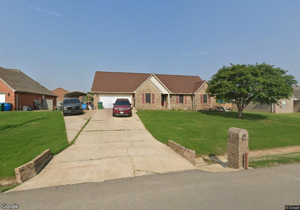
This home is located at 320 Beverly Dr, Atoka, TN 38004 and is currently estimated at $359,637, approximately $152 per square foot. 320 Beverly Dr is a home located in Tipton County with nearby schools including Atoka Elementary School, Brighton Middle School, and Brighton High School.
Ownership History
Date
Name
Owned For
Owner Type
Purchase Details
Closed on
Aug 3, 2004
Sold by
Creative Development
Bought by
Claffey Jack L
Current Estimated Value
Home Financials for this Owner
Home Financials are based on the most recent Mortgage that was taken out on this home.
Original Mortgage
$167,000
Outstanding Balance
$83,856
Interest Rate
6.19%
Estimated Equity
$275,781
Purchase Details
Closed on
Sep 16, 2003
Bought by
Creative Development Inc
Purchase Details
Closed on
Oct 4, 1990
Bought by
Munford Development Co
Create a Home Valuation Report for This Property
The Home Valuation Report is an in-depth analysis detailing your home's value as well as a comparison with similar homes in the area
Home Values in the Area
Average Home Value in this Area
Purchase History
| Date | Buyer | Sale Price | Title Company |
|---|---|---|---|
| Claffey Jack L | $167,000 | -- | |
| Creative Development Inc | $36,000 | -- | |
| Munford Development Co | -- | -- |
Source: Public Records
Mortgage History
| Date | Status | Borrower | Loan Amount |
|---|---|---|---|
| Open | Munford Development Co | $167,000 |
Source: Public Records
Tax History Compared to Growth
Tax History
| Year | Tax Paid | Tax Assessment Tax Assessment Total Assessment is a certain percentage of the fair market value that is determined by local assessors to be the total taxable value of land and additions on the property. | Land | Improvement |
|---|---|---|---|---|
| 2024 | $1,874 | $83,075 | $8,675 | $74,400 |
| 2023 | $1,874 | $83,075 | $8,675 | $74,400 |
| 2022 | $1,785 | $58,150 | $6,375 | $51,775 |
| 2021 | $1,756 | $58,150 | $6,375 | $51,775 |
| 2020 | $1,755 | $58,150 | $6,375 | $51,775 |
| 2019 | $1,796 | $50,025 | $6,375 | $43,650 |
| 2018 | $1,796 | $50,025 | $6,375 | $43,650 |
| 2017 | $1,611 | $50,025 | $6,375 | $43,650 |
| 2016 | $1,611 | $50,025 | $6,375 | $43,650 |
| 2015 | $1,609 | $50,025 | $6,375 | $43,650 |
| 2014 | $1,487 | $50,030 | $0 | $0 |
Source: Public Records
Map
Nearby Homes
- 371 Beverly Dr
- 538 Rosemark Rd
- 189 Cotton Fall Dr
- 93 Sterling Farm Dr
- 78 Doe Trail
- 128 Loch Haven Cove S
- 104 Lochmeade Dr
- 420 Trebing Pkwy
- 170 Como Ln
- 125 Columbia Way
- 00 Atoka Idaville Rd
- 0 Smith Dr Unit 10202728
- 61 Como Ln
- 29 Merino Dr
- 236 Como Ln
- 35 Drysdale Cove
- 284 Merino Dr
- 50 Drysdale Cove
- 60 Drysdale Cove
- 33 Ward Ln
- 310 Beverly Dr
- 338 Beverly Dr
- 205 Dogwood Trace
- 187 Dogwood Trace
- 231 Dogwood Trace
- 319 Beverly Dr
- 290 Beverly Dr
- 337 Beverly Dr
- 301 Beverly Dr
- 167 Dogwood Trace
- 281 Beverly Dr
- 382 Beverly Dr
- 208 Dogwood Trace
- 188 Dogwood Trace
- 391 Rosemark Rd
- 99 Marian Dr
- 369 Rosemark Rd
- 261 Beverly Dr
- 256 Beverly Dr
- 411 Rosemark Rd