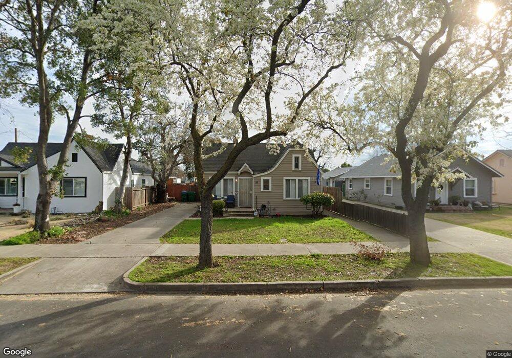
320 Louie Ave Lodi, CA 95240
North Lodi NeighborhoodEstimated Value: $411,000 - $536,000
2
Beds
1
Bath
837
Sq Ft
$585/Sq Ft
Est. Value
About This Home
This home is located at 320 Louie Ave, Lodi, CA 95240 and is currently estimated at $489,667, approximately $585 per square foot. 320 Louie Ave is a home located in San Joaquin County with nearby schools including Lakewood Elementary School, Millswood Middle School, and Lodi High School.
Ownership History
Date
Name
Owned For
Owner Type
Purchase Details
Closed on
Apr 14, 2023
Sold by
Hoag Revocable Trust and Hoag Daniel George
Bought by
Graeff Christy Jean
Current Estimated Value
Purchase Details
Closed on
Nov 2, 2015
Sold by
Berg Lisa J and Beverly J Hoag Living Trust
Bought by
Hoag Daniel A and Hoag Revocable Trust
Purchase Details
Closed on
Jun 2, 2010
Sold by
Hoag Daniel
Bought by
Hoag Daniel A and Hoag Revocable Trust
Purchase Details
Closed on
Nov 21, 2007
Sold by
Hoag Beverly J and Beverly J Hoag Living Trust
Bought by
Hoag Daniel and Hoag Beverly J
Purchase Details
Closed on
Oct 12, 2004
Sold by
Hoag Daniel A
Bought by
Hoag Beverly J and Beverly J Hoag Living Trust
Purchase Details
Closed on
Aug 30, 2004
Sold by
Hoag Georjean
Bought by
Hoag Beverly J and Beverly J Hoag Living Trust
Create a Home Valuation Report for This Property
The Home Valuation Report is an in-depth analysis detailing your home's value as well as a comparison with similar homes in the area
Home Values in the Area
Average Home Value in this Area
Purchase History
We collect this data history from publicly available records. To have your information removed, we recommend requesting removal directly through your county’s website.
| Date | Buyer | Sale Price | Title Company |
|---|---|---|---|
| Graeff Christy Jean | -- | None Listed On Document | |
| Hoag Daniel A | -- | None Available | |
| Hoag Daniel A | -- | None Available | |
| Hoag Daniel | $200,000 | None Available | |
| Hoag Beverly J | -- | -- | |
| Hoag Beverly J | -- | -- |
Source: Public Records
Tax History
| Year | Tax Paid | Tax Assessment Tax Assessment Total Assessment is a certain percentage of the fair market value that is determined by local assessors to be the total taxable value of land and additions on the property. | Land | Improvement |
|---|---|---|---|---|
| 2025 | $7,423 | $681,462 | $202,878 | $478,584 |
| 2024 | $7,221 | $668,100 | $198,900 | $469,200 |
| 2023 | $3,970 | $362,861 | $116,233 | $246,628 |
| 2022 | $3,882 | $355,747 | $113,954 | $241,793 |
| 2021 | $3,952 | $348,772 | $111,720 | $237,052 |
| 2020 | $3,850 | $345,197 | $110,575 | $234,622 |
| 2019 | $3,773 | $338,429 | $108,407 | $230,022 |
| 2018 | $3,721 | $331,794 | $106,282 | $225,512 |
| 2017 | $3,638 | $325,290 | $104,199 | $221,091 |
| 2016 | $3,412 | $318,913 | $102,156 | $216,757 |
| 2015 | $3,376 | $314,126 | $100,623 | $213,503 |
| 2014 | $3,323 | $307,973 | $98,652 | $209,321 |
Source: Public Records
Map
Nearby Homes
- 625 N Church St Unit 5
- 230 River Oaks Dr
- 518 N Church St
- 720 N School St
- 625 N Sacramento St
- 606 W Turner Rd
- 0 W Turner Rd Unit 226006338
- 333 W Locust St
- 1258 Rivergate Dr
- 101 Mokelumne River Dr
- 834 Daisy Ave
- 1041 Yuloni Dr
- 1180 Northwood Dr
- 635 N Sacramento St
- 223 Rush St
- 1729 Le Bec Ct
- 1786 Le Bec Ct
- 1150 Junewood Ct
- 1424 Graffigna Ave
- 1507 Holly Dr
- 316 Louie Ave
- 324 1/2 Louie Ave
- 324 Louie Ave
- 312 Louie Ave
- 328 Louie Ave
- 308 Louie Ave
- 332 Louie Ave
- 321 Forrest Ave Unit 1/2
- 321 Forrest Ave
- 321 Forrest Ave
- 336 Louie Ave
- 319 Louie Ave
- 323 Louie Ave
- 313 Forrest Ave
- 315 Louie Ave
- 713 N Pleasant Ave
- 729 N Pleasant Ave
- 717 N Pleasant Ave
- 327 Louie Ave
- 325 Forrest Ave
Your Personal Tour Guide
Ask me questions while you tour the home.