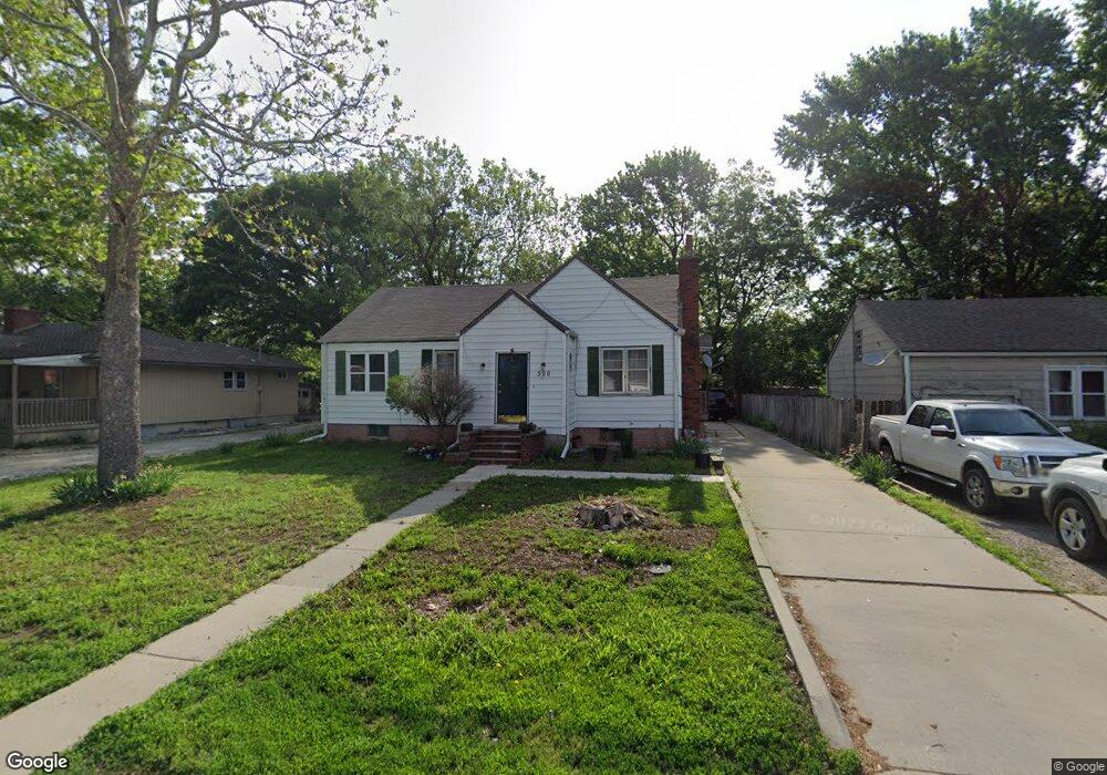
320 N Buchanan St Olathe, KS 66061
Estimated Value: $221,000 - $262,000
3
Beds
2
Baths
1,146
Sq Ft
$212/Sq Ft
Est. Value
About This Home
This home is located at 320 N Buchanan St, Olathe, KS 66061 and is currently estimated at $243,316, approximately $212 per square foot. 320 N Buchanan St is a home located in Johnson County with nearby schools including Mahaffie Elementary School, Santa Fe Trail Middle School, and Olathe North Sr High School.
Ownership History
Date
Name
Owned For
Owner Type
Purchase Details
Closed on
Nov 29, 2002
Sold by
Kayser Sandra K and Kayser Elan K
Bought by
Mcintyre Larry K and Mcintyre Melene
Current Estimated Value
Home Financials for this Owner
Home Financials are based on the most recent Mortgage that was taken out on this home.
Original Mortgage
$81,000
Outstanding Balance
$34,317
Interest Rate
6.05%
Estimated Equity
$208,999
Create a Home Valuation Report for This Property
The Home Valuation Report is an in-depth analysis detailing your home's value as well as a comparison with similar homes in the area
Home Values in the Area
Average Home Value in this Area
Purchase History
| Date | Buyer | Sale Price | Title Company |
|---|---|---|---|
| Mcintyre Larry K | -- | Old Republic Title |
Source: Public Records
Mortgage History
| Date | Status | Borrower | Loan Amount |
|---|---|---|---|
| Open | Mcintyre Larry K | $81,000 |
Source: Public Records
Tax History Compared to Growth
Tax History
| Year | Tax Paid | Tax Assessment Tax Assessment Total Assessment is a certain percentage of the fair market value that is determined by local assessors to be the total taxable value of land and additions on the property. | Land | Improvement |
|---|---|---|---|---|
| 2024 | $2,284 | $21,091 | $4,398 | $16,693 |
| 2023 | $2,157 | $19,263 | $4,000 | $15,263 |
| 2022 | $1,912 | $16,652 | $3,635 | $13,017 |
| 2021 | $1,888 | $15,467 | $3,635 | $11,832 |
| 2020 | $1,769 | $14,386 | $3,160 | $11,226 |
| 2019 | $1,723 | $13,926 | $3,160 | $10,766 |
| 2018 | $1,630 | $13,099 | $2,530 | $10,569 |
| 2017 | $1,459 | $11,638 | $2,530 | $9,108 |
| 2016 | $1,299 | $10,661 | $2,530 | $8,131 |
| 2015 | $1,210 | $9,959 | $2,530 | $7,429 |
| 2013 | -- | $8,223 | $2,299 | $5,924 |
Source: Public Records
Map
Nearby Homes
- 540 E Prairie St
- 816 E Whitney St
- 501 E Spruce St
- 510 E Park St
- 519 E Cedar St
- 224 S Church St
- 336 E Park St
- 107 E Nelson Cir
- 1001 E Cedar St
- 821 N Hamilton St
- 500 E Johnston St
- 817 E Layton Dr
- 1008 E Fredrickson Dr
- 1012 E Fredrickson Dr
- 1113 E Cedar St
- 136 E Nelson Cir
- 801 E Piatt Ln
- 11938 N Keeler St
- 321 S Wabash Cir
- 320 S Walker St
- 316 N Buchanan St
- 326 N Buchanan St
- 310 N Buchanan St
- 331 N Keeler St
- 330 N Buchanan St
- 325 N Keeler St
- 333 N Keeler St
- 308 N Buchanan St
- 317 N Keeler St
- 325 N Buchanan St
- 334 N Buchanan St
- 323 N Buchanan St
- 407 N Keeler St
- 315 N Keeler St
- 321 N Buchanan St
- 306 N Buchanan St
- 311 N Keeler St
- 404 N Keeler St
- 320 N Keeler St
- 304 N Buchanan St