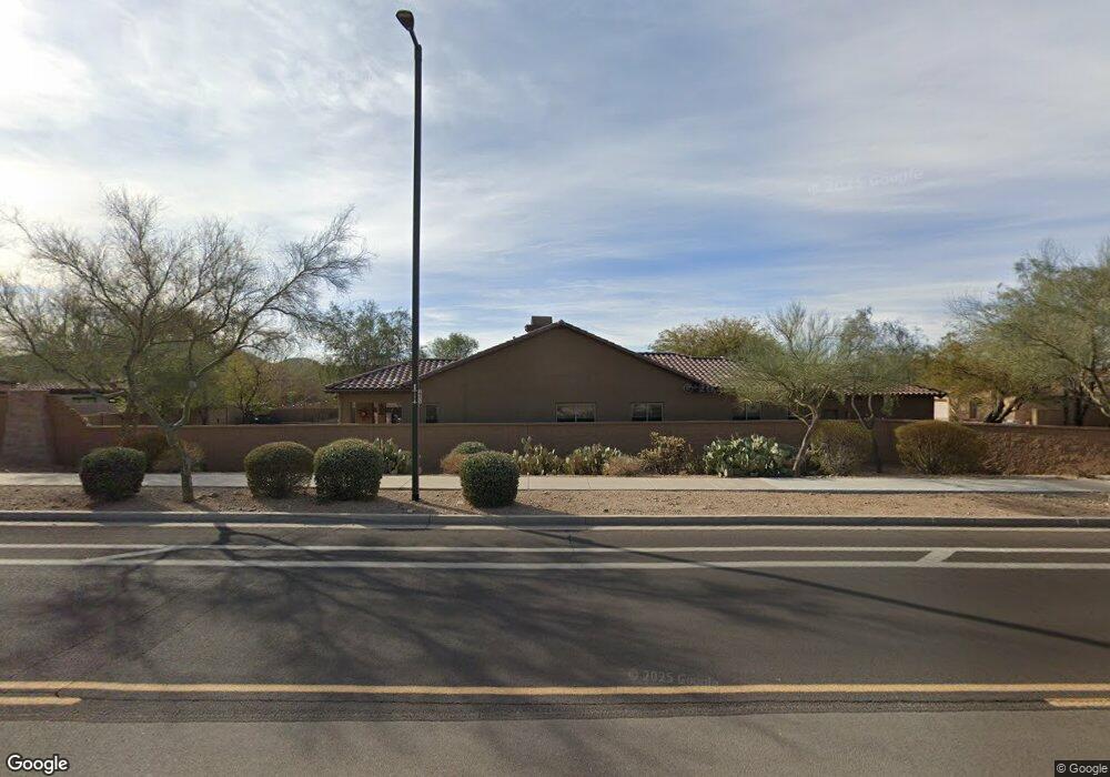
32033 N 20th Dr Phoenix, AZ 85085
North Gateway NeighborhoodEstimated Value: $891,642 - $1,181,000
4
Beds
3
Baths
3,047
Sq Ft
$321/Sq Ft
Est. Value
About This Home
This home is located at 32033 N 20th Dr, Phoenix, AZ 85085 and is currently estimated at $978,411, approximately $321 per square foot. 32033 N 20th Dr is a home located in Maricopa County with nearby schools including Sonoran Foothills, Barry Goldwater High School, and Ridgeline Academy.
Ownership History
Date
Name
Owned For
Owner Type
Purchase Details
Closed on
Jun 22, 2011
Sold by
Luna Roja Llc
Bought by
Capulli Anthony
Current Estimated Value
Home Financials for this Owner
Home Financials are based on the most recent Mortgage that was taken out on this home.
Original Mortgage
$287,920
Outstanding Balance
$197,833
Interest Rate
4.56%
Mortgage Type
New Conventional
Estimated Equity
$780,578
Purchase Details
Closed on
Mar 30, 2011
Sold by
Oglevee Stefan W
Bought by
Luna Roja Llc
Purchase Details
Closed on
Sep 26, 2006
Sold by
Oglevee Melissa
Bought by
Oglevee Stefan W
Home Financials for this Owner
Home Financials are based on the most recent Mortgage that was taken out on this home.
Original Mortgage
$166,000
Interest Rate
6.44%
Mortgage Type
Unknown
Create a Home Valuation Report for This Property
The Home Valuation Report is an in-depth analysis detailing your home's value as well as a comparison with similar homes in the area
Home Values in the Area
Average Home Value in this Area
Purchase History
| Date | Buyer | Sale Price | Title Company |
|---|---|---|---|
| Capulli Anthony | $359,900 | Stewart Title & Trust Of Pho | |
| Luna Roja Llc | $281,000 | None Available | |
| Oglevee Stefan W | -- | Westminster Title Agency Inc | |
| Oglevee Stefan | $773,390 | Westminster Title Agency Inc | |
| Toll Brothers Az Lp | -- | Westminster Title Agency Inc |
Source: Public Records
Mortgage History
| Date | Status | Borrower | Loan Amount |
|---|---|---|---|
| Open | Capulli Anthony | $287,920 | |
| Previous Owner | Toll Brothers Az Lp | $166,000 | |
| Previous Owner | Oglevee Stefan W | $500,000 |
Source: Public Records
Tax History Compared to Growth
Tax History
| Year | Tax Paid | Tax Assessment Tax Assessment Total Assessment is a certain percentage of the fair market value that is determined by local assessors to be the total taxable value of land and additions on the property. | Land | Improvement |
|---|---|---|---|---|
| 2025 | $4,661 | $51,964 | -- | -- |
| 2024 | $4,577 | $49,489 | -- | -- |
| 2023 | $4,577 | $63,200 | $12,640 | $50,560 |
| 2022 | $4,403 | $46,580 | $9,310 | $37,270 |
| 2021 | $4,536 | $43,600 | $8,720 | $34,880 |
| 2020 | $4,447 | $42,410 | $8,480 | $33,930 |
| 2019 | $4,301 | $41,060 | $8,210 | $32,850 |
| 2018 | $4,147 | $39,450 | $7,890 | $31,560 |
| 2017 | $3,993 | $37,180 | $7,430 | $29,750 |
| 2016 | $3,758 | $37,160 | $7,430 | $29,730 |
| 2015 | $3,306 | $36,730 | $7,340 | $29,390 |
Source: Public Records
Map
Nearby Homes
- 2033 W Burnside Trail
- 31914 N 20th Ln
- 32002 N 19th Ln
- 2025 W Calle Del Sol --
- 1929 W Burnside Trail
- 2179 W Burnside Trail
- 2187 W Burnside Trail
- 31821 N 19th Ln
- 2015 W Forest Pleasant Place
- 2.2 acres N 19th Ave Unit 3
- 31912 N 23rd Ave
- 2030 W Whisper Rock Trail
- 32634 N 21st Ln
- 1807 W Sierra Sunset Trail
- 2425 W Bronco Butte Trail Unit 2024
- 2425 W Bronco Butte Trail Unit 2014
- 2425 W Bronco Butte Trail Unit 2008
- 2425 W Bronco Butte Trail Unit 2015
- 2425 W Bronco Butte Trail Unit 2028
- 2425 W Bronco Butte Trail Unit 2011
- 32033 N 20th Ln
- 32029 N 20th Dr
- 32029 N 20th Ln
- 32025 N 20th Dr
- 32025 N 20th Ln
- 32032 N 20th Dr
- 32028 N 20th Dr
- 32024 N 20th Dr
- 32021 N 20th Dr
- 32026 N 20th Ln
- 2053 W Burnside Trail
- 32020 N 20th Dr
- 2057 W Burnside Trail
- 2057 W Burnside Trail
- 2045 W Burnside Trail
- 32022 N 20th Ln
- 2041 W Burnside Trail
- 2037 W Burnside Trail
- 32018 N 20th Ln
- 2052 W Burnside Trail