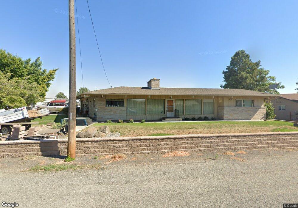
3205 21st St Clarkston, WA 99403
Estimated Value: $476,000 - $710,000
--
Bed
--
Bath
1,919
Sq Ft
$305/Sq Ft
Est. Value
About This Home
This home is located at 3205 21st St, Clarkston, WA 99403 and is currently estimated at $585,000, approximately $304 per square foot. 3205 21st St is a home located in Asotin County with nearby schools including Heights Elementary School, Lincoln Middle School, and Charles Francis Adams High School.
Ownership History
Date
Name
Owned For
Owner Type
Purchase Details
Closed on
May 7, 2010
Sold by
Henderson Betty L
Bought by
Ausman Kurt S and Ausman Nicole Y
Current Estimated Value
Home Financials for this Owner
Home Financials are based on the most recent Mortgage that was taken out on this home.
Original Mortgage
$200,410
Outstanding Balance
$137,252
Interest Rate
5.5%
Mortgage Type
FHA
Estimated Equity
$447,748
Create a Home Valuation Report for This Property
The Home Valuation Report is an in-depth analysis detailing your home's value as well as a comparison with similar homes in the area
Home Values in the Area
Average Home Value in this Area
Purchase History
| Date | Buyer | Sale Price | Title Company |
|---|---|---|---|
| Ausman Kurt S | $245,000 | Alliance Title & Escrow |
Source: Public Records
Mortgage History
| Date | Status | Borrower | Loan Amount |
|---|---|---|---|
| Open | Ausman Kurt S | $200,410 |
Source: Public Records
Tax History Compared to Growth
Tax History
| Year | Tax Paid | Tax Assessment Tax Assessment Total Assessment is a certain percentage of the fair market value that is determined by local assessors to be the total taxable value of land and additions on the property. | Land | Improvement |
|---|---|---|---|---|
| 2021 | $2,966 | $269,200 | $41,300 | $227,900 |
| 2020 | $3,053 | $269,200 | $41,300 | $227,900 |
| 2019 | $2,663 | $268,400 | $30,000 | $238,400 |
| 2018 | $3,266 | $268,400 | $30,000 | $238,400 |
| 2017 | $2,988 | $268,400 | $30,000 | $238,400 |
| 2016 | $2,988 | $268,400 | $30,000 | $238,400 |
| 2015 | $300 | $259,200 | $30,000 | $229,200 |
| 2013 | $3,001 | $252,500 | $30,000 | $222,500 |
Source: Public Records
Map
Nearby Homes
- 2047 10th Ave
- 1993 & 1971 10th Ave
- 2308 Chukar Ct
- 2115 6th Ave Unit 51
- 2115 6th Ave Unit Spc 48
- 2115 6th Ave
- 2351 Reservoir Rd
- 3560 Quailridge Dr
- 2015 6th Ave Unit 319
- 2015 6th Ave Unit 14
- 2015 6th Ave Unit 113
- 2015 6th Ave Unit 112
- 2015 6th Ave Unit 111
- 2015 6th Ave Unit 109
- 2015 6th Ave
- 2015 6th Ave Unit 131A
- 2275 Chukar Dr
- 2285 Chukar Dr
- 2289 Chukar Dr
- 2668 Cascade St
- 3179 21st St
- 3215 21st St
- 3182 Hallgren Dr
- 3181 Hallgren Dr
- 3221 21st St
- 3171 21st St
- 3174 21st St
- 3176 Hallgren Dr
- 3158 21st St
- 3151 21st St
- 3161 21st St
- 3216 21st St
- 3168 Hallgren Dr
- 3155 21st St
- 3155 21st St Unit off 10th ave
- 3159 Hallgren Dr
- 3158 Hallgren Dr
- 3164 Hallgren Dr
- 3138 21st St
- 3145 21st St