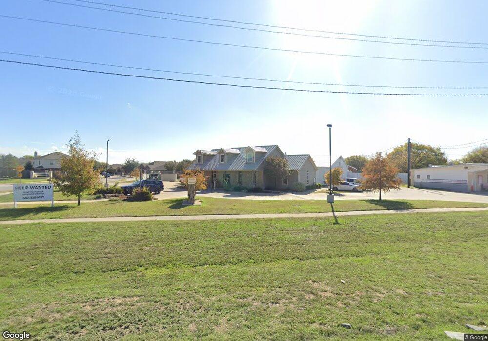
3209 Fort Worth Dr Denton, TX 76205
South Denton NeighborhoodEstimated Value: $1,684,277
--
Bed
--
Bath
10,450
Sq Ft
$161/Sq Ft
Est. Value
About This Home
This home is located at 3209 Fort Worth Dr, Denton, TX 76205 and is currently estimated at $1,684,277, approximately $161 per square foot. 3209 Fort Worth Dr is a home located in Denton County with nearby schools including Ryan Elementary School, McMath Middle School, and Denton High School.
Ownership History
Date
Name
Owned For
Owner Type
Purchase Details
Closed on
Oct 24, 2024
Sold by
Preston Rodney S and Preston Kathy A
Bought by
Kp Dinh Investment Group Llc
Current Estimated Value
Home Financials for this Owner
Home Financials are based on the most recent Mortgage that was taken out on this home.
Original Mortgage
$1,106,308
Outstanding Balance
$1,094,094
Interest Rate
6.09%
Mortgage Type
New Conventional
Estimated Equity
$590,183
Purchase Details
Closed on
May 31, 2011
Sold by
Ehrlich Brothers Development Lp
Bought by
Preston Rodney S and Preston Kathy A
Home Financials for this Owner
Home Financials are based on the most recent Mortgage that was taken out on this home.
Original Mortgage
$288,000
Interest Rate
4.85%
Mortgage Type
Purchase Money Mortgage
Create a Home Valuation Report for This Property
The Home Valuation Report is an in-depth analysis detailing your home's value as well as a comparison with similar homes in the area
Home Values in the Area
Average Home Value in this Area
Purchase History
| Date | Buyer | Sale Price | Title Company |
|---|---|---|---|
| Kp Dinh Investment Group Llc | -- | None Listed On Document | |
| Preston Rodney S | -- | Stewart |
Source: Public Records
Mortgage History
| Date | Status | Borrower | Loan Amount |
|---|---|---|---|
| Open | Kp Dinh Investment Group Llc | $1,106,308 | |
| Previous Owner | Preston Rodney S | $288,000 |
Source: Public Records
Tax History Compared to Growth
Tax History
| Year | Tax Paid | Tax Assessment Tax Assessment Total Assessment is a certain percentage of the fair market value that is determined by local assessors to be the total taxable value of land and additions on the property. | Land | Improvement |
|---|---|---|---|---|
| 2025 | $16,259 | $912,491 | $353,172 | $559,319 |
| 2024 | $16,259 | $842,337 | $353,172 | $489,165 |
| 2023 | $14,364 | $752,290 | $264,879 | $487,411 |
| 2022 | $14,383 | $677,559 | $264,879 | $412,680 |
| 2021 | $13,607 | $612,100 | $264,879 | $347,221 |
| 2020 | $13,991 | $612,100 | $264,879 | $347,221 |
| 2019 | $15,377 | $644,468 | $264,879 | $379,589 |
| 2018 | $14,910 | $617,240 | $264,879 | $352,361 |
| 2017 | $15,333 | $620,327 | $264,879 | $355,448 |
| 2016 | $15,658 | $633,494 | $264,879 | $368,615 |
| 2015 | -- | $355,000 | $264,879 | $90,121 |
Source: Public Records
Map
Nearby Homes
- 3105 Pecan Tree Dr
- 3109 Pecan Tree Dr
- 3108 Spenrock Ct
- 3304 Teasbend Ct
- 3108 Pinehurst Ct
- 400 Regency Ct
- 301 Fairmount Ct
- 3309 Del Mar Dr
- 3200 Belmont St
- 409 Meadowlands Dr
- Type - 2 Plan at Ryan Woods
- 100 Bentwood Ct
- 28 Timbergreen Cir
- 2808 Tamarack Ln
- 2608 Tamarack Ln
- 5005 Shady Grove Ln
- 3200 Hornbeam St
- 2620 Tamarack Ln
- 2616 Tamarack Ln
- 2800 Emerald Trace Dr
- 1225 Nora Ln
- 1224 Nora Ln
- 1221 Nora Ln
- 1204 Central Village Dr
- 1217 Nora Ln
- 1209 Central Village Dr
- 1216 Nora Ln
- 1200 Central Village Dr
- 1212 Nora Ln
- 1205 Central Village Dr
- 1213 Nora Ln
- 1204 Nora Ln
- 1112 Central Village Dr
- 1201 Central Village Dr
- 1200 Nora Ln
- 1209 Nora Ln
- 1113 Central Village Dr
- 1116 Nora Ln
- 1205 Nora Ln
- 1108 Central Village Dr