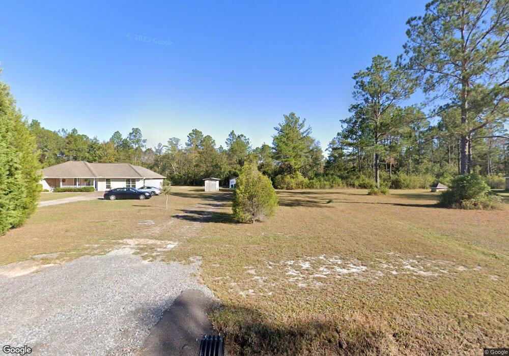
3209 Jerry Davis Rd Moss Point, MS 39562
Estimated Value: $205,000 - $232,166
Studio
2
Baths
1,612
Sq Ft
$138/Sq Ft
Est. Value
About This Home
This home is located at 3209 Jerry Davis Rd, Moss Point, MS 39562 and is currently estimated at $222,042, approximately $137 per square foot. 3209 Jerry Davis Rd is a home located in Jackson County with nearby schools including East Central Lower Elementary School, East Central Upper Elementary School, and East Central Middle School.
Ownership History
Date
Name
Owned For
Owner Type
Purchase Details
Closed on
Mar 27, 2018
Sold by
Cwp Inc
Bought by
Vaughn Jason
Current Estimated Value
Home Financials for this Owner
Home Financials are based on the most recent Mortgage that was taken out on this home.
Original Mortgage
$30,000
Outstanding Balance
$25,583
Interest Rate
4.45%
Estimated Equity
$196,459
Purchase Details
Closed on
Sep 16, 2011
Bought by
Vaughn Jeffery
Home Financials for this Owner
Home Financials are based on the most recent Mortgage that was taken out on this home.
Original Mortgage
$112,061
Interest Rate
3.75%
Mortgage Type
FHA
Create a Home Valuation Report for This Property
The Home Valuation Report is an in-depth analysis detailing your home's value as well as a comparison with similar homes in the area
Purchase History
| Date | Buyer | Sale Price | Title Company |
|---|---|---|---|
| Vaughn Jason | -- | -- | |
| Vaughn Jeffery | -- | Luckett Land Title Inc |
Source: Public Records
Mortgage History
| Date | Status | Borrower | Loan Amount |
|---|---|---|---|
| Open | Vaughn Jason | $30,000 | |
| Closed | Vaughn Jason | -- | |
| Previous Owner | Vaughn Jeffery | $112,061 |
Source: Public Records
Tax History
| Year | Tax Paid | Tax Assessment Tax Assessment Total Assessment is a certain percentage of the fair market value that is determined by local assessors to be the total taxable value of land and additions on the property. | Land | Improvement |
|---|---|---|---|---|
| 2025 | $1,434 | $14,590 | $3,943 | $10,647 |
| 2024 | $1,434 | $13,113 | $3,836 | $9,277 |
| 2023 | $1,274 | $13,113 | $3,836 | $9,277 |
| 2022 | $1,230 | $13,113 | $3,836 | $9,277 |
| 2021 | $1,237 | $13,180 | $3,836 | $9,344 |
| 2020 | $1,223 | $12,606 | $3,552 | $9,054 |
| 2019 | $1,206 | $12,606 | $3,552 | $9,054 |
| 2018 | $1,105 | $11,534 | $3,552 | $7,982 |
| 2017 | $1,129 | $11,534 | $3,552 | $7,982 |
| 2016 | $1,072 | $11,534 | $3,552 | $7,982 |
| 2015 | $1,001 | $108,800 | $35,520 | $73,280 |
| 2014 | $1,008 | $11,137 | $3,552 | $7,585 |
| 2013 | $1,897 | $16,706 | $5,328 | $11,378 |
Source: Public Records
Map
Nearby Homes
- 19500 Angel Ln
- 19506 Highway 63
- 20700 Cameron Ln
- 17209 Red Top Ln
- Tbd Hurley Wade Rd
- 5402 Huckleberry Ln
- 0 Grafe Homestead Rd Unit 4137349
- 21217 E Trails End Rd
- 3016 Ed Parker Rd
- 7201 Bentwood Dr
- 5455 Gavin Hamilton Rd
- 0 Mississippi 614
- 0000 Mississippi 614
- 26.1 Acres Brinkman Rd E
- 6685 Caraway Rd
- 0 00 Gavin Hamilton Rd
- 0 R B Dickerson Rd
- 7521 Townsite Rd
- 24040 Robert e Lee Rd
- 0 Dr Unit 4052148
- 3211 Jerry Davis Rd
- 3101 Jerry Davis Rd
- 3205 Jerry Davis Rd
- 3201 Jerry Davis Rd
- 3025 Jerry Davis Rd
- 3303 Jerry Davis Rd
- 0 Jerry Davis Rd
- 3100 Jerry Davis Rd
- 3521 Jerry Davis Rd
- 3001 Jerry Davis Rd
- 19209 Thrasher Dr
- 3313 Jerry Davis Rd
- 3517 Jerry Davis Rd
- 19135 Thrasher Dr
- 3012 Jerry Davis Rd
- 3401 Jerry Davis Rd
- 19200 Thrasher Dr
- 3028 Jerry Davis Rd
- 3512 Jerry Davis Rd
- 2929 Jerry Davis Rd
Your Personal Tour Guide
Ask me questions while you tour the home.