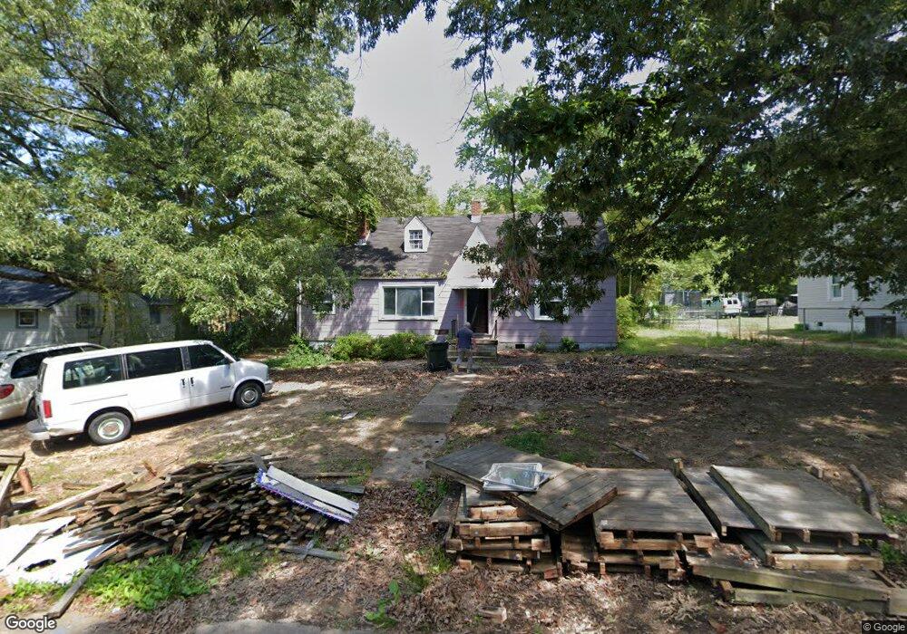
3209 Manorcrest Rd Richmond, VA 23234
British Camp Farms NeighborhoodEstimated Value: $215,000 - $241,000
3
Beds
1
Bath
956
Sq Ft
$239/Sq Ft
Est. Value
About This Home
This home is located at 3209 Manorcrest Rd, Richmond, VA 23234 and is currently estimated at $228,359, approximately $238 per square foot. 3209 Manorcrest Rd is a home located in Richmond City with nearby schools including Broad Rock Elementary School, Thomas C. Boushall Middle School, and Richmond High School for the Arts.
Ownership History
Date
Name
Owned For
Owner Type
Purchase Details
Closed on
Feb 18, 2010
Sold by
Sec Of Housing And Urban
Bought by
Solferino Raymond
Current Estimated Value
Purchase Details
Closed on
Jun 14, 2000
Sold by
Madren John A and Madren Dorothy J
Bought by
Crawford Antionio L
Home Financials for this Owner
Home Financials are based on the most recent Mortgage that was taken out on this home.
Original Mortgage
$64,600
Interest Rate
8.24%
Mortgage Type
FHA
Create a Home Valuation Report for This Property
The Home Valuation Report is an in-depth analysis detailing your home's value as well as a comparison with similar homes in the area
Home Values in the Area
Average Home Value in this Area
Purchase History
| Date | Buyer | Sale Price | Title Company |
|---|---|---|---|
| Solferino Raymond | $112,000 | -- | |
| Crawford Antionio L | $65,000 | -- |
Source: Public Records
Mortgage History
| Date | Status | Borrower | Loan Amount |
|---|---|---|---|
| Previous Owner | Crawford Antionio L | $64,600 |
Source: Public Records
Tax History
| Year | Tax Paid | Tax Assessment Tax Assessment Total Assessment is a certain percentage of the fair market value that is determined by local assessors to be the total taxable value of land and additions on the property. | Land | Improvement |
|---|---|---|---|---|
| 2025 | $1,680 | $150,000 | $53,000 | $97,000 |
| 2024 | $1,680 | $140,000 | $48,000 | $92,000 |
| 2023 | $1,644 | $137,000 | $48,000 | $89,000 |
| 2022 | $1,452 | $121,000 | $33,000 | $88,000 |
| 2020 | $1,737 | $92,000 | $25,000 | $67,000 |
| 2019 | $1,642 | $87,000 | $25,000 | $62,000 |
| 2018 | $756 | $63,000 | $20,000 | $43,000 |
| 2017 | $744 | $62,000 | $20,000 | $42,000 |
| 2016 | $732 | $61,000 | $20,000 | $41,000 |
| 2015 | $1,142 | $61,000 | $20,000 | $41,000 |
| 2014 | $1,142 | $61,000 | $20,000 | $41,000 |
Source: Public Records
Map
Nearby Homes
- 4201 Walmsley Blvd
- 4157 Walmsley Blvd
- 3429 Hopkins Rd
- 3313 Hopkins Rd
- 4200 Warwick Rd
- 4300 Warwick Rd
- 3432 Broadwick Rd
- 3440 Broadwick Rd
- 3428 Broadwick Rd
- 3436 Broadwick Rd
- 3444 Broadwick Rd
- 3448 Broadwick Rd
- 3452 Broadwick Rd
- 3437 Broadwick Rd
- 3457 Broadwick Rd
- 3429 Pond Aly
- 4207 Narbeth Ave
- 2800 Lauradale Ln
- 3817 Kinalin Ln
- 3817 Bridgeton Rd
- 3215 Manorcrest Rd
- 3201 Manorcrest Rd
- 4209 Welford Ave
- 3216 Olive Ave
- 3221 Manorcrest Rd
- 3210 Olive Ave
- 3200 Manorcrest Rd
- 3222 Olive Ave
- 3214 Manorcrest Rd
- 4201 Welford Ave
- 3227 Manorcrest Rd
- 3228 Olive Ave
- 3220 Manorcrest Rd
- 4311 Welford Ave
- 4218 Welford Ave
- 4212 Welford Ave
- 3234 Olive Ave
- 3233 Manorcrest Rd
- 4300 Welford Ave
- 3226 Manorcrest Rd
Your Personal Tour Guide
Ask me questions while you tour the home.