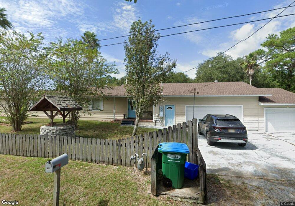
3209 Milstead Rd Gautier, MS 39553
Estimated Value: $155,000 - $194,000
2
Beds
2
Baths
1,419
Sq Ft
$123/Sq Ft
Est. Value
About This Home
This home is located at 3209 Milstead Rd, Gautier, MS 39553 and is currently estimated at $174,082, approximately $122 per square foot. 3209 Milstead Rd is a home located in Jackson County with nearby schools including Gautier Elementary School, Gautier Middle School, and Gautier High School.
Ownership History
Date
Name
Owned For
Owner Type
Purchase Details
Closed on
Mar 31, 2018
Sold by
Sistrunk Con
Bought by
Sistrunk Roseann
Current Estimated Value
Purchase Details
Closed on
Dec 20, 2011
Sold by
Regions Bank
Bought by
Sistrunk Con R and Sistrunk Roseann
Home Financials for this Owner
Home Financials are based on the most recent Mortgage that was taken out on this home.
Original Mortgage
$66,763
Interest Rate
3.87%
Mortgage Type
FHA
Create a Home Valuation Report for This Property
The Home Valuation Report is an in-depth analysis detailing your home's value as well as a comparison with similar homes in the area
Home Values in the Area
Average Home Value in this Area
Purchase History
| Date | Buyer | Sale Price | Title Company |
|---|---|---|---|
| Sistrunk Roseann | -- | -- | |
| Sistrunk Con R | -- | Pilger Title Company |
Source: Public Records
Mortgage History
| Date | Status | Borrower | Loan Amount |
|---|---|---|---|
| Previous Owner | Sistrunk Con R | $66,763 |
Source: Public Records
Tax History
| Year | Tax Paid | Tax Assessment Tax Assessment Total Assessment is a certain percentage of the fair market value that is determined by local assessors to be the total taxable value of land and additions on the property. | Land | Improvement |
|---|---|---|---|---|
| 2025 | $1,304 | $10,398 | $1,403 | $8,995 |
| 2024 | $1,304 | $9,741 | $1,358 | $8,383 |
| 2023 | $1,115 | $9,741 | $1,358 | $8,383 |
| 2022 | $1,101 | $9,741 | $1,358 | $8,383 |
| 2021 | $1,108 | $9,794 | $1,358 | $8,436 |
| 2020 | $885 | $8,142 | $1,509 | $6,633 |
| 2019 | $895 | $8,142 | $1,509 | $6,633 |
| 2018 | $895 | $8,142 | $1,509 | $6,633 |
| 2017 | $826 | $8,142 | $1,509 | $6,633 |
| 2016 | $799 | $8,142 | $1,509 | $6,633 |
| 2015 | $637 | $67,660 | $15,090 | $52,570 |
| 2014 | $644 | $6,766 | $1,509 | $5,257 |
| 2013 | $619 | $6,766 | $1,509 | $5,257 |
Source: Public Records
Map
Nearby Homes
- 0 Milstead Rd
- 3217 Milstead Rd
- 0 Irondale St
- 1208 de La Pointe Dr
- 3309 Mary Walker Dr
- 1021 Old Spanish Trail
- 714 Frasier Dr
- 624 Old Spanish Trail
- 1417 U S 90 Unit Lot 315
- 0 Hwy 90 Hwy Unit 4130634
- 0 Orrell
- 00 Orrell
- 1409 U S 90 Unit Lot 310
- 1409 U S 90 Unit Lot 276
- 1409 U S 90 Unit Lot 255
- 1409 U S 90 Unit Lot 313
- 1409 U S 90 Unit Lot 52
- 1409 U S 90 Unit Lot 21
- 1409 U S 90 Unit Lot 1
- 1409 U S 90 Unit Lot 319
- 3208 Rollins Rd
- 3210 Milstead Rd
- 728 de La Pointe Dr
- 3216 Milstead Rd
- 3205 Irondale St
- 3209 Irondale St
- 3209 N Irondale St
- 724 de La Pointe Dr
- 3305 Milstead Rd
- 3304 Rollins Rd
- 3308 Rollins Rd
- 3309 Milstead Rd
- 3310 Irondale St
- 704 Sandstone St
- 700 River Oaks Dr
- 0 de La Pointe Dr
- 713 de La Pointe Dr
- 810 Highway 90
- 726 U S 90 Unit E
- 726 Us 90
Your Personal Tour Guide
Ask me questions while you tour the home.