Estimated Value: $1,590,387 - $2,018,000
3
Beds
3
Baths
1,880
Sq Ft
$996/Sq Ft
Est. Value
About This Home
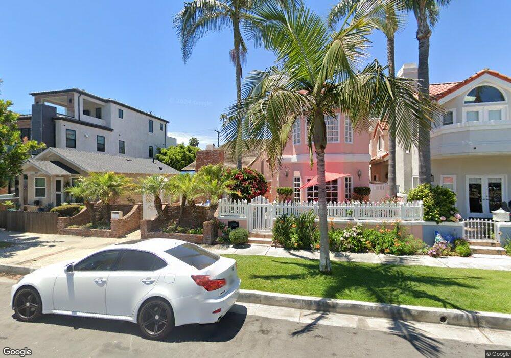
This home is located at 321 8th St, Huntington Beach, CA 92648 and is currently estimated at $1,872,597, approximately $996 per square foot. 321 8th St is a home located in Orange County with nearby schools including Agnes L. Smith Elementary, Ethel Dwyer Middle, and Huntington Beach High School.
Ownership History
Date
Name
Owned For
Owner Type
Purchase Details
Closed on
May 10, 2025
Sold by
Carson Ruby and Mccauley David
Bought by
David And Ruby Mccauley Trust and Mccauley
Current Estimated Value
Purchase Details
Closed on
Feb 22, 2010
Sold by
Carson Ruby
Bought by
Mccauley David and Carson Ruby
Home Financials for this Owner
Home Financials are based on the most recent Mortgage that was taken out on this home.
Original Mortgage
$938,250
Interest Rate
4.93%
Mortgage Type
Reverse Mortgage Home Equity Conversion Mortgage
Purchase Details
Closed on
Dec 22, 1993
Sold by
Carson Richard and Carson Ruby
Bought by
Carson Ruby
Home Financials for this Owner
Home Financials are based on the most recent Mortgage that was taken out on this home.
Original Mortgage
$120,000
Interest Rate
7.09%
Create a Home Valuation Report for This Property
The Home Valuation Report is an in-depth analysis detailing your home's value as well as a comparison with similar homes in the area
Home Values in the Area
Average Home Value in this Area
Purchase History
| Date | Buyer | Sale Price | Title Company |
|---|---|---|---|
| David And Ruby Mccauley Trust | -- | None Listed On Document | |
| Mccauley David | -- | Placer Title Company | |
| Carson Ruby | -- | Fidelity National Title |
Source: Public Records
Mortgage History
| Date | Status | Borrower | Loan Amount |
|---|---|---|---|
| Previous Owner | Mccauley David | $938,250 | |
| Previous Owner | Carson Ruby | $120,000 |
Source: Public Records
Tax History Compared to Growth
Tax History
| Year | Tax Paid | Tax Assessment Tax Assessment Total Assessment is a certain percentage of the fair market value that is determined by local assessors to be the total taxable value of land and additions on the property. | Land | Improvement |
|---|---|---|---|---|
| 2025 | $4,430 | $380,699 | $206,995 | $173,704 |
| 2024 | $4,430 | $373,235 | $202,936 | $170,299 |
| 2023 | $4,327 | $365,917 | $198,957 | $166,960 |
| 2022 | $4,212 | $358,743 | $195,056 | $163,687 |
| 2021 | $4,134 | $351,709 | $191,231 | $160,478 |
| 2020 | $4,105 | $348,103 | $189,270 | $158,833 |
| 2019 | $4,057 | $341,278 | $185,559 | $155,719 |
| 2018 | $3,994 | $334,587 | $181,921 | $152,666 |
| 2017 | $3,939 | $328,027 | $178,354 | $149,673 |
| 2016 | $3,769 | $321,596 | $174,857 | $146,739 |
| 2015 | $3,731 | $316,766 | $172,231 | $144,535 |
| 2014 | $3,652 | $310,561 | $168,857 | $141,704 |
Source: Public Records
Map
Nearby Homes
- 309 8th St
- 427 10th St
- 221 10th St
- 316 6th St
- 1111 Olive Ave Unit A & B
- 513 Pecan Ave
- 228 12th St Unit 1113 Olive Av
- 116 11th St
- 621 8th St
- 526 12th St
- 517 Walnut Ave
- 1102 Pacific Coast Hwy Unit Lot 4
- 308 5th St
- 521 12th St
- 711 Pacific Coast Hwy Unit 303
- 711 Pacific Coast Hwy Unit 330
- 711 Pacific Coast Hwy Unit 206
- 1200 Pacific Coast Hwy Unit 102
- 1200 Pacific Coast Hwy
- 1200 Pacific Coast Hwy Unit 214