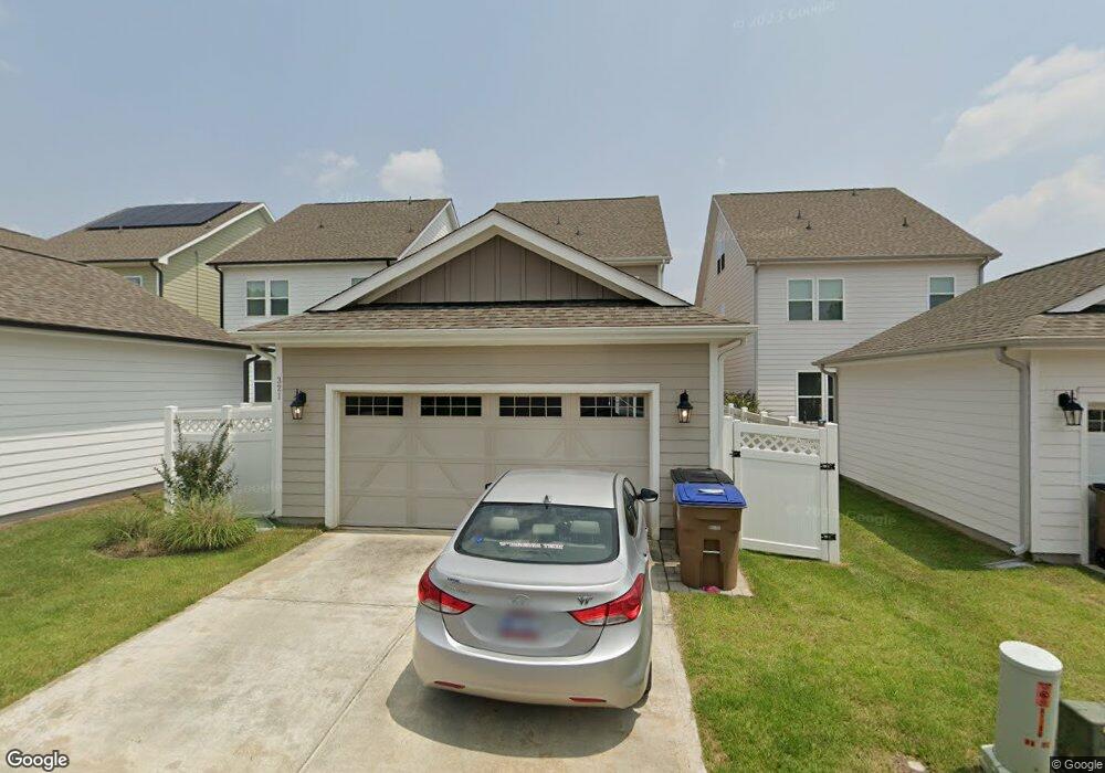
321 Brookboro Dr Wake Forest, NC 27587
Estimated Value: $455,516 - $521,000
Studio
1
Bath
2,080
Sq Ft
$231/Sq Ft
Est. Value
About This Home
This home is located at 321 Brookboro Dr, Wake Forest, NC 27587 and is currently estimated at $479,879, approximately $230 per square foot. 321 Brookboro Dr is a home with nearby schools including Wake Forest Elementary School, Wake Forest-Rolesville Middle School, and Wake Forest High School.
Ownership History
Date
Name
Owned For
Owner Type
Purchase Details
Closed on
Feb 1, 2018
Sold by
Ashton Raleigh Residential Llc
Bought by
Schaar Virginia
Current Estimated Value
Home Financials for this Owner
Home Financials are based on the most recent Mortgage that was taken out on this home.
Original Mortgage
$248,000
Outstanding Balance
$209,769
Interest Rate
3.94%
Mortgage Type
New Conventional
Estimated Equity
$270,110
Create a Home Valuation Report for This Property
The Home Valuation Report is an in-depth analysis detailing your home's value as well as a comparison with similar homes in the area
Home Values in the Area
Average Home Value in this Area
Purchase History
| Date | Buyer | Sale Price | Title Company |
|---|---|---|---|
| Schaar Virginia | $310,000 | None Available |
Source: Public Records
Mortgage History
| Date | Status | Borrower | Loan Amount |
|---|---|---|---|
| Open | Schaar Virginia | $248,000 |
Source: Public Records
Tax History
| Year | Tax Paid | Tax Assessment Tax Assessment Total Assessment is a certain percentage of the fair market value that is determined by local assessors to be the total taxable value of land and additions on the property. | Land | Improvement |
|---|---|---|---|---|
| 2025 | $4,394 | $453,809 | $100,000 | $353,809 |
| 2024 | $4,377 | $453,809 | $100,000 | $353,809 |
Source: Public Records
Map
Nearby Homes
- 1701 Highpoint St
- 1708 Highpoint St
- 515 Forestville Rd
- 519 Forestville Rd
- 218 Forestville Rd
- 416 Windsboro Way
- 541 Forestville Rd
- 549 Forestville Rd
- 1512 Highpoint St
- 561 Forestville Rd
- 553 Forestville Rd
- 557 Forestville Rd
- 577 Forestville Rd
- 0 S Main St
- 825 Abbyberry Dr
- 1420 Holding Village Way
- 726 Silo Park Dr
- 1451 Cimarron Pkwy
- 1208 S Franklin St
- 809 Callan View Ave
- 317 Brookboro Dr Unit 245
- 325 Brookboro Dr
- 313 Brookboro Dr
- 309 Brookboro Dr Unit 247
- 305 Brookboro Dr Unit 248
- 400 Old Dairy Dr
- 1665 Highpoint St
- 1661 Highpoint St
- 1657 Highpoint St
- 301 Brookboro Dr Unit 249
- 1653 Highpoint St Unit 250
- 1653 Highpoint St
- 320 Levi Ln
- 324 Levi Ln
- 324 Levi Ln Unit 348
- 316 Levi Ln Unit 346
- 404 Old Dairy Dr Unit HVGA - 241
- 312 Levi Ln Unit 345
- 1701 Highpoint St Unit HVGT Lot 255
- 308 Levi Ln
Your Personal Tour Guide
Ask me questions while you tour the home.