321 Grassy Ln New Cumberland, WV 26047
Estimated Value: $285,000 - $531,943
3
Beds
2
Baths
3,013
Sq Ft
$124/Sq Ft
Est. Value
About This Home
This home is located at 321 Grassy Ln, New Cumberland, WV 26047 and is currently estimated at $372,314, approximately $123 per square foot. 321 Grassy Ln is a home located in Hancock County with nearby schools including St. Paul School.
Ownership History
Date
Name
Owned For
Owner Type
Purchase Details
Closed on
Dec 10, 2013
Sold by
Robinson Stanley A and Robinson Glenda M
Bought by
Klink Brandon and Klink Deena
Current Estimated Value
Home Financials for this Owner
Home Financials are based on the most recent Mortgage that was taken out on this home.
Original Mortgage
$300,000
Outstanding Balance
$235,412
Interest Rate
4.52%
Mortgage Type
Unknown
Estimated Equity
$261,924
Create a Home Valuation Report for This Property
The Home Valuation Report is an in-depth analysis detailing your home's value as well as a comparison with similar homes in the area
Home Values in the Area
Average Home Value in this Area
Purchase History
| Date | Buyer | Sale Price | Title Company |
|---|---|---|---|
| Klink Brandon | -- | None Available |
Source: Public Records
Mortgage History
| Date | Status | Borrower | Loan Amount |
|---|---|---|---|
| Open | Klink Brandon | $300,000 |
Source: Public Records
Tax History Compared to Growth
Tax History
| Year | Tax Paid | Tax Assessment Tax Assessment Total Assessment is a certain percentage of the fair market value that is determined by local assessors to be the total taxable value of land and additions on the property. | Land | Improvement |
|---|---|---|---|---|
| 2024 | $2,642 | $207,040 | $34,180 | $172,860 |
| 2023 | $2,642 | $207,040 | $34,180 | $172,860 |
| 2022 | $2,687 | $207,040 | $34,180 | $172,860 |
| 2021 | $2,696 | $207,040 | $34,180 | $172,860 |
| 2020 | $2,685 | $207,040 | $34,180 | $172,860 |
| 2019 | $2,724 | $207,040 | $34,180 | $172,860 |
| 2018 | $2,737 | $207,040 | $34,180 | $172,860 |
| 2017 | $2,766 | $207,040 | $34,180 | $172,860 |
| 2016 | $2,976 | $223,020 | $34,140 | $188,880 |
| 2015 | $109 | $27,030 | $27,000 | $30 |
| 2014 | $109 | $8,100 | $8,100 | $0 |
Source: Public Records
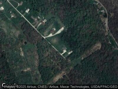
Map
Nearby Homes
- 0 Wylie Ridge Rd Unit 3890573
- VL Eagle Mountain Estate
- 176 Kingsview Dr
- 109 Greentree Ln
- 1 Riverside Dr
- 0 Ohio River Blvd Unit 5056985
- 0 Ohio River Blvd Unit 5057024
- 0 Ohio River Blvd Unit 5057021
- 0 Kings Creek Rd Unit 138767
- 100 Cleveland Rd
- TBD Alta St
- 268 Central Ave
- 0 Locust St
- 131 Saint Ann Way
- 143 Saint Johns Rd
- 323 N Fork Rd
- 323 E North Fork Rd
- 417 Thurman Ave
- 0 Surrounding Rose Garden Unit 5114539
- 165 Elk St