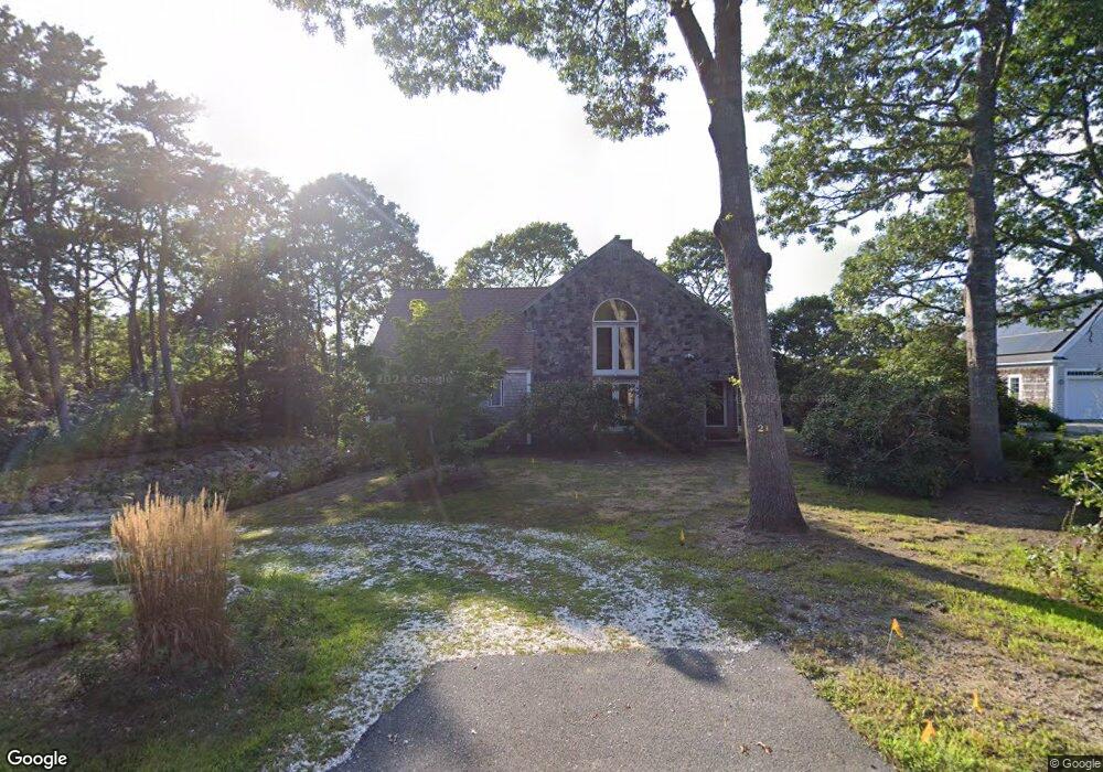
321 Lund Farm Way Brewster, MA 02631
Estimated Value: $893,000 - $1,011,000
4
Beds
3
Baths
2,199
Sq Ft
$441/Sq Ft
Est. Value
About This Home
This home is located at 321 Lund Farm Way, Brewster, MA 02631 and is currently estimated at $970,017, approximately $441 per square foot. 321 Lund Farm Way is a home located in Barnstable County with nearby schools including Stony Brook Elementary School, Eddy Elementary School, and Nauset Regional Middle School.
Ownership History
Date
Name
Owned For
Owner Type
Purchase Details
Closed on
Jan 4, 2024
Sold by
Masterson Robert P and Masterson Dianne J
Bought by
Masterson Jeffrey P and Masterson Benjamin A
Current Estimated Value
Purchase Details
Closed on
Dec 29, 2020
Sold by
Masterson Robert P and Masterson Dianne J
Bought by
R P & D J Masterson 2020 Lt and Masterson
Purchase Details
Closed on
May 12, 1983
Bought by
Masterson Robert P and Masterson Dianne J
Create a Home Valuation Report for This Property
The Home Valuation Report is an in-depth analysis detailing your home's value as well as a comparison with similar homes in the area
Home Values in the Area
Average Home Value in this Area
Purchase History
| Date | Buyer | Sale Price | Title Company |
|---|---|---|---|
| Masterson Jeffrey P | -- | None Available | |
| Masterson Robert P | -- | None Available | |
| R P & D J Masterson 2020 Lt | -- | None Available | |
| Masterson Robert P | -- | -- |
Source: Public Records
Mortgage History
| Date | Status | Borrower | Loan Amount |
|---|---|---|---|
| Previous Owner | Masterson Robert P | $70,000 | |
| Previous Owner | Masterson Robert P | $65,000 |
Source: Public Records
Tax History Compared to Growth
Tax History
| Year | Tax Paid | Tax Assessment Tax Assessment Total Assessment is a certain percentage of the fair market value that is determined by local assessors to be the total taxable value of land and additions on the property. | Land | Improvement |
|---|---|---|---|---|
| 2025 | $5,915 | $859,800 | $260,700 | $599,100 |
| 2024 | $5,528 | $811,700 | $245,900 | $565,800 |
| 2023 | $5,119 | $732,300 | $219,500 | $512,800 |
| 2022 | $5,157 | $657,000 | $182,900 | $474,100 |
| 2021 | $4,803 | $559,800 | $159,000 | $400,800 |
| 2020 | $4,652 | $539,700 | $159,000 | $380,700 |
| 2019 | $4,503 | $524,800 | $152,900 | $371,900 |
| 2018 | $4,218 | $510,600 | $152,900 | $357,700 |
| 2017 | $3,928 | $468,200 | $152,900 | $315,300 |
| 2016 | $3,744 | $444,100 | $150,000 | $294,100 |
| 2015 | $3,616 | $437,800 | $147,000 | $290,800 |
Source: Public Records
Map
Nearby Homes
- 277 Lund Farm Way
- 410 Blueberry Pond Dr
- 190 Blueberry Pond Dr
- 28 Middlecott Ln
- 100 Fletcher Ln Unit E
- 81 Fletcher Ln Unit I
- 81 Fletcher Ln Unit C
- 80 Fletcher Ln Unit E
- 60 Fletcher Ln Unit H
- 60 Fletcher Ln Unit C
- 61 Fletcher Ln Unit H
- 62 Fletcher Ln Unit N
- 153 Red Fawn Rd
- 82 Fletcher Ln Unit I
- 0 Old Chatham Rd
- 46 Court Way
- 38 Eaton Ln Unit 38
- 137 Eaton Ln
- 49 Eaton Ln Unit 10
- 22 N Pond Dr
- 329 Lund Farm Way
- 310 Lund Farm Way
- 326 Lund Farm Way
- 13 N Pond Dr
- 337 Lund Farm Way
- 34 N Pond Dr
- 292 Lund Farm Way
- 27 N Pond Dr
- 287 Lund Farm Way
- 148 Horseshoe Way
- 82 N Pond Dr
- 485 Lund Farm Way
- 94 N Pond Dr
- 149 Horseshoe Way
- 44 N Pond Dr
- 355 Lund Farm Way
- 280 Lund Farm Way
- 352 Lund Farm Way
- 43 N Pond Dr