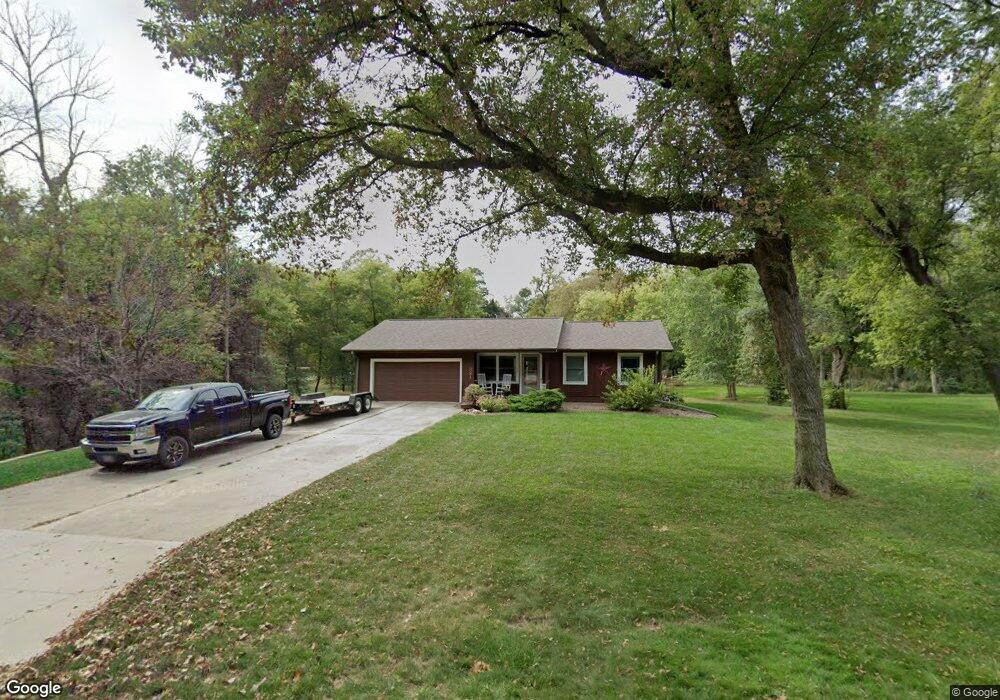
321 Mantor Dr Mantorville, MN 55955
Estimated Value: $370,000 - $412,000
3
Beds
3
Baths
1,104
Sq Ft
$354/Sq Ft
Est. Value
About This Home
This home is located at 321 Mantor Dr, Mantorville, MN 55955 and is currently estimated at $390,305, approximately $353 per square foot. 321 Mantor Dr is a home located in Dodge County with nearby schools including Kasson-Mantorville Elementary School, Kasson-Mantorville Middle School, and Kasson-Mantorville Senior High School.
Ownership History
Date
Name
Owned For
Owner Type
Purchase Details
Closed on
Nov 20, 2009
Sold by
Wendland Curtis and Wendland Curt
Bought by
Estate Of Florence Ella Reeves
Current Estimated Value
Home Financials for this Owner
Home Financials are based on the most recent Mortgage that was taken out on this home.
Original Mortgage
$70,000
Interest Rate
5.05%
Mortgage Type
New Conventional
Create a Home Valuation Report for This Property
The Home Valuation Report is an in-depth analysis detailing your home's value as well as a comparison with similar homes in the area
Home Values in the Area
Average Home Value in this Area
Purchase History
| Date | Buyer | Sale Price | Title Company |
|---|---|---|---|
| Estate Of Florence Ella Reeves | $149,000 | None Available |
Source: Public Records
Mortgage History
| Date | Status | Borrower | Loan Amount |
|---|---|---|---|
| Closed | Estate Of Florence Ella Reeves | $70,000 |
Source: Public Records
Tax History Compared to Growth
Tax History
| Year | Tax Paid | Tax Assessment Tax Assessment Total Assessment is a certain percentage of the fair market value that is determined by local assessors to be the total taxable value of land and additions on the property. | Land | Improvement |
|---|---|---|---|---|
| 2025 | $4,540 | $368,400 | $76,000 | $292,400 |
| 2024 | $4,130 | $368,800 | $76,000 | $292,800 |
| 2023 | $3,882 | $321,500 | $76,000 | $245,500 |
| 2022 | $3,728 | $291,800 | $40,200 | $251,600 |
| 2021 | $3,644 | $252,900 | $40,200 | $212,700 |
| 2020 | $3,382 | $247,500 | $40,200 | $207,300 |
| 2019 | $3,268 | $232,600 | $40,200 | $192,400 |
| 2018 | $2,972 | $218,000 | $40,200 | $177,800 |
| 2017 | $2,240 | $195,200 | $40,200 | $155,000 |
| 2016 | $2,222 | $149,300 | $40,200 | $109,100 |
| 2015 | $2,100 | $145,100 | $40,200 | $104,900 |
| 2014 | $1,884 | $0 | $0 | $0 |
Source: Public Records
Map
Nearby Homes
- 421 Clay St
- 24575 615th St
- 321 5th St W
- 1007 Blanch Ct
- 20 Amy Ln
- 647 Stagecoach Rd
- 2109 6th Ave NE
- 814 19th St NE
- 1504 14th Ave NE
- 1202 15th St NE
- 1408 14th Ave NE
- 1000 12th Place NW
- 1007 11th Ave NW
- Townhome Plan at Bigelow-Voigt Eighth
- 1307 12th St NW
- 1803 20th Avenue Cir NE
- 901 8th Ave NE
- 803 8th St NW
- Two-Story Plan at Komet Acres
- 1601 21st Ave NE