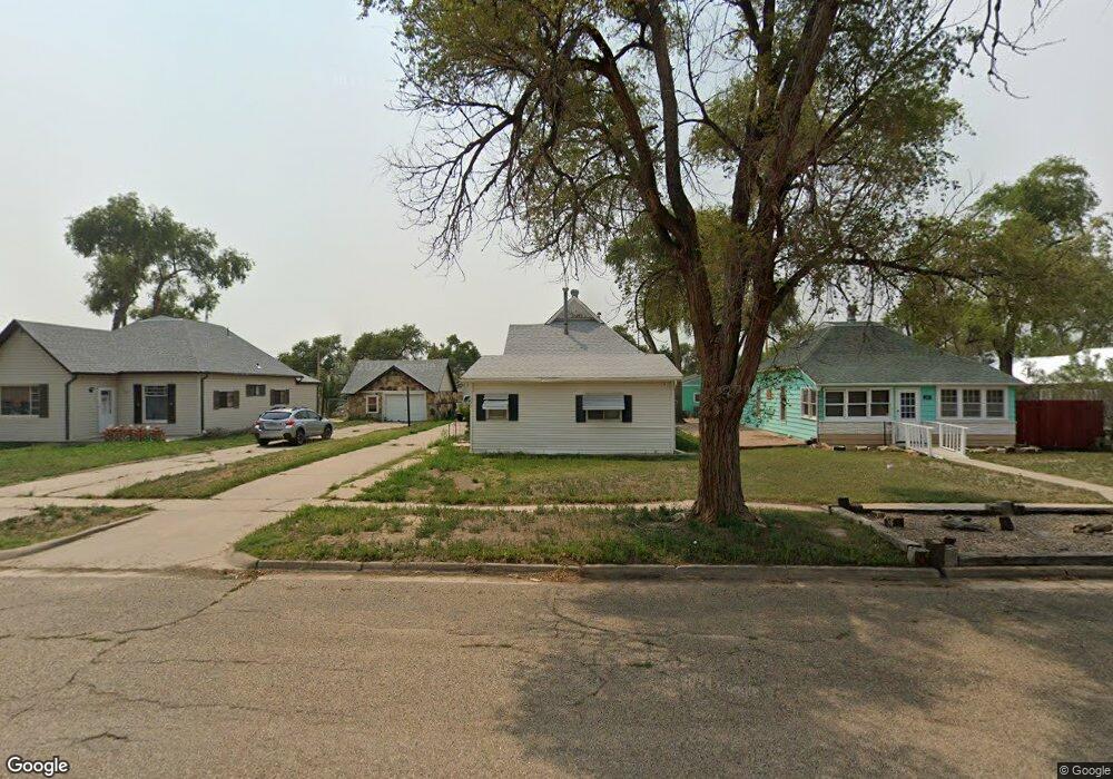
321 Maple Ave Unit 1 Las Animas, CO 81054
Estimated Value: $73,000 - $97,000
3
Beds
1
Bath
1,371
Sq Ft
$61/Sq Ft
Est. Value
About This Home
This home is located at 321 Maple Ave Unit 1, Las Animas, CO 81054 and is currently estimated at $83,455, approximately $60 per square foot. 321 Maple Ave Unit 1 is a home located in Bent County with nearby schools including Las Animas Elementary School, Las Animas Junior High School, and Las Animas High School.
Ownership History
Date
Name
Owned For
Owner Type
Purchase Details
Closed on
Apr 25, 2018
Sold by
Mcafee Rentals 2 Llc
Bought by
Calhoon Bryce N and Calhoon Brandy K
Current Estimated Value
Home Financials for this Owner
Home Financials are based on the most recent Mortgage that was taken out on this home.
Original Mortgage
$33,300
Outstanding Balance
$28,699
Interest Rate
4.44%
Mortgage Type
Purchase Money Mortgage
Estimated Equity
$54,756
Purchase Details
Closed on
Nov 18, 2010
Sold by
Wells Fargo Bank Na
Bought by
Mcafee Rontals 21 Llc
Purchase Details
Closed on
Aug 31, 2010
Sold by
Brown Alta Mae
Bought by
Wells Fargo Bank Na and Option One Mortgage Loan Trust
Create a Home Valuation Report for This Property
The Home Valuation Report is an in-depth analysis detailing your home's value as well as a comparison with similar homes in the area
Home Values in the Area
Average Home Value in this Area
Purchase History
| Date | Buyer | Sale Price | Title Company |
|---|---|---|---|
| Calhoon Bryce N | $37,000 | None Available | |
| Mcafee Rontals 21 Llc | $20,500 | -- | |
| Wells Fargo Bank Na | -- | -- |
Source: Public Records
Mortgage History
| Date | Status | Borrower | Loan Amount |
|---|---|---|---|
| Open | Calhoon Bryce N | $33,300 |
Source: Public Records
Tax History Compared to Growth
Tax History
| Year | Tax Paid | Tax Assessment Tax Assessment Total Assessment is a certain percentage of the fair market value that is determined by local assessors to be the total taxable value of land and additions on the property. | Land | Improvement |
|---|---|---|---|---|
| 2024 | $1 | $1,520 | $74 | $1,446 |
| 2023 | $177 | $1,520 | $74 | $1,446 |
| 2022 | $382 | $5,250 | $240 | $5,010 |
| 2021 | $384 | $3,552 | $200 | $3,352 |
| 2020 | $340 | $3,150 | $200 | $2,950 |
| 2019 | $361 | $3,150 | $200 | $2,950 |
| 2018 | $361 | $3,308 | $202 | $3,106 |
| 2017 | $364 | $3,308 | $202 | $3,106 |
| 2016 | $394 | $3,598 | $223 | $3,375 |
| 2015 | -- | $3,598 | $223 | $3,375 |
| 2014 | -- | $3,690 | $223 | $3,467 |
| 2013 | -- | $3,690 | $223 | $3,467 |
Source: Public Records
Map
Nearby Homes
- 706 3rd St
- 422 Grove Ave
- 433 Grove Ave
- 243 Elm Ave
- 428 Elm Ave
- 426 Poplar Ave
- 509 5th St
- 1032 Locust Ave
- 1046 Locust Ave
- 434 2nd St
- 312 Carson Ave
- 643&645 Ambassador Thompson Blvd Unit 2
- 651 Ash Ave
- 705 Locust Ave
- TBD Ash Ave
- 1103 Ambassador Thompson Blvd
- 145 Liberty Ct
- 24 Bent Ave
- 629 St Vrain Ave
- 626 St Vrain St