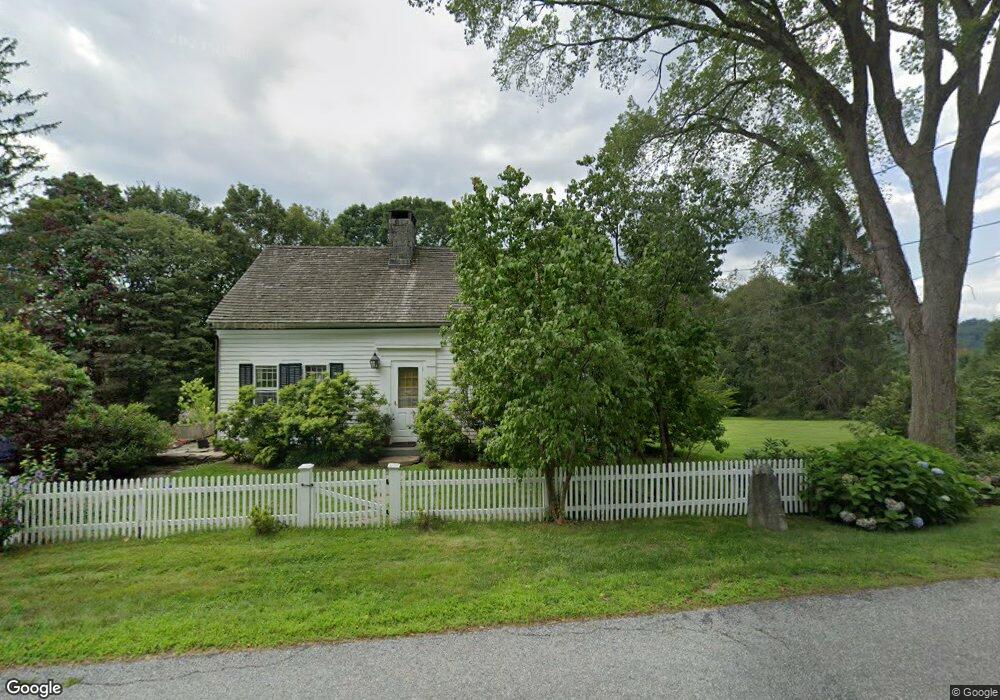
321 Munger Ln Bethlehem, CT 06751
Estimated Value: $495,000 - $649,000
3
Beds
3
Baths
1,898
Sq Ft
$291/Sq Ft
Est. Value
About This Home
This home is located at 321 Munger Ln, Bethlehem, CT 06751 and is currently estimated at $551,454, approximately $290 per square foot. 321 Munger Ln is a home located in Litchfield County with nearby schools including Bethlehem Elementary School, Mitchell Elementary School, and Woodbury Middle School.
Ownership History
Date
Name
Owned For
Owner Type
Purchase Details
Closed on
Dec 21, 2017
Sold by
Sclaroff Steve
Bought by
Garlic Breath Llc
Current Estimated Value
Purchase Details
Closed on
Aug 12, 2008
Sold by
Tolles Douglas
Bought by
Sclaroff Steven
Home Financials for this Owner
Home Financials are based on the most recent Mortgage that was taken out on this home.
Original Mortgage
$300,000
Interest Rate
6.49%
Purchase Details
Closed on
Sep 23, 2000
Sold by
Tolles Phyllis
Bought by
Pustola Jill
Create a Home Valuation Report for This Property
The Home Valuation Report is an in-depth analysis detailing your home's value as well as a comparison with similar homes in the area
Home Values in the Area
Average Home Value in this Area
Purchase History
| Date | Buyer | Sale Price | Title Company |
|---|---|---|---|
| Garlic Breath Llc | -- | -- | |
| Garlic Breath Llc | -- | -- | |
| Sclaroff Steven | $400,000 | -- | |
| Sclaroff Steven | $400,000 | -- | |
| Pustola Jill | $175,000 | -- | |
| Pustola Jill | $175,000 | -- |
Source: Public Records
Mortgage History
| Date | Status | Borrower | Loan Amount |
|---|---|---|---|
| Previous Owner | Pustola Jill | $292,500 | |
| Previous Owner | Pustola Jill | $300,000 |
Source: Public Records
Tax History Compared to Growth
Tax History
| Year | Tax Paid | Tax Assessment Tax Assessment Total Assessment is a certain percentage of the fair market value that is determined by local assessors to be the total taxable value of land and additions on the property. | Land | Improvement |
|---|---|---|---|---|
| 2025 | $6,765 | $299,600 | $57,600 | $242,000 |
| 2024 | $6,516 | $299,600 | $57,600 | $242,000 |
| 2023 | $5,457 | $198,500 | $55,200 | $143,300 |
| 2022 | $5,459 | $198,500 | $55,200 | $143,300 |
| 2021 | $5,461 | $198,500 | $55,200 | $143,300 |
| 2020 | $5,302 | $198,500 | $55,200 | $143,300 |
| 2019 | $5,318 | $198,500 | $55,200 | $143,300 |
| 2018 | $5,047 | $209,000 | $64,300 | $144,700 |
| 2017 | $5,304 | $209,000 | $64,300 | $144,700 |
| 2016 | $4,893 | $209,000 | $64,300 | $144,700 |
| 2015 | $4,799 | $209,000 | $64,300 | $144,700 |
| 2014 | $4,696 | $209,000 | $64,300 | $144,700 |
Source: Public Records
Map
Nearby Homes
- 112 Todd Hill Rd
- 118 Lake Dr
- 21 Long Meadow Rd
- 208 Wood Creek Rd
- 159 Main St N
- 8 Main St N
- 104 Terrell Farm Rd
- 23 Kenyon Rd
- 124 Auncient Oak Rd
- 34 Evergreen Passway
- 298 Kenyon Rd
- 35 Weekeepeemee Rd
- 114 Carmel Hill Rd N
- 182 Magnolia Hill Rd
- 319 Main St S
- 51 Senff Rd
- 169 E Shore Rd
- 171 E Shore Rd
- 89 East St
- 10 Sunny Ridge Rd