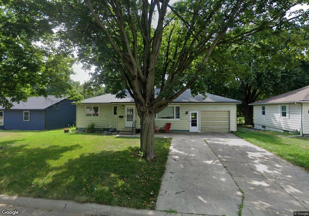
321 N 19th St Estherville, IA 51334
Estimated Value: $125,000 - $184,000
2
Beds
2
Baths
1,120
Sq Ft
$132/Sq Ft
Est. Value
About This Home
This home is located at 321 N 19th St, Estherville, IA 51334 and is currently estimated at $148,032, approximately $132 per square foot. 321 N 19th St is a home located in Emmet County with nearby schools including Estherville Lincoln Central Middle School, Estherville Lincoln Central High School, and Estherville Community Christian School.
Ownership History
Date
Name
Owned For
Owner Type
Purchase Details
Closed on
Oct 29, 2012
Sold by
Nitchals Daivd W and Nitchals Jennifer N
Bought by
Smith Courtney L
Current Estimated Value
Home Financials for this Owner
Home Financials are based on the most recent Mortgage that was taken out on this home.
Original Mortgage
$75,971
Outstanding Balance
$55,442
Interest Rate
3.32%
Mortgage Type
USDA
Estimated Equity
$92,590
Create a Home Valuation Report for This Property
The Home Valuation Report is an in-depth analysis detailing your home's value as well as a comparison with similar homes in the area
Home Values in the Area
Average Home Value in this Area
Purchase History
| Date | Buyer | Sale Price | Title Company |
|---|---|---|---|
| Smith Courtney L | $74,500 | None Available |
Source: Public Records
Mortgage History
| Date | Status | Borrower | Loan Amount |
|---|---|---|---|
| Open | Smith Courtney L | $75,971 |
Source: Public Records
Tax History Compared to Growth
Tax History
| Year | Tax Paid | Tax Assessment Tax Assessment Total Assessment is a certain percentage of the fair market value that is determined by local assessors to be the total taxable value of land and additions on the property. | Land | Improvement |
|---|---|---|---|---|
| 2025 | $2,112 | $124,200 | $15,400 | $108,800 |
| 2024 | $2,112 | $110,800 | $15,400 | $95,400 |
| 2023 | $2,034 | $110,800 | $15,400 | $95,400 |
| 2022 | $1,982 | $91,900 | $15,400 | $76,500 |
| 2021 | $1,982 | $91,900 | $15,400 | $76,500 |
| 2020 | $2,042 | $91,000 | $15,000 | $76,000 |
| 2019 | $1,892 | $82,200 | $0 | $0 |
| 2018 | $1,886 | $82,200 | $0 | $0 |
| 2017 | $3,804 | $82,500 | $0 | $0 |
| 2016 | $1,902 | $82,500 | $0 | $0 |
| 2015 | $1,902 | $78,600 | $0 | $0 |
| 2014 | $1,820 | $78,600 | $0 | $0 |
Source: Public Records
Map
Nearby Homes
- 408 N 17th Ct
- 420 N 20th St
- 203 N 15th St
- 1321 N 14th St
- 609 S 14th St
- 320 N 7th St
- 314 N 7th St
- 815 14th Ave N
- 1609 Maplecrest Dr
- 1203 N 6th St
- 913 N 6th St
- 303 Knollwood Dr
- 215 2nd Ave S
- 305 W 5th Ave N
- 220 W 1st Ave S
- 320 W 5th Ave N
- LOT 2 Brad Alan Blvd
- 1761 368th Ave
- 1102 Oak Hill Rd
- 1633 365th Ave