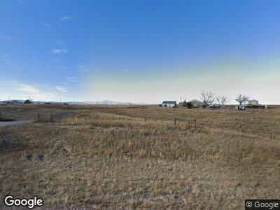
321 N Wheatland Hwy Wheatland, WY 82201
Estimated Value: $254,000 - $293,000
--
Bed
--
Bath
1,716
Sq Ft
$158/Sq Ft
Est. Value
About This Home
This home is located at 321 N Wheatland Hwy, Wheatland, WY 82201 and is currently estimated at $271,385, approximately $158 per square foot. 321 N Wheatland Hwy is a home located in Platte County.
Create a Home Valuation Report for This Property
The Home Valuation Report is an in-depth analysis detailing your home's value as well as a comparison with similar homes in the area
Home Values in the Area
Average Home Value in this Area
Mortgage History
| Date | Status | Borrower | Loan Amount |
|---|---|---|---|
| Closed | Jenkins Wade | $98,223 |
Source: Public Records
Tax History Compared to Growth
Tax History
| Year | Tax Paid | Tax Assessment Tax Assessment Total Assessment is a certain percentage of the fair market value that is determined by local assessors to be the total taxable value of land and additions on the property. | Land | Improvement |
|---|---|---|---|---|
| 2024 | $1,380 | $20,288 | $4,040 | $16,248 |
| 2023 | $1,354 | $19,911 | $3,575 | $16,336 |
| 2022 | $1,389 | $19,562 | $3,575 | $15,987 |
| 2021 | $1,364 | $19,207 | $3,373 | $15,834 |
| 2020 | $1,335 | $18,805 | $3,373 | $15,432 |
| 2019 | $1,305 | $18,509 | $3,373 | $15,136 |
| 2018 | $1,315 | $18,647 | $3,373 | $15,274 |
| 2017 | $1,308 | $18,552 | $3,373 | $15,179 |
| 2016 | $1,247 | $17,688 | $3,373 | $14,315 |
| 2015 | $1,171 | $17,724 | $3,373 | $14,351 |
| 2014 | $1,171 | $16,670 | $3,373 | $13,297 |
Source: Public Records
Map
Nearby Homes
- 321 N Wheatland Hwy
- 315 N Wheatland Hwy
- 342 N Wheatland Hwy
- 367 N Wheatland Hwy
- 378 N Wheatland Hwy
- 387 N Wheatland Hwy
- 313 N Wheatland Hwy
- 28 Riverview Rd
- 380 N Wheatland Hwy
- Laramie River 50
- 168 E Laramie River Rd
- 1 Grayrocks Rd
- 445 N Wheatland Hwy
- 445 N Wheatland Hwy
- 9 Riverview Rd
- 2 Lakeview Dr
- 10 Lakeview Dr
- 23 Riverview Rd
- 31 Riverview Rd
- 15 West Dr
