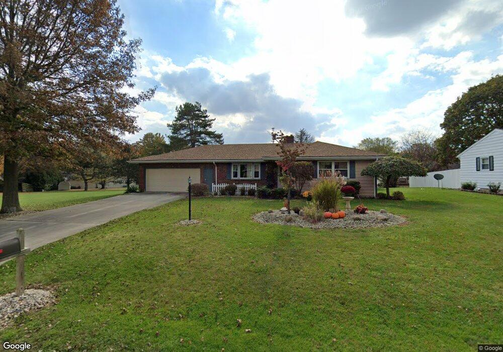
321 Random Rd Upper Sandusky, OH 43351
Estimated Value: $197,000 - $355,000
4
Beds
2
Baths
1,264
Sq Ft
$201/Sq Ft
Est. Value
About This Home
This home is located at 321 Random Rd, Upper Sandusky, OH 43351 and is currently estimated at $254,693, approximately $201 per square foot. 321 Random Rd is a home located in Wyandot County with nearby schools including Upper Sandusky High School and St. Peter Elementary School.
Ownership History
Date
Name
Owned For
Owner Type
Purchase Details
Closed on
Apr 12, 2006
Sold by
Pierson Sarah E and Pierson William D
Bought by
Pierson Sarah E and Pierson William D
Current Estimated Value
Home Financials for this Owner
Home Financials are based on the most recent Mortgage that was taken out on this home.
Original Mortgage
$156,000
Outstanding Balance
$98,075
Interest Rate
8.25%
Mortgage Type
Adjustable Rate Mortgage/ARM
Estimated Equity
$156,618
Create a Home Valuation Report for This Property
The Home Valuation Report is an in-depth analysis detailing your home's value as well as a comparison with similar homes in the area
Home Values in the Area
Average Home Value in this Area
Purchase History
| Date | Buyer | Sale Price | Title Company |
|---|---|---|---|
| Pierson Sarah E | -- | None Available |
Source: Public Records
Mortgage History
| Date | Status | Borrower | Loan Amount |
|---|---|---|---|
| Open | Pierson Sarah E | $156,000 |
Source: Public Records
Tax History
| Year | Tax Paid | Tax Assessment Tax Assessment Total Assessment is a certain percentage of the fair market value that is determined by local assessors to be the total taxable value of land and additions on the property. | Land | Improvement |
|---|---|---|---|---|
| 2025 | $2,048 | $68,070 | $9,000 | $59,070 |
| 2024 | $1,904 | $59,850 | $7,360 | $52,490 |
| 2023 | $1,904 | $59,850 | $7,360 | $52,490 |
| 2022 | $1,904 | $46,640 | $5,990 | $40,650 |
| 2021 | $1,554 | $46,640 | $5,990 | $40,650 |
| 2020 | $1,553 | $46,640 | $5,990 | $40,650 |
| 2019 | $1,551 | $46,640 | $5,990 | $40,650 |
| 2018 | $1,422 | $43,590 | $5,320 | $38,270 |
| 2017 | $1,445 | $43,590 | $5,320 | $38,270 |
| 2016 | $1,353 | $43,590 | $5,320 | $38,270 |
| 2015 | -- | $42,180 | $5,320 | $36,860 |
| 2014 | -- | $42,180 | $5,320 | $36,860 |
| 2013 | -- | $42,180 | $5,320 | $36,860 |
Source: Public Records
Map
Nearby Homes
- 1030 Halbedel St
- 955 Greenbrier Rd
- 987 Greenbrier Rd
- 987 Greenbrier Rd Unit 139
- 987 Greenbrier Rd Unit 137
- 0 State Route 53 & 67 Unit 11165687
- 0 Highway 30
- 605 Polaris Dr
- 479 Front St
- 479 N 5th St
- 512 N 7th St
- 123 Rivers Edge Ln
- 432 E Bigelow St
- 334 N 4th St
- 333 N 5th St
- 314 N 4th St
- 101 Rivers Edge Ln
- 212 Duck Pond Rd
- 0 County Highway 121
- 116 E Walker St
- 311 Random Rd
- 340 Rosemont Dr
- 360 Rosemont Dr
- 331 Random Rd
- 318 Random Rd
- 302 Rosemont Dr
- 312 Random Rd
- 307 Random Rd
- 1045 Edgewood Dr
- 380 Rosemont Dr
- 308 Random Rd
- 1049 Edgewood Dr
- 351 Rosemont Dr
- 991 Winding Hollow Ln
- 302 Random Rd
- 1023 Edgewood Dr
- 328 Random Rd
- 1053 Edgewood Dr
- 990 Winding Hollow Ln
- 985 Winding Hollow Ln
Your Personal Tour Guide
Ask me questions while you tour the home.