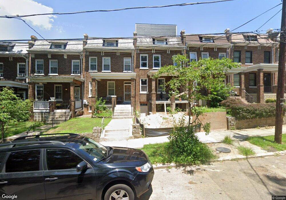
321 Varnum St NW Washington, DC 20011
Petworth NeighborhoodEstimated Value: $663,000 - $831,000
3
Beds
1
Bath
1,488
Sq Ft
$500/Sq Ft
Est. Value
About This Home
This home is located at 321 Varnum St NW, Washington, DC 20011 and is currently estimated at $743,997, approximately $499 per square foot. 321 Varnum St NW is a home located in District of Columbia with nearby schools including Barnard Elementary School, MacFarland Middle School, and Roosevelt High School @ MacFarland.
Ownership History
Date
Name
Owned For
Owner Type
Purchase Details
Closed on
Apr 4, 2022
Sold by
Loreia Daniels Tanya
Bought by
Daniels Tanya Loreia
Current Estimated Value
Purchase Details
Closed on
Jul 9, 1997
Sold by
Dempsey Willie and Dempsey Emma L
Bought by
Daniels Tanya L
Home Financials for this Owner
Home Financials are based on the most recent Mortgage that was taken out on this home.
Original Mortgage
$84,915
Interest Rate
7.86%
Mortgage Type
FHA
Create a Home Valuation Report for This Property
The Home Valuation Report is an in-depth analysis detailing your home's value as well as a comparison with similar homes in the area
Home Values in the Area
Average Home Value in this Area
Purchase History
| Date | Buyer | Sale Price | Title Company |
|---|---|---|---|
| Daniels Tanya Loreia | -- | Lockard Law Pllc | |
| Daniels Tanya L | -- | -- |
Source: Public Records
Mortgage History
| Date | Status | Borrower | Loan Amount |
|---|---|---|---|
| Previous Owner | Daniels Tanya L | $84,915 |
Source: Public Records
Tax History Compared to Growth
Tax History
| Year | Tax Paid | Tax Assessment Tax Assessment Total Assessment is a certain percentage of the fair market value that is determined by local assessors to be the total taxable value of land and additions on the property. | Land | Improvement |
|---|---|---|---|---|
| 2024 | $5,601 | $746,000 | $510,130 | $235,870 |
| 2023 | $5,441 | $724,060 | $497,730 | $226,330 |
| 2022 | $5,378 | $672,030 | $468,270 | $203,760 |
| 2021 | $5,462 | $642,590 | $451,860 | $190,730 |
| 2020 | $5,279 | $621,030 | $434,870 | $186,160 |
| 2019 | $5,024 | $591,050 | $408,660 | $182,390 |
| 2018 | $4,835 | $568,790 | $0 | $0 |
| 2017 | $4,219 | $496,390 | $0 | $0 |
| 2016 | $3,798 | $446,810 | $0 | $0 |
| 2015 | $3,412 | $401,370 | $0 | $0 |
| 2014 | $2,889 | $339,930 | $0 | $0 |
Source: Public Records
Map
Nearby Homes
- 319 Varnum St NW Unit 3
- 312 Webster St NW
- 318 Webster St NW Unit 3
- 318 Webster St NW Unit 2
- 318 Webster St NW Unit 1
- 4308 4th St NW Unit 1084
- 4312 4th St NW
- 208 Webster St NW
- 210 Varnum St NW Unit 4
- 210 Varnum St NW Unit 1
- 4405 New Hampshire Ave NW
- 222 Upshur St NW
- 4110 4th St NW
- 317 Taylor St NW
- 4504 New Hampshire Ave NW
- 127 Rock Creek Church Rd NW
- 4421 5th St NW
- 111 Varnum St NW Unit 3
- 4101 Illinois Ave NW
- 4522 4th St NW
- 319 Varnum St NW
- 319 Varnum St NW Unit 1
- 319 Varnum St NW Unit 2
- 317 Varnum St NW
- 325 Varnum St NW
- 315 Varnum St NW
- 313 Varnum St NW
- 311 Varnum St NW
- 4305 4th St NW
- 4303 4th St NW
- 309 Varnum St NW
- 4307 4th St NW
- 4309 4th St NW
- 4315 4th St NW
- 4313 4th St NW
- 320 Webster St NW
- 320 Webster St NW Unit 3
- 320 Webster St NW Unit 2
- 320 Webster St NW Unit 1