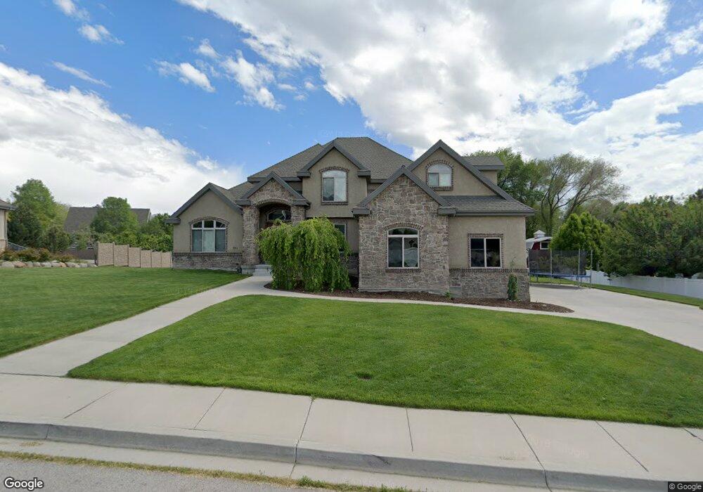
321 W 600 N Lindon, UT 84042
Estimated Value: $842,000 - $1,144,000
5
Beds
3
Baths
3,082
Sq Ft
$327/Sq Ft
Est. Value
About This Home
This home is located at 321 W 600 N, Lindon, UT 84042 and is currently estimated at $1,009,035, approximately $327 per square foot. 321 W 600 N is a home located in Utah County with nearby schools including Lindon Elementary School, Oak Canyon Junior High School, and Pleasant Grove High School.
Ownership History
Date
Name
Owned For
Owner Type
Purchase Details
Closed on
Aug 9, 2007
Sold by
Tomlinson Christopher Scott and Tomlinson Collette
Bought by
Tomlinson Christopher S and Tomlinson Collette
Current Estimated Value
Home Financials for this Owner
Home Financials are based on the most recent Mortgage that was taken out on this home.
Original Mortgage
$395,000
Interest Rate
6.65%
Mortgage Type
New Conventional
Purchase Details
Closed on
Feb 23, 2001
Sold by
Tomlinson Lowell B and Tomlinson Ronda M
Bought by
Tomlinson Christopher Scott and Tomlinson Collette
Purchase Details
Closed on
Dec 18, 2000
Sold by
Tomlinson Lowell B and Tomlinson Ronda M
Bought by
Tomlinson Lowell B and Tomlinson Ronda M
Create a Home Valuation Report for This Property
The Home Valuation Report is an in-depth analysis detailing your home's value as well as a comparison with similar homes in the area
Home Values in the Area
Average Home Value in this Area
Purchase History
| Date | Buyer | Sale Price | Title Company |
|---|---|---|---|
| Tomlinson Christopher S | -- | Eagle Pointe Title Insuranc | |
| Tomlinson Christopher Scott | -- | -- | |
| Tomlinson Lowell B | -- | -- |
Source: Public Records
Mortgage History
| Date | Status | Borrower | Loan Amount |
|---|---|---|---|
| Closed | Tomlinson Christopher S | $395,000 |
Source: Public Records
Tax History
| Year | Tax Paid | Tax Assessment Tax Assessment Total Assessment is a certain percentage of the fair market value that is determined by local assessors to be the total taxable value of land and additions on the property. | Land | Improvement |
|---|---|---|---|---|
| 2025 | $4,251 | $543,125 | -- | -- |
| 2024 | $4,251 | $523,985 | $0 | $0 |
| 2023 | $4,009 | $530,915 | $0 | $0 |
| 2022 | $4,038 | $516,450 | $0 | $0 |
| 2021 | $3,541 | $683,000 | $278,400 | $404,600 |
| 2020 | $3,382 | $642,100 | $253,100 | $389,000 |
| 2019 | $2,846 | $563,700 | $206,700 | $357,000 |
| 2018 | $2,883 | $538,400 | $181,400 | $357,000 |
| 2017 | $2,655 | $265,870 | $0 | $0 |
| 2016 | $2,681 | $248,270 | $0 | $0 |
| 2015 | $2,785 | $243,815 | $0 | $0 |
| 2014 | $2,538 | $220,110 | $0 | $0 |
Source: Public Records
Map
Nearby Homes
- 355 W 600 N
- 517 N 80 W
- 461 W 490 N
- 465 W 490 N
- 469 W 490 N
- 696 S Locust Ave
- 1135 E 900 S
- 793 E Orchard Dr
- 494 E Apple Blossom Dr
- 130 E 800 N
- 190 E 800 N Unit 4
- 170 E 800 N Unit 3
- 150 E 800 N Unit 2
- 1172 E Murdock Dr
- 435 E 790 S Unit 8
- 308 E 750 N
- 1176 E 470 S
- 1515 E 200 S
- 271 N 400 E Unit 1
- 271 N 400 E
Your Personal Tour Guide
Ask me questions while you tour the home.