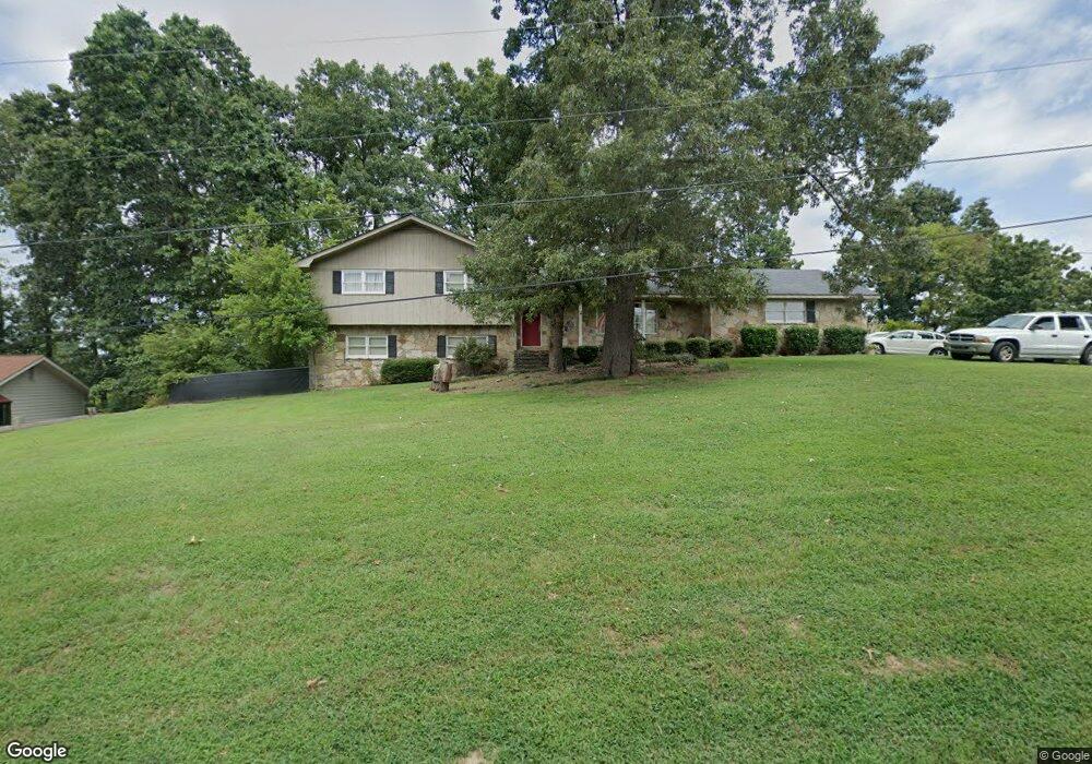
321 Westwood Cir Dalton, GA 30721
Estimated Value: $290,000 - $385,000
4
Beds
3
Baths
2,732
Sq Ft
$119/Sq Ft
Est. Value
About This Home
This home is located at 321 Westwood Cir, Dalton, GA 30721 and is currently estimated at $325,944, approximately $119 per square foot. 321 Westwood Cir is a home located in Whitfield County with nearby schools including Pleasant Grove Elementary School, New Hope Middle School, and Northwest Whitfield County High School.
Ownership History
Date
Name
Owned For
Owner Type
Purchase Details
Closed on
Sep 1, 1998
Bought by
Stout Annette Selsavage
Current Estimated Value
Create a Home Valuation Report for This Property
The Home Valuation Report is an in-depth analysis detailing your home's value as well as a comparison with similar homes in the area
Home Values in the Area
Average Home Value in this Area
Purchase History
| Date | Buyer | Sale Price | Title Company |
|---|---|---|---|
| Stout Annette Selsavage | -- | -- |
Source: Public Records
Tax History Compared to Growth
Tax History
| Year | Tax Paid | Tax Assessment Tax Assessment Total Assessment is a certain percentage of the fair market value that is determined by local assessors to be the total taxable value of land and additions on the property. | Land | Improvement |
|---|---|---|---|---|
| 2024 | $3,071 | $119,430 | $15,600 | $103,830 |
| 2023 | $1,639 | $83,438 | $10,600 | $72,838 |
| 2022 | $1,799 | $69,546 | $10,600 | $58,946 |
| 2021 | $1,800 | $69,546 | $10,600 | $58,946 |
| 2020 | $1,849 | $69,546 | $10,600 | $58,946 |
| 2019 | $1,874 | $69,546 | $10,600 | $58,946 |
| 2018 | $1,730 | $64,204 | $10,600 | $53,604 |
| 2017 | $1,731 | $64,204 | $10,600 | $53,604 |
| 2016 | $1,340 | $53,048 | $5,250 | $47,798 |
| 2014 | $1,229 | $53,048 | $5,250 | $47,798 |
| 2013 | -- | $53,048 | $5,250 | $47,798 |
Source: Public Records
Map
Nearby Homes
- 439 Westbrook Rd
- 1903 Middle Summit Dr
- 1899 N Summit Dr Unit 66
- 1903 Summit View Dr
- 110 Pinewood Way
- 1899 Middle Summit Dr Unit 98
- 503 Moore Dr
- 407 Quillian Rd
- 1709 Willow Oak Ln Unit 53
- 1706 Chestnut Oak Dr Unit 90
- 522 Westbrook Rd
- 1730 Brighton Way
- 1702 Chestnut Oak Dr
- 1702 Chestnut Oak Dr Unit 83
- 1713 Brighton Way
- 0 TRACT 5 2nd St
- 2100 Cleveland Hwy
- 1699 Burnt Oak Dr Unit 195
- 1699 Burnt Oak Dr
- 2201 Cleveland Hwy
- 319 Westwood Cir
- 323 Westwood Cir
- 314 Westwood Cir
- 312 Westwood Cir
- 316 Westwood Cir
- 317 Westwood Cir
- 325 Westwood Cir
- 214 Westwood Cir
- 216 Westwood Cir
- 212 Westwood Cir
- 210 Westwood Cir
- 315 Westwood Cir
- 0 Westwood Cir Unit 1387184
- 0 Westwood Cir
- 218 Westwood Cir
- 308 Westwood Cir
- 327 Westwood Cir
- 213 Westwood Cir
- 313 Westwood Cir
- 220 Westwood Cir