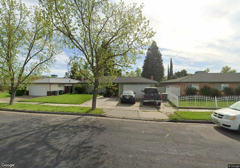
3210 Loughborough Dr Merced, CA 95348
North Merced NeighborhoodEstimated Value: $283,000 - $339,438
3
Beds
2
Baths
1,284
Sq Ft
$247/Sq Ft
Est. Value
About This Home
This home is located at 3210 Loughborough Dr, Merced, CA 95348 and is currently estimated at $317,360, approximately $247 per square foot. 3210 Loughborough Dr is a home located in Merced County with nearby schools including John Muir Elementary School, Rudolph Rivera Middle School, and Merced High School.
Ownership History
Date
Name
Owned For
Owner Type
Purchase Details
Closed on
Mar 24, 2002
Sold by
Quezada Daniel G and Quezada Alicia G
Bought by
Quezada Daniel G and Quezada Alicia G
Current Estimated Value
Home Financials for this Owner
Home Financials are based on the most recent Mortgage that was taken out on this home.
Original Mortgage
$71,000
Interest Rate
6.84%
Mortgage Type
Purchase Money Mortgage
Create a Home Valuation Report for This Property
The Home Valuation Report is an in-depth analysis detailing your home's value as well as a comparison with similar homes in the area
Home Values in the Area
Average Home Value in this Area
Purchase History
| Date | Buyer | Sale Price | Title Company |
|---|---|---|---|
| Quezada Daniel G | -- | First American Title Co |
Source: Public Records
Mortgage History
| Date | Status | Borrower | Loan Amount |
|---|---|---|---|
| Closed | Quezada Daniel G | $71,000 |
Source: Public Records
Tax History Compared to Growth
Tax History
| Year | Tax Paid | Tax Assessment Tax Assessment Total Assessment is a certain percentage of the fair market value that is determined by local assessors to be the total taxable value of land and additions on the property. | Land | Improvement |
|---|---|---|---|---|
| 2025 | $1,261 | $126,223 | $49,822 | $76,401 |
| 2024 | $1,261 | $123,749 | $48,846 | $74,903 |
| 2023 | $1,243 | $121,324 | $47,889 | $73,435 |
| 2022 | $1,223 | $118,946 | $46,950 | $71,996 |
| 2021 | $1,219 | $116,615 | $46,030 | $70,585 |
| 2020 | $1,227 | $115,421 | $45,559 | $69,862 |
| 2019 | $1,207 | $113,159 | $44,666 | $68,493 |
| 2018 | $1,099 | $110,941 | $43,791 | $67,150 |
| 2017 | $1,139 | $108,767 | $42,933 | $65,834 |
| 2016 | $1,120 | $106,636 | $42,092 | $64,544 |
| 2015 | $1,101 | $105,035 | $41,460 | $63,575 |
| 2014 | $1,076 | $102,978 | $40,648 | $62,330 |
Source: Public Records
Map
Nearby Homes
- 3280 Cheyenne Dr
- 3196 Austin Ave
- 3160 Austin Ave
- 1615 Loughborough Dr
- 1482 Autry Way
- 1328 Paseo Redondo Dr
- 1475 Bianchi Ln
- 1347 Paseo Redondo Dr
- 2941 Ritter Ln
- 2215 W St
- 1420 W 25th St
- 3425 Sueno Ct
- 3502 San Francisco St
- 2500 N Highway 59 #115
- 2500 N State Highway 59 Unit 36
- 2500 N State Highway 59
- 3593 San Vincent Ave
- 1397 Esplanade Dr
- 2440 Crystal Springs Ave
- 2410 S St
- 3202 Loughborough Dr
- 3218 Loughborough Dr
- 3201 Sacramento Dr
- 3209 Sacramento Dr
- 3180 Loughborough Dr
- 3226 Loughborough Dr
- 3179 Sacramento Dr
- 3217 Sacramento Dr
- 3207 Loughborough Dr
- 3215 Loughborough Dr
- 3234 Loughborough Dr
- 3170 Loughborough Dr
- 3169 Sacramento Dr
- 3219 Loughborough Dr
- 3201 Loughborough Dr
- 3225 Sacramento Dr
- 3225 Loughborough Dr
- 3242 Loughborough Dr
- 3160 Loughborough Dr
- 3159 Sacramento Dr