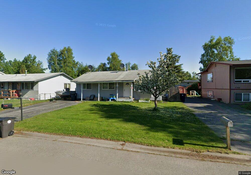
3213 Cassius Ct Anchorage, AK 99508
Airport Heights NeighborhoodEstimated Value: $174,000 - $339,000
3
Beds
1
Bath
960
Sq Ft
$275/Sq Ft
Est. Value
About This Home
This home is located at 3213 Cassius Ct, Anchorage, AK 99508 and is currently estimated at $263,566, approximately $274 per square foot. 3213 Cassius Ct is a home located in Anchorage Municipality with nearby schools including Airport Heights Elementary School, Wendler Middle School, and Bettye Davis East Anchorage High School.
Ownership History
Date
Name
Owned For
Owner Type
Purchase Details
Closed on
Oct 16, 2008
Sold by
Spudowski Sara L
Bought by
Norman Christopher I
Current Estimated Value
Purchase Details
Closed on
Oct 19, 2005
Sold by
Brice Barbara D and Little Benjamin W
Bought by
Norman Christopher I and Spudowski Sara L
Home Financials for this Owner
Home Financials are based on the most recent Mortgage that was taken out on this home.
Original Mortgage
$187,518
Interest Rate
5.67%
Mortgage Type
FHA
Purchase Details
Closed on
Dec 5, 1997
Sold by
Dixon Charles and Dixon Catherine B
Bought by
Brice Barbara D and Little Benjamin W
Create a Home Valuation Report for This Property
The Home Valuation Report is an in-depth analysis detailing your home's value as well as a comparison with similar homes in the area
Home Values in the Area
Average Home Value in this Area
Purchase History
| Date | Buyer | Sale Price | Title Company |
|---|---|---|---|
| Norman Christopher I | -- | Accommodation | |
| Norman Christopher I | -- | Stewart | |
| Brice Barbara D | -- | -- | |
| Brice Barbara D | -- | -- |
Source: Public Records
Mortgage History
| Date | Status | Borrower | Loan Amount |
|---|---|---|---|
| Previous Owner | Norman Christopher I | $187,518 | |
| Closed | Brice Barbara D | $0 |
Source: Public Records
Tax History
| Year | Tax Paid | Tax Assessment Tax Assessment Total Assessment is a certain percentage of the fair market value that is determined by local assessors to be the total taxable value of land and additions on the property. | Land | Improvement |
|---|---|---|---|---|
| 2025 | $3,999 | $262,100 | $80,300 | $181,800 |
| 2024 | $3,999 | $247,700 | $80,300 | $167,400 |
| 2023 | $3,825 | $224,600 | $80,300 | $144,300 |
| 2022 | $3,752 | $222,800 | $80,300 | $142,500 |
| 2021 | $3,626 | $201,200 | $80,300 | $120,900 |
| 2020 | $3,341 | $196,500 | $80,300 | $116,200 |
| 2019 | $3,195 | $195,300 | $80,300 | $115,000 |
| 2018 | $2,533 | $193,100 | $80,300 | $112,800 |
| 2017 | $2,831 | $200,800 | $80,300 | $120,500 |
| 2016 | $2,423 | $193,400 | $76,800 | $116,600 |
| 2015 | $2,423 | $187,000 | $76,800 | $110,200 |
| 2014 | $2,423 | $171,300 | $58,300 | $113,000 |
Source: Public Records
Map
Nearby Homes
- 3215 E 18th Cir
- 3514 E 19th Ave
- 1524 Rosemary St
- 1703 Alder Dr
- 000 Tr A Thurston
- 3714 E 17th Ave
- 1536 Valarian St
- 1701 Aleutian St
- 3958 Reka Dr Unit A1
- 1811 Talkeetna St
- 1715 Katrina Cir
- 2211 Daybreak Ct
- 2601 Darby Cir
- 4358 Reka Dr Unit 4358
- 2089 Cliffside Dr Unit 29B-6
- 1625 Sitka St Unit 103
- 1610 Eastridge Dr Unit 301
- 1620 Eastridge Dr Unit 203
- 4660 Reka Dr Unit D05
- 4011 San Roberto Ave
- 3223 Cassius Ct
- 3205 Cassius Ct
- 3214 E 19th Ct
- 3233 Cassius Ct
- 3224 E 19th Ct
- 3155 Cassius Ct
- 3206 E 19th Ct
- 3226 Cassius Ct Unit 15
- 3248 Cassius Ct Unit 18
- 3248 Cassius Ct
- 3208 Cassius Ct
- 3208 Cassius Ct Unit 14
- 3234 E 19th Ct
- 3154 E 19th Ct
- 3305 Cassius Ct
- 3149 Cassius Ct
- 3228 Cassius Ct
- 3228 Cassius Ct Unit 2
- 3228 Cassius Ct Unit 16
- 3246 Cassius Ct
Your Personal Tour Guide
Ask me questions while you tour the home.