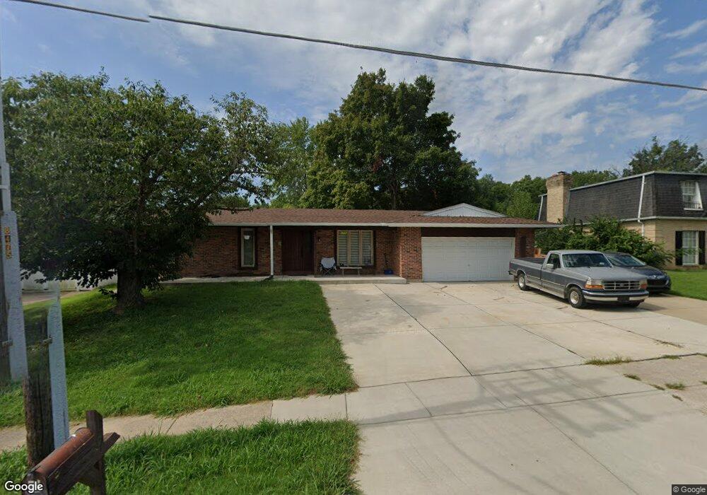
3213 Droste Rd Saint Charles, MO 63301
Old Town Saint Charles NeighborhoodEstimated Value: $308,000 - $314,000
3
Beds
2
Baths
1,557
Sq Ft
$200/Sq Ft
Est. Value
About This Home
This home is located at 3213 Droste Rd, Saint Charles, MO 63301 and is currently estimated at $311,473, approximately $200 per square foot. 3213 Droste Rd is a home located in St. Charles County with nearby schools including Monroe Elementary School, Jefferson Intermediate School, and Hardin Middle School.
Ownership History
Date
Name
Owned For
Owner Type
Purchase Details
Closed on
May 26, 2017
Sold by
Bernat Cody Allen and Estate Of David Lee Bernat
Bought by
Dalton John and Dalton Renee M
Current Estimated Value
Home Financials for this Owner
Home Financials are based on the most recent Mortgage that was taken out on this home.
Original Mortgage
$82,000
Interest Rate
3.97%
Mortgage Type
New Conventional
Purchase Details
Closed on
May 12, 2017
Sold by
Bernat Cody A and Estate Of David Lee Bemat
Bought by
Bernat Cody A and Bernat Nicholas R
Home Financials for this Owner
Home Financials are based on the most recent Mortgage that was taken out on this home.
Original Mortgage
$82,000
Interest Rate
3.97%
Mortgage Type
New Conventional
Purchase Details
Closed on
Oct 9, 2001
Sold by
Bernat Diane M
Bought by
Bernat David L
Create a Home Valuation Report for This Property
The Home Valuation Report is an in-depth analysis detailing your home's value as well as a comparison with similar homes in the area
Home Values in the Area
Average Home Value in this Area
Purchase History
| Date | Buyer | Sale Price | Title Company |
|---|---|---|---|
| Dalton John | -- | None Available | |
| Bernat Cody A | -- | None Available | |
| Bernat David L | -- | -- |
Source: Public Records
Mortgage History
| Date | Status | Borrower | Loan Amount |
|---|---|---|---|
| Closed | Dalton John | $82,000 |
Source: Public Records
Tax History Compared to Growth
Tax History
| Year | Tax Paid | Tax Assessment Tax Assessment Total Assessment is a certain percentage of the fair market value that is determined by local assessors to be the total taxable value of land and additions on the property. | Land | Improvement |
|---|---|---|---|---|
| 2025 | $3,372 | $51,366 | -- | -- |
| 2023 | $3,367 | $52,554 | $0 | $0 |
| 2022 | $2,894 | $42,089 | $0 | $0 |
| 2021 | $2,898 | $42,089 | $0 | $0 |
| 2020 | $2,743 | $38,281 | $0 | $0 |
| 2019 | $2,719 | $38,281 | $0 | $0 |
| 2018 | $2,497 | $33,403 | $0 | $0 |
| 2017 | $2,464 | $33,403 | $0 | $0 |
| 2016 | $2,336 | $30,499 | $0 | $0 |
| 2015 | $2,332 | $30,499 | $0 | $0 |
| 2014 | $2,187 | $28,204 | $0 | $0 |
Source: Public Records
Map
Nearby Homes
- 2 Wynnbrook Manor Dr
- 733 Norwich Dr
- 729 Norwich Dr
- 2741 Penbrooke Ln
- 1135 Olde Saybrook Dr
- 4362 Hineman Dr
- 35 Lake Forest Ln
- 3212 Denton Ln
- 125 Gardner Place
- 3335 Ipswich Ln
- 401 Hunters Ridge
- 2968 Elbe Dr
- 9 Mallard Ct
- 450 Nantucket Dr
- 3017 Landau Ct
- 454 Nantucket Dr
- 104 Dornoch Dr
- 8 Boenker Ct
- 2905 Maldon Ln
- 2916 Mockingbird Dr