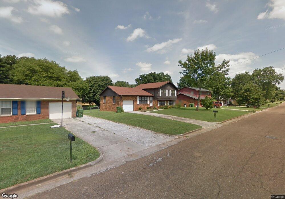
3213 Lewisburg Dr NW Huntsville, AL 35810
Mastin Lake Park NeighborhoodEstimated Value: $170,420 - $243,000
4
Beds
2
Baths
1,750
Sq Ft
$119/Sq Ft
Est. Value
About This Home
This home is located at 3213 Lewisburg Dr NW, Huntsville, AL 35810 and is currently estimated at $208,355, approximately $119 per square foot. 3213 Lewisburg Dr NW is a home located in Madison County with nearby schools including Lakewood Elementary School, Ronald E. McNair Junior High School, and Jemison High School.
Ownership History
Date
Name
Owned For
Owner Type
Purchase Details
Closed on
Jun 14, 2010
Sold by
Mitchell James C
Bought by
Mitchell Robert Lee
Current Estimated Value
Purchase Details
Closed on
Mar 29, 2010
Sold by
Fannie Mae
Bought by
Mitchell James C
Purchase Details
Closed on
Mar 16, 2010
Sold by
Financial Freedom Acquisition Llc
Bought by
Fannie Mae
Purchase Details
Closed on
Jan 21, 2010
Sold by
Yeskawich Sumie
Bought by
Financial Freedom Acquisition Llc
Create a Home Valuation Report for This Property
The Home Valuation Report is an in-depth analysis detailing your home's value as well as a comparison with similar homes in the area
Home Values in the Area
Average Home Value in this Area
Purchase History
| Date | Buyer | Sale Price | Title Company |
|---|---|---|---|
| Mitchell Robert Lee | -- | -- | |
| Mitchell James C | $70,000 | -- | |
| Fannie Mae | -- | -- | |
| Financial Freedom Acquisition Llc | $80,775 | -- |
Source: Public Records
Tax History Compared to Growth
Tax History
| Year | Tax Paid | Tax Assessment Tax Assessment Total Assessment is a certain percentage of the fair market value that is determined by local assessors to be the total taxable value of land and additions on the property. | Land | Improvement |
|---|---|---|---|---|
| 2025 | $1,556 | $26,820 | $6,280 | $20,540 |
| 2024 | $1,556 | $25,080 | $5,000 | $20,080 |
| 2023 | $1,455 | $24,140 | $5,000 | $19,140 |
| 2022 | $1,225 | $21,120 | $4,180 | $16,940 |
| 2021 | $1,005 | $17,320 | $2,340 | $14,980 |
| 2020 | $963 | $8,180 | $1,170 | $7,010 |
| 2019 | $876 | $7,550 | $1,170 | $6,380 |
| 2018 | $860 | $14,820 | $0 | $0 |
| 2017 | $860 | $14,820 | $0 | $0 |
| 2016 | $860 | $14,820 | $0 | $0 |
| 2015 | $776 | $13,380 | $0 | $0 |
| 2014 | $662 | $11,420 | $0 | $0 |
Source: Public Records
Map
Nearby Homes
- 3226 Lewisburg Dr NW
- 3023 Greenhill Dr NW
- 2803 Eva Dr NW
- 3116 Greenhill Dr NW
- 3604 Knollwood Dr NW
- 2814 Claiborne Rd NW
- 3121 Greenhill Dr NW
- 2901 Greenhill Dr NW
- 3129 Millbrook Dr NW
- 2818 Brett Rd NW
- 2608 Sparkman Dr NW
- 2906 Sparkman Dr NW
- 3610 Princess St NW
- 2917 Ford Place NW
- 3509 Fay St NW
- 2702 Oakdale Terrace NW
- 3602 Oakdale Cir NW
- 3400 Brenda St NW
- 3728 Oakdale Ct NW
- 2628 Thornhill Rd NW
- 3211 Lewisburg Dr NW
- 3215 Lewisburg Dr NW
- 3216 W Helena Dr NW
- 3209 Lewisburg Dr NW
- 3217 Lewisburg Dr NW
- 3212 W Helena Dr NW
- 3220 W Helena Dr NW
- 3212 Lewisburg Dr NW
- 3214 Lewisburg Dr NW
- 3210 Lewisburg Dr NW
- 3208 W Helena Dr NW
- 3222 W Helena Dr NW
- 3216 Lewisburg Dr NW
- 3208 Lewisburg Dr NW
- 3207 Lewisburg Dr NW
- 3219 Lewisburg Dr NW
- 3224 W Helena Dr NW
- 3219 W Helena Dr NW
- 3206 Lewisburg Dr NW
- 3218 Lewisburg Dr NW