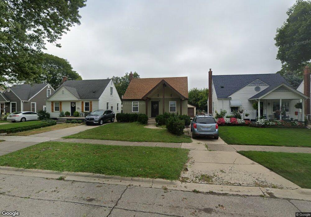
3213 Pardee Ave Unit Bldg-Unit Dearborn, MI 48124
Southwestern Outer Drive NeighborhoodEstimated Value: $199,000 - $237,000
3
Beds
1
Bath
1,092
Sq Ft
$202/Sq Ft
Est. Value
About This Home
This home is located at 3213 Pardee Ave Unit Bldg-Unit, Dearborn, MI 48124 and is currently estimated at $220,672, approximately $202 per square foot. 3213 Pardee Ave Unit Bldg-Unit is a home located in Wayne County with nearby schools including Whitmore-Bolles Elementary School, Smith Middle School, and Edsel Ford High School.
Ownership History
Date
Name
Owned For
Owner Type
Purchase Details
Closed on
Jun 27, 2022
Sold by
Fouad Saad Ahmed
Bought by
Burriss Shaun
Current Estimated Value
Purchase Details
Closed on
Dec 28, 2021
Sold by
Cherish Davis
Bought by
Saad Ahmed
Purchase Details
Closed on
Apr 5, 2018
Sold by
Hubert Steven
Bought by
Davis Cherish
Purchase Details
Closed on
Apr 30, 2013
Sold by
Formosa Mark
Bought by
Hubert Steven
Purchase Details
Closed on
Mar 11, 2013
Sold by
Mozol Kathleen and Moyer Noreen
Bought by
Formosa Mark
Create a Home Valuation Report for This Property
The Home Valuation Report is an in-depth analysis detailing your home's value as well as a comparison with similar homes in the area
Home Values in the Area
Average Home Value in this Area
Purchase History
| Date | Buyer | Sale Price | Title Company |
|---|---|---|---|
| Burriss Shaun | $207,000 | V1 Title Agency | |
| Saad Ahmed | $161,000 | Embassy Title Agency | |
| Davis Cherish | $145,500 | Title One Inc | |
| Hubert Steven | $60,000 | Title One Inc | |
| Formosa Mark | $42,000 | None Available |
Source: Public Records
Tax History
| Year | Tax Paid | Tax Assessment Tax Assessment Total Assessment is a certain percentage of the fair market value that is determined by local assessors to be the total taxable value of land and additions on the property. | Land | Improvement |
|---|---|---|---|---|
| 2025 | $3,215 | $92,800 | $0 | $0 |
| 2024 | $3,145 | $77,500 | $0 | $0 |
| 2023 | $2,976 | $68,400 | $0 | $0 |
| 2022 | $3,218 | $62,600 | $0 | $0 |
| 2021 | $3,162 | $58,900 | $0 | $0 |
| 2019 | $3,130 | $49,600 | $0 | $0 |
| 2018 | $2,037 | $43,700 | $0 | $0 |
| 2017 | $584 | $41,000 | $0 | $0 |
| 2016 | $1,905 | $39,400 | $0 | $0 |
| 2015 | $3,601 | $37,200 | $0 | $0 |
| 2013 | $3,445 | $34,450 | $0 | $0 |
| 2011 | -- | $39,150 | $0 | $0 |
Source: Public Records
Map
Nearby Homes
- 3131 Mckinley St
- 22732 Madison St
- 3346 Roosevelt St
- 3265 Parker St
- 3530 Roosevelt St
- 3345 Parker St
- 3610 Bennett St
- 3020 Williams St
- 3803 Bennett St
- 2920 Grindley Park St
- 21047 Outer Dr
- 3321 Williams St
- 3505 Williams St
- 3515 Williams St
- 23000 Columbia St
- 3313 Alice St
- 2239 Parker St
- 3837 Katherine St
- 2970 Geneva St
- 2612 Grindley Park St
- 3213 Pardee Ave
- 3221 Pardee Ave
- 3205 Pardee Ave
- 3155 Pardee Ave
- 3231 Pardee Ave
- 3147 Pardee Ave
- 3212 Lincoln St
- 3204 Lincoln St
- 3220 Lincoln St
- 3154 Lincoln St
- 3228 Lincoln St
- 3139 Pardee Ave
- 3245 Pardee Ave
- 3146 Lincoln St
- 3236 Lincoln St
- 3255 Pardee Ave
- 3131 Pardee Ave
- 3138 Lincoln St
- 3244 Lincoln St
- 3220 Pardee Ave
Your Personal Tour Guide
Ask me questions while you tour the home.