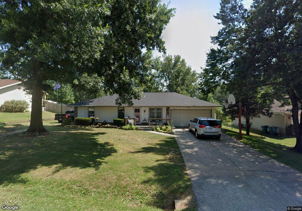
3214 W Wick St Springfield, MO 65810
Estimated Value: $218,888 - $256,000
3
Beds
2
Baths
1,272
Sq Ft
$184/Sq Ft
Est. Value
About This Home
This home is located at 3214 W Wick St, Springfield, MO 65810 and is currently estimated at $234,222, approximately $184 per square foot. 3214 W Wick St is a home located in Greene County with nearby schools including David Harrison Elementary School, Wilson's Creek Intermediate School, and Cherokee Middle School.
Ownership History
Date
Name
Owned For
Owner Type
Purchase Details
Closed on
Jun 2, 2005
Sold by
Secretary Of Hud
Bought by
Johnson Haley A
Current Estimated Value
Home Financials for this Owner
Home Financials are based on the most recent Mortgage that was taken out on this home.
Original Mortgage
$15,460
Interest Rate
5.34%
Mortgage Type
Stand Alone Second
Purchase Details
Closed on
Mar 1, 2005
Sold by
Abn Amro Mortgage Group Inc
Bought by
Secretary Of Hud
Create a Home Valuation Report for This Property
The Home Valuation Report is an in-depth analysis detailing your home's value as well as a comparison with similar homes in the area
Home Values in the Area
Average Home Value in this Area
Purchase History
| Date | Buyer | Sale Price | Title Company |
|---|---|---|---|
| Johnson Haley A | -- | Lincoln Evans Land Title Co | |
| Secretary Of Hud | -- | None Available |
Source: Public Records
Mortgage History
| Date | Status | Borrower | Loan Amount |
|---|---|---|---|
| Closed | Johnson Haley A | $15,460 | |
| Open | Johnson Haley A | $61,840 |
Source: Public Records
Tax History
| Year | Tax Paid | Tax Assessment Tax Assessment Total Assessment is a certain percentage of the fair market value that is determined by local assessors to be the total taxable value of land and additions on the property. | Land | Improvement |
|---|---|---|---|---|
| 2025 | $1,332 | $25,860 | $7,410 | $18,450 |
| 2024 | $1,222 | $22,060 | $4,750 | $17,310 |
| 2023 | $1,215 | $22,060 | $4,750 | $17,310 |
| 2022 | $1,088 | $20,240 | $4,750 | $15,490 |
| 2021 | $1,087 | $20,240 | $4,750 | $15,490 |
| 2020 | $998 | $17,610 | $4,750 | $12,860 |
| 2019 | $969 | $17,610 | $4,750 | $12,860 |
| 2018 | $813 | $14,730 | $4,750 | $9,980 |
| 2017 | $805 | $13,780 | $4,750 | $9,030 |
| 2016 | $753 | $13,780 | $4,750 | $9,030 |
| 2015 | $747 | $13,780 | $4,750 | $9,030 |
| 2014 | $732 | $13,400 | $4,750 | $8,650 |
Source: Public Records
Map
Nearby Homes
- 3048 W Teton Dr
- 3049 W Edward St
- 2975 W Marty St
- 2971 W Teton Dr
- 2953 W Marty St
- 2959 W Teton Dr
- 2941 W Marty St
- 2937 W Teton Dr
- 2929 W Marty St
- 2946 W Teton Dr
- 2926 W Marty St
- 2925 W Teton Dr
- 4911 S Sycamore Ave
- 2914 W Marty St
- 3017 W Teton Dr
- 3039 W Teton Dr
- 2983 W Teton Dr
- 3481 W Moark St
- 4654 S Farm Road 135
- 2992 W Nottingham St
- 3204 W Wick St
- 3222 W Wick St
- 3215 W Marty St
- 3205 W Marty St
- 3223 W Marty St
- 3158 W Wick St
- 3230 W Wick St
- 3215 W Wick St
- 3223 W Wick St
- 3159 W Marty St
- 3201 W Wick St
- 3231 W Marty St
- 3231 W Wick St
- 3150 W Wick St
- 3240 W Wick St
- 3151 W Marty St
- 3241 W Marty St
- 3214 W Edward St
- 3222 W Edward St
- 3241 W Wick St
Your Personal Tour Guide
Ask me questions while you tour the home.